
OSLO TS
Tanker
Current Trip
| Time Travelled | 1 day |
|---|---|
| Remaining Time | 1 day |
| Distance Travelled | 444.27 nm |
| Remaining Distance | 363.21 nm |
| AVG Speed | 11.8 Knopen |
| MAX Speed | 13.7 Knopen |
| AVG Wind | 13 knots |
| MAX Wind | 26.3 knots |
| MIN Temp | 4.3°C / 39.74°F |
| MAX Temp | 9.7°C / 49.46°F |
| Diepgang | 15 M |
| Positie ontvangen | 1 m geleden |
Current Position
| Lengtegraad | --- |
|---|---|
| Breedtegraat | --- |
| Status | Under way using engine |
| Snelheid | 11.7 Knopen |
| Koers | 161.2° |
| Gebied | Kattegat |
| Station | T-AIS |
| Positie ontvangen | 1 m geleden |
Info
Information
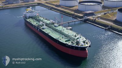
The current position of OSLO TS is in Kattegat with coordinates 56.87512° / 11.80838° as reported on 2025-12-09 17:16 by AIS to our vessel tracker app. The vessel's current speed is 11.7 Knopen and is heading at the port of GDANSK. The estimated time of arrival as calculated by MyShipTracking vessel tracking app is 2025-12-11 02:53 LT
The vessel OSLO TS (IMO: 9737383, MMSI: 248006000) is a Tanker It's sailing under the flag of [MT] Malta.
In this page you can find informations about the vessels current position, last detected port calls, and current voyage information. If the vessels is not in coverage by AIS you will find the latest position.
The current position of OSLO TS is detected by our AIS receivers and we are not responsible for the reliability of the data. The last position was recorded while the vessel was in Coverage by the Ais receivers of our vessel tracking app.
The current draught of OSLO TS as reported by AIS is 15 meters
Weather
| Temperature | 7.4°C / 45.32°F |
|---|---|
| Wind Speed | 10 knots |
| Direction | 186° S |
| Pressure | 1008.3 hPa |
| Humidity | 97.4 % |
| Cloud Coverage | 100 % |
Featured Company
Last Port Calls
| Port | Arrival | Departure | Time In Port |
|---|---|---|---|
| 2025-12-06 07:50 | 2025-12-08 05:05 | 1 d | |
| 2025-11-29 02:00 | 2025-11-30 06:54 | 1 d | |
| 2025-11-24 14:20 | 2025-11-25 14:43 | 1 d | |
| 2025-11-16 09:34 | 2025-11-18 12:18 | 2 d | |
| 2025-10-26 14:26 | 2025-10-27 13:08 | 22 h | |
| 2025-10-17 03:27 | 2025-10-18 05:44 | 1 d | |
| 2025-10-12 09:02 | 2025-10-13 12:45 | 1 d | |
| 2025-10-07 18:52 | 2025-10-08 19:13 | 1 d | |
| 2025-10-01 17:42 | 2025-10-03 09:24 | 1 d |
Last Trips
| Origin | Departure | Destination | Arrival | Distance | |
|---|---|---|---|---|---|
| 2025-11-30 06:54 | 2025-12-06 07:50 | 1145.59 nm | |||
| 2025-11-25 14:43 | 2025-11-29 02:00 | 949.19 nm | |||
| 2025-11-18 12:18 | 2025-11-24 14:20 | 913.41 nm | |||
| 2025-10-27 13:08 | 2025-11-16 09:34 | 2340.18 nm | |||
| 2025-10-18 05:44 | 2025-10-26 14:26 | 886.95 nm | |||
| 2025-10-13 12:45 | 2025-10-17 03:27 | 972.96 nm | |||
| 2025-10-08 19:13 | 2025-10-12 09:02 | 950.96 nm | |||
| 2025-10-03 09:24 | 2025-10-07 18:52 | 865.37 nm | |||
| 2025-09-29 02:02 | 2025-10-01 17:42 | 792.88 nm |
Events
| Tijd | Evenement | Details | Positie / Bestemming | Info |
|---|---|---|---|---|
| 2025-12-09 11:44 | Wijzig zee gebeid | Danish part of the Kattegat Danish part of the Skaggerak |
57.77545 / 10.85584
Kattegat
NOMON>PLGDN
|
Snelheid: 11.9 kn Koers: 123.5° |
| 2025-12-09 10:10 | Status Changed | Under way using engine Default |
57.80579 / 10.29236
NOMON>PLGDN
|
Snelheid: 12.6 kn Koers: 87° |
| 2025-12-09 10:09 | Status Changed | Default Under way using engine |
57.80563 / 10.28453
NOMON>PLGDN
|
Snelheid: 12.6 kn Koers: 85.8° |
| 2025-12-09 10:04 | Status Changed | Under way using engine Default |
57.80449 / 10.24905
NOMON>PLGDN
|
Snelheid: 12.2 kn Koers: 86° |
| 2025-12-09 10:01 | Status Changed | Default Under way using engine |
57.80393 / 10.23109
NOMON>PLGDN
|
Snelheid: 11.7 kn Koers: 86.6° |
| 2025-12-09 09:54 | Status Changed | Under way using engine Default |
57.80265 / 10.18750
NOMON>PLGDN
|
Snelheid: 11.7 kn Koers: 87° |
| 2025-12-09 09:53 | Status Changed | Default Under way using engine |
57.80249 / 10.18153
NOMON>PLGDN
|
Snelheid: 11.2 kn Koers: 86.8° |
| 2025-12-09 07:18 | Status Changed | Under way using engine Default |
57.78588 / 9.24908
NOMON>PLGDN
|
Snelheid: 4.8 kn Koers: 5° |
| 2025-12-09 07:17 | Status Changed | Default Under way using engine |
57.78404 / 9.24786
NOMON>PLGDN
|
Snelheid: 4.9 kn Koers: 6° |
| 2025-12-09 06:27 | Wijzig zee gebeid | Danish part of the Skaggerak Norwegian part of the Skaggerak |
57.75241 / 8.99258
Skaggerak
NOMON>PLGDN
|
Snelheid: 12.6 kn Koers: 97.6° |