
OSLO TS
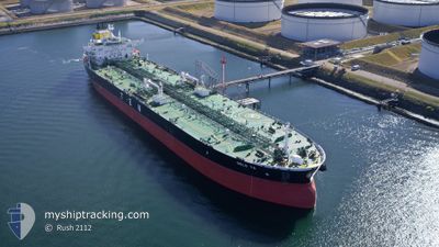
Tanker
Current Trip
| Time Travelled | 16 days |
|---|---|
| Remaining Time | --- |
| Distance Travelled | 4176.50 морская миля |
| Remaining Distance | --- |
| AVG Speed | 11.8 Узлы |
| MAX Speed | 15.6 Узлы |
| AVG Wind | 16.5 knots |
| MAX Wind | 35 knots |
| MIN Temp | -4°C / 24.8°F |
| MAX Temp | 18.2°C / 64.76°F |
| Осадка | 11.6 м |
| Позиция Получена | 9 d тому назад |
Current Position
| Долгота | -4.23499° |
|---|---|
| Широта | 58.73811° |
| Статус | Under way using engine |
| Скорость | 11.8 Узлы |
| Курс | 270.9° |
| Район | North Atlantic Ocean |
| Станция | T-AIS |
| Позиция Получена | 9 d тому назад |
Info
Information
The current position of OSLO TS is in North Atlantic Ocean with coordinates 58.73811° / -4.23499° as reported on 2024-04-10 03:00 by AIS to our vessel tracker app. The vessel's current speed is 11.8 Узлы and is heading at the port of PASCAGOULA. The estimated time of arrival as calculated by MyShipTracking vessel tracking app is 2024-04-25 05:00 LT
The vessel OSLO TS (IMO: 9737383, MMSI: 248006000) is a Tanker It's sailing under the flag of [MT] Malta.
In this page you can find informations about the vessels current position, last detected port calls, and current voyage information. If the vessels is not in coverage by AIS you will find the latest position.
The current position of OSLO TS is detected by our AIS receivers and we are not responsible for the reliability of the data. The last position was recorded while the vessel was in Coverage by the Ais receivers of our vessel tracking app.
The current draught of OSLO TS as reported by AIS is 11.6 meters
Weather
| Temperature | 18.7°C / 65.66°F |
|---|---|
| Wind Speed | 16 knots |
| Direction | 131° SE |
| Pressure | 1014.9 hPa |
| Humidity | 84.8 % |
| Cloud Coverage | 73 % |
Featured Company
Last Port Calls
| Port | Arrival | Departure | Time In Port |
|---|---|---|---|
| 2024-04-02 09:31 | 2024-04-03 19:23 | 1 d | |
| 2024-03-27 20:23 | 2024-03-29 02:01 | 1 d | |
| 2024-03-22 08:54 | 2024-03-23 18:20 | 1 d | |
| 2024-03-16 11:03 | 2024-03-17 16:28 | 1 d | |
| 2024-03-05 08:14 | 2024-03-08 19:24 | 3 d | |
| 2024-02-29 09:23 | 2024-03-01 21:45 | 1 d | |
| 2024-02-06 08:18 | 2024-02-08 16:00 | 2 d | |
| 2024-02-01 16:20 | 2024-02-03 13:13 | 1 d |
Last Trips
| Origin | Departure | Destination | Arrival | Distance | |
|---|---|---|---|---|---|
| 2024-03-29 03:01 | 2024-04-02 12:31 | 1258.38 морская миля | |||
| 2024-03-23 19:20 | 2024-03-27 21:23 | 815.04 морская миля | |||
| 2024-03-17 18:28 | 2024-03-22 09:54 | 1287.93 морская миля | |||
| 2024-03-08 20:24 | 2024-03-16 13:03 | 1139.81 морская миля | |||
| 2024-03-01 22:45 | 2024-03-05 09:14 | 445.84 морская миля | |||
| 2024-02-08 10:00 | 2024-02-29 10:23 | 5758.50 морская миля | |||
| 2024-02-03 07:13 | 2024-02-06 02:18 | 538.65 морская миля | |||
| 2023-12-01 21:32 | 2024-02-01 10:20 | 5946.19 морская миля |
Events
| Время | Событие | Детали | Позиция / Направление | Информация |
|---|---|---|---|---|
| 2024-04-10 03:11 | Статус изменился | Default Under way using engine |
58.73916 / -4.30596
GBSCF>USPGL
|
Скорость: 11.8 kn Курс: 270.9° |
| 2024-04-10 03:00 | Вне покрытия |
58.73811 / -4.23499
North Atlantic Ocean
GBSCF>USPGL
|
Скорость: 11.8 kn Курс: 270.9° |
|
| 2024-04-10 01:04 | Изменение морского района | United Kingdom part of the North Atlantic Ocean United Kingdom part of the North Sea |
58.74044 / -3.42232
North Atlantic Ocean
GBSCF>USPGL
|
Скорость: 14.4 kn Курс: 270.1° |
| 2024-04-10 00:18 | ETA изменился | 2024/04/25 05:00 2024/04/10 00:14 |
58.77912 / -3.09258
GBSCF>USPGL
|
Скорость: 12.3 kn Курс: 228.2° |
| 2024-04-10 00:16 | ETA изменился | 2024/04/10 00:14 2024/04/08 12:36 |
58.78323 / -3.08350
GBSCF>USPGL
|
Скорость: 12.1 kn Курс: 229.5° |
| 2024-04-09 23:20 | Начало движения | 2.6 nm, South West of SCAPA |
58.92162 / -3.02116
GBSCF>USPGL
|
Скорость: 3.1 kn Курс: 286° |
| 2024-04-09 23:16 | Статус изменился | Under way using engine At anchor |
58.92012 / -3.01831
GBSCF>USPGL
|
Скорость: 0.9 kn Курс: 301° |