
OSLO TS
Tanker
Current Trip
| Time Travelled | 20 days |
|---|---|
| Remaining Time | --- |
| Distance Travelled | 5404.24 nm |
| Remaining Distance | --- |
| AVG Speed | 11.9 Knots |
| MAX Speed | 15.6 Knots |
| AVG Wind | 16.4 knots |
| MAX Wind | 35 knots |
| MIN Temp | -4°C / 24.8°F |
| MAX Temp | 25.5°C / 77.9°F |
| Dybgang | 10.4 m |
| Position Modtaget | 16 h, 11 m siden |
Current Position
| Longitude | -79.57172° |
|---|---|
| Latitude | 25.52253° |
| Status | Under way using engine |
| Fart | 12.2 Knots |
| Kurs | 188.5° |
| Område | North Atlantic Ocean |
| Station | T-AIS |
| Position Modtaget | 16 h, 11 m siden |
Info
Information
The current position of OSLO TS is in North Atlantic Ocean with coordinates 25.52253° / -79.57172° as reported on 2024-04-23 05:26 by AIS to our vessel tracker app. The vessel's current speed is 12.2 Knots and is heading at the port of PASCAGOULA. The estimated time of arrival as calculated by MyShipTracking vessel tracking app is 2024-04-25 14:00 LT
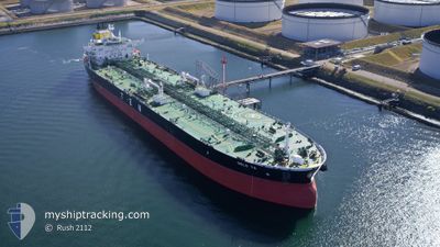
The vessel OSLO TS (IMO: 9737383, MMSI: 248006000) is a Tanker It's sailing under the flag of [MT] Malta.
In this page you can find informations about the vessels current position, last detected port calls, and current voyage information. If the vessels is not in coverage by AIS you will find the latest position.
The current position of OSLO TS is detected by our AIS receivers and we are not responsible for the reliability of the data. The last position was recorded while the vessel was in Coverage by the Ais receivers of our vessel tracking app.
The current draught of OSLO TS as reported by AIS is 10.4 meters
Weather
| Temperature | 25.6°C / 78.08°F |
|---|---|
| Wind Speed | 16 knots |
| Direction | 74° ENE |
| Pressure | 1016.8 hPa |
| Humidity | 74.9 % |
| Cloud Coverage | 29 % |
Featured Company
Last Port Calls
| Port | Arrival | Departure | Time In Port |
|---|---|---|---|
| 2024-04-02 09:31 | 2024-04-03 19:23 | 1 d | |
| 2024-03-27 20:23 | 2024-03-29 02:01 | 1 d | |
| 2024-03-22 08:54 | 2024-03-23 18:20 | 1 d | |
| 2024-03-16 11:03 | 2024-03-17 16:28 | 1 d | |
| 2024-03-05 08:14 | 2024-03-08 19:24 | 3 d | |
| 2024-02-29 09:23 | 2024-03-01 21:45 | 1 d | |
| 2024-02-06 08:18 | 2024-02-08 16:00 | 2 d | |
| 2024-02-01 16:20 | 2024-02-03 13:13 | 1 d |
Last Trips
| Origin | Departure | Destination | Arrival | Distance | |
|---|---|---|---|---|---|
| 2024-03-29 03:01 | 2024-04-02 12:31 | 1258.38 nm | |||
| 2024-03-23 19:20 | 2024-03-27 21:23 | 815.04 nm | |||
| 2024-03-17 18:28 | 2024-03-22 09:54 | 1287.93 nm | |||
| 2024-03-08 20:24 | 2024-03-16 13:03 | 1139.81 nm | |||
| 2024-03-01 22:45 | 2024-03-05 09:14 | 445.84 nm | |||
| 2024-02-08 10:00 | 2024-02-29 10:23 | 5758.50 nm | |||
| 2024-02-03 07:13 | 2024-02-06 02:18 | 538.65 nm | |||
| 2023-12-01 21:32 | 2024-02-01 10:20 | 5946.19 nm |
Events
| Tid | Hændelsen | Detaljer | Position / Dest | Info |
|---|---|---|---|---|
| 2024-04-23 05:29 | Status er ændret | Default Under way using engine |
25.51195 / -79.57355
GBSCF>USPGL
|
Fart: 12.2 kn Kurs: 188.5° |
| 2024-04-23 05:26 | Udenfor Dækning |
25.52253 / -79.57172
North Atlantic Ocean
GBSCF>USPGL
|
Fart: 12.2 kn Kurs: 188.5° |
|
| 2024-04-23 04:52 | Status er ændret | Under way using engine Default |
25.63410 / -79.55155
GBSCF>USPGL
|
Fart: 11.5 kn Kurs: 186° |
| 2024-04-23 04:29 | Status er ændret | Default Under way using engine |
25.70745 / -79.53841
GBSCF>USPGL
|
Fart: 11.5 kn Kurs: 185.9° |
| 2024-04-23 03:59 | Status er ændret | Under way using engine Default |
25.80134 / -79.52798
GBSCF>USPGL
|
Fart: 11.6 kn Kurs: 184° |
| 2024-04-23 03:49 | Status er ændret | Default Under way using engine |
25.83351 / -79.52570
GBSCF>USPGL
|
Fart: 11.5 kn Kurs: 183.1° |
| 2024-04-23 01:44 | Dybgangen er ændret | 10.4 11.6 |
26.26008 / -79.47134
GBSCF>USPGL
|
Fart: 12.6 kn Kurs: 188.1° |
| 2024-04-23 01:44 | ETA er ændret | 2024/04/25 14:00 2024/04/25 05:00 |
26.26008 / -79.47134
GBSCF>USPGL
|
Fart: 12.6 kn Kurs: 188.1° |
| 2024-04-23 01:29 | Status er ændret | Under way using engine Default |
26.31279 / -79.46199
GBSCF>USPGL
|
Fart: 12.6 kn Kurs: 189° |
| 2024-04-23 01:29 | Indenfor Dækning |
26.31163 / -79.46225
North Atlantic Ocean
GBSCF>USPGL
|
Fart: 12.7 kn Kurs: 191° |