
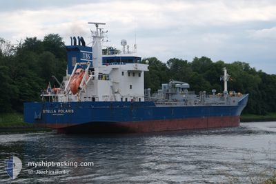
STELLA POLARIS
Oil/Chemical Tanker
Current Trip
| Time Travelled | 2 days |
|---|---|
| Remaining Time | --- |
| Distance Travelled | 385.64 nm |
| Remaining Distance | --- |
| AVG Speed | 7.2 Knots |
| MAX Speed | 11.5 Knots |
| AVG Wind | 23.2 knots |
| MAX Wind | 29 knots |
| MIN Temp | 4.8°C / 40.64°F |
| MAX Temp | 7.8°C / 46.04°F |
| Draught | 5.2 m |
| Position Received | 3 m ago |
Current Position
| Longitude | --- |
|---|---|
| Latitude | --- |
| Status | At anchor |
| Speed | 0.4 Knots |
| Course | 250° |
| Area | North Sea |
| Station | T-AIS |
| Position Received | 3 m ago |
Info
Information
The current position of STELLA POLARIS is in North Sea with coordinates 53.63171° / 6.20962° as reported on 2025-03-05 11:47 by AIS to our vessel tracker app. The vessel's current speed is 0.4 Knots
The vessel STELLA POLARIS (IMO: 9187057, MMSI: 245911000) is a Oil/Chemical Tanker that was built in 1999 ( 26 years old ). It's sailing under the flag of [NL] Netherlands.
In this page you can find informations about the vessels current position, last detected port calls, and current voyage information. If the vessels is not in coverage by AIS you will find the latest position.
The current position of STELLA POLARIS is detected by our AIS receivers and we are not responsible for the reliability of the data. The last position was recorded while the vessel was in Coverage by the Ais receivers of our vessel tracking app.
The current draught of STELLA POLARIS as reported by AIS is 5.2 meters
Weather
| Temperature | 6.4°C / 43.52°F |
|---|---|
| Wind Speed | 21 knots |
| Direction | 235° SW |
| Pressure | 1021.4 hPa |
| Humidity | 83.7 % |
| Cloud Coverage | 82 % |
Featured Company
Last Port Calls
| Port | Arrival | Departure | Time In Port |
|---|---|---|---|
| 2025-03-02 09:38 | 2025-03-03 08:16 | 22 h | |
| 2025-02-23 11:53 | 2025-02-24 10:15 | 22 h | |
| 2025-02-07 18:54 | 2025-02-09 06:36 | 1 d | |
| 2025-02-06 23:50 | 2025-02-07 16:15 | 16 h | |
| 2025-02-05 21:53 | 2025-02-06 14:14 | 16 h | |
| 2025-02-02 18:09 | 2025-02-03 15:37 | 21 h | |
| 2025-02-02 00:47 | 2025-02-02 16:47 | 15 h | |
| 2025-01-30 18:54 | 2025-01-30 19:55 | 1 h | |
| 2025-01-27 15:53 | 2025-01-28 11:37 | 19 h | |
| 2025-01-14 07:53 | 2025-01-15 06:17 | 22 h |
Most Visited Ports (Last year)
| Port | Arrivals | |
|---|---|---|
| 15 | ||
| 14 | ||
| 9 | ||
| 7 | ||
| 4 | ||
| 4 |
Last Trips
| Origin | Departure | Destination | Arrival | Distance | |
|---|---|---|---|---|---|
| 2025-02-24 10:15 | 2025-03-02 09:38 | 1286.02 nm | |||
| 2025-02-09 06:36 | 2025-02-23 11:53 | 2401.56 nm | |||
| 2025-02-06 14:14 | 2025-02-07 18:54 | 131.06 nm | |||
| 2025-02-06 14:14 | 2025-02-06 23:50 | 104.26 nm | |||
| 2025-02-03 15:37 | 2025-02-05 21:53 | 637.63 nm | |||
| 2025-02-02 16:47 | 2025-02-02 18:09 | 10.48 nm | |||
| 2025-01-30 19:55 | 2025-02-02 00:47 | 336.97 nm | |||
| 2025-01-28 11:37 | 2025-01-30 18:54 | 666.11 nm | |||
| 2025-01-15 06:17 | 2025-01-27 15:53 | 1754.90 nm | |||
| 2025-01-02 11:09 | 2025-01-14 07:53 | 1779.06 nm |
Events
| Time | Event | Details | Position / Dest | Info |
|---|---|---|---|---|
| 2025-03-05 11:38 | Status Changed | At anchor Default |
53.63153 / 6.20972
NO TRF > NL DZL
|
Speed: 0.5 kn Course: 260° |
| 2025-03-05 11:32 | Status Changed | Default At anchor |
53.63187 / 6.20945
NO TRF > NL DZL
|
Speed: 0.1 kn Course: 241° |
| 2025-03-05 11:23 | Status Changed | At anchor Default |
53.63185 / 6.20948
NO TRF > NL DZL
|
Speed: Course: 245° |
| 2025-03-05 11:08 | Status Changed | Default At anchor |
53.63185 / 6.20957
NO TRF > NL DZL
|
Speed: 0.2 kn Course: 243° |
| 2025-03-05 10:59 | Status Changed | At anchor Default |
53.63197 / 6.20950
NO TRF > NL DZL
|
Speed: 0.4 kn Course: 260° |
| 2025-03-05 10:26 | Status Changed | Default At anchor |
53.63177 / 6.20962
NO TRF > NL DZL
|
Speed: 0.1 kn Course: 261° |
| 2025-03-05 10:08 | Status Changed | At anchor Default |
53.63145 / 6.20972
NO TRF > NL DZL
|
Speed: 0.2 kn Course: 253° |
| 2025-03-05 09:41 | Status Changed | Default At anchor |
53.63150 / 6.20967
NO TRF > NL DZL
|
Speed: 0.5 kn Course: 270° |
| 2025-03-05 08:59 | STOP Moving | 9.89 nm, North of SCHIERMONNIKOOG |
53.63182 / 6.20960
NO TRF > NL DZL
|
Speed: 0.1 kn Course: 251° |
| 2025-03-05 08:17 | Status Changed | At anchor Under way using engine |
53.63052 / 6.20758
NO TRF > NL DZL
|
Speed: 0.7 kn Course: 326° |