
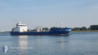
STELLA POLARIS
Oil/Chemical Tanker
Current Trip
| Time Travelled | 1 day |
|---|---|
| Remaining Time | 12 h, 32 mins |
| Distance Travelled | 43.53 nm |
| Remaining Distance | 155.34 nm |
| AVG Speed | 10.3 Knopen |
| MAX Speed | 11.7 Knopen |
| AVG Wind | 13.5 knots |
| MAX Wind | 24.3 knots |
| MIN Temp | 7.7°C / 45.86°F |
| MAX Temp | 9.4°C / 48.92°F |
| Diepgang | 5.3 M |
| Positie ontvangen | Nu |
Current Position
| Lengtegraad | 5.87535° |
|---|---|
| Breedtegraat | 53.72859° |
| Status | Under way using engine |
| Snelheid | 11.2 Knopen |
| Koers | 250.6° |
| Gebied | North Sea |
| Station | T-AIS |
| Positie ontvangen | Nu |
Info
Information
The current position of STELLA POLARIS is in North Sea with coordinates 53.72859° / 5.87535° as reported on 2024-04-19 09:20 by AIS to our vessel tracker app. The vessel's current speed is 11.2 Knopen and is heading at the port of ROTTERDAM. The estimated time of arrival as calculated by MyShipTracking vessel tracking app is 2024-04-19 21:53 LT
The vessel STELLA POLARIS (IMO: 9187057, MMSI: 245911000) is a Oil/Chemical Tanker that was built in 1999 ( 25 Jaar oud ). It's sailing under the flag of [NL] Netherlands.
In this page you can find informations about the vessels current position, last detected port calls, and current voyage information. If the vessels is not in coverage by AIS you will find the latest position.
The current position of STELLA POLARIS is detected by our AIS receivers and we are not responsible for the reliability of the data. The last position was recorded while the vessel was in Coverage by the Ais receivers of our vessel tracking app.
The current draught of STELLA POLARIS as reported by AIS is 5.3 meters
Weather
| Temperature | 8.7°C / 47.66°F |
|---|---|
| Wind Speed | 24 knots |
| Direction | 309° NW |
| Pressure | 1004 hPa |
| Humidity | 78.3 % |
| Cloud Coverage | 100 % |
Featured Company
Last Port Calls
| Port | Arrival | Departure | Time In Port |
|---|---|---|---|
| 2024-04-17 12:54 | 2024-04-17 13:22 | 28 m | |
| 2024-04-10 18:50 | 2024-04-11 03:59 | 9 h | |
| 2024-04-09 13:13 | 2024-04-10 04:45 | 15 h | |
| 2024-04-06 17:36 | 2024-04-07 05:11 | 11 h | |
| 2024-04-01 18:21 | 2024-04-01 18:25 | 4 m | |
| 2024-03-29 06:04 | 2024-03-30 08:47 | 1 d | |
| 2024-03-25 07:31 | 2024-03-26 06:42 | 23 h | |
| 2024-03-19 17:22 | 2024-03-20 10:15 | 16 h | |
| 2024-03-14 18:32 | 2024-03-15 08:16 | 13 h | |
| 2024-03-07 21:32 | 2024-03-08 06:50 | 9 h |
Most Visited Ports (Last year)
| Port | Arrivals | |
|---|---|---|
| 16 | ||
| 14 | ||
| 12 | ||
| 8 | ||
| 7 | ||
| 3 |
Last Trips
| Origin | Departure | Destination | Arrival | Distance | |
|---|---|---|---|---|---|
| 2024-04-11 06:59 | 2024-04-17 14:54 | 1185.70 nm | |||
| 2024-04-10 06:45 | 2024-04-10 21:50 | 168.50 nm | |||
| 2024-04-07 07:11 | 2024-04-09 15:13 | 541.76 nm | |||
| 2024-04-01 20:25 | 2024-04-06 19:36 | 535.88 nm | |||
| 2024-03-30 09:47 | 2024-04-01 20:21 | 403.86 nm | |||
| 2024-03-26 08:42 | 2024-03-29 07:04 | 755.80 nm | |||
| 2024-03-20 11:15 | 2024-03-25 09:31 | 687.22 nm | |||
| 2024-03-15 09:16 | 2024-03-19 18:22 | 521.99 nm | |||
| 2024-03-08 07:50 | 2024-03-14 19:32 | 1224.01 nm | |||
| 2024-03-02 19:25 | 2024-03-07 22:32 | 1204.89 nm |
Events
| Tijd | Evenement | Details | Positie / Bestemming | Info |
|---|---|---|---|---|
| 2024-04-19 08:19 | Buitenbereik |
53.77925 / 6.18012
North Sea
NLDZL>>NLRTM
|
Snelheid: 10.6 kn Koers: 284.8° |
|
| 2024-04-19 08:13 | Gevonden in zee | Dutch part of the North Sea |
53.76661 / 6.20340
North Sea
NLDZL>>NLRTM
|
Snelheid: 11.1 kn Koers: 336.5° |
| 2024-04-19 08:13 | Binnenbereik |
53.76661 / 6.20340
North Sea
NLDZL>>NLRTM
|
Snelheid: 11.1 kn Koers: 336.5° |
|
| 2024-04-19 06:20 | Buitenbereik |
53.58544 / 6.61848
North Sea
NLDZL>>NLRTM
|
Snelheid: 11.1 kn Koers: 307.2° |
|
| 2024-04-19 06:17 | Status Changed | Under way using engine Moored |
53.57923 / 6.63230
NLDZL>>NLRTM
|
Snelheid: 11.7 kn Koers: 291.6° |
| 2024-04-19 05:39 | Wijzig zee gebeid | German part of the North Sea Dutch part of the North Sea |
53.51527 / 6.77717
North Sea
NLDZL>>NLRTM
|
Snelheid: 11.6 kn Koers: 307.2° |
| 2024-04-19 04:09 | Start beweging | 1.63 nm, East of DELFZIJL |
53.31983 / 6.96941
NLDZL>>NLRTM
|
Snelheid: 4.9 kn Koers: 105° |
| 2024-04-19 04:01 | Draught Changed | 5.3 6.4 |
53.31973 / 6.96600
NLDZL>>NLRTM
|
Snelheid: Koers: 88° |
| 2024-04-19 04:01 | Destination Changed | NLDZL>>NLRTM SE NYN>>NLDZL |
53.31973 / 6.96600
NLDZL>>NLRTM
|
Snelheid: Koers: 88° |
| 2024-04-19 04:01 | ETA Changed | 2024/04/20 01:00 2024/04/16 08:00 |
53.31973 / 6.96600
NLDZL>>NLRTM
|
Snelheid: Koers: 88° |