
FEDERAL CHURCHILL
Cargo
Current Trip
| Time Travelled | 21 days |
|---|---|
| Remaining Time | --- |
| Distance Travelled | 2480.09 nm |
| Remaining Distance | --- |
| AVG Speed | 11.9 Knots |
| MAX Speed | 15.1 Knots |
| AVG Wind | 6.5 knots |
| MAX Wind | 22 knots |
| MIN Temp | -1.6°C / 29.12°F |
| MAX Temp | 29.4°C / 84.92°F |
| Draught | 11 m |
| Position Received | 19 h, 57 m ago |
Current Position
| Longitude | --- |
|---|---|
| Latitude | --- |
| Status | At anchor |
| Speed | 0.1 Knots |
| Course | 265° |
| Area | North Pacific Ocean |
| Station | T-AIS |
| Position Received | 19 h, 57 m ago |
Info
Information
The current position of FEDERAL CHURCHILL is in North Pacific Ocean with coordinates 13.85085° / -90.73653° as reported on 2025-03-13 11:29 by AIS to our vessel tracker app. The vessel's current speed is 0.1 Knots
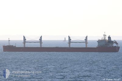
The vessel FEDERAL CHURCHILL (IMO: 9671060, MMSI: 538006469) is a Cargo It's sailing under the flag of [MH] Marshall Is.
In this page you can find informations about the vessels current position, last detected port calls, and current voyage information. If the vessels is not in coverage by AIS you will find the latest position.
The current position of FEDERAL CHURCHILL is detected by our AIS receivers and we are not responsible for the reliability of the data. The last position was recorded while the vessel was in Coverage by the Ais receivers of our vessel tracking app.
The current draught of FEDERAL CHURCHILL as reported by AIS is 11 meters
Weather
| Temperature | 27.7°C / 81.86°F |
|---|---|
| Wind Speed | 10 knots |
| Direction | 311° NW |
| Pressure | 1011.2 hPa |
| Humidity | 71.9 % |
| Cloud Coverage | 82 % |
Featured Company
Last Port Calls
| Port | Arrival | Departure | Time In Port |
|---|---|---|---|
| 2025-02-19 02:32 | 2025-02-20 19:03 | 1 d | |
| 2025-02-08 09:40 | 2025-02-12 08:47 | 3 d | |
| 2025-01-10 20:14 | 2025-01-16 13:05 | 5 d |
Most Visited Ports (Last year)
| Port | Arrivals | |
|---|---|---|
| 7 | ||
| 6 | ||
| 6 | ||
| 3 | ||
| 3 | ||
| 2 |
Last Trips
| Origin | Departure | Destination | Arrival | Distance | |
|---|---|---|---|---|---|
| 2025-02-12 08:47 | 2025-02-19 02:32 | 1650.94 nm | |||
| 2025-01-16 13:05 | 2025-02-08 09:40 | 2135.06 nm | |||
| 2024-12-29 12:57 | 2025-01-10 20:14 | 3115.37 nm |
Events
| Time | Event | Details | Position / Dest | Info |
|---|---|---|---|---|
| 2025-03-13 11:41 | Status Changed | Default At anchor |
13.85067 / -90.73659
GT_PRQ
|
Speed: 0.1 kn Course: 265° |
| 2025-03-13 11:29 | Status Changed | At anchor Default |
13.85085 / -90.73653
GT_PRQ
|
Speed: 0.1 kn Course: 263° |
| 2025-03-13 11:29 | OUT of Coverage |
13.85085 / -90.73653
North Pacific Ocean
|
Speed: 0.1 kn Course: 176.3° |
|
| 2025-03-13 11:08 | Status Changed | Default At anchor |
13.85093 / -90.73649
GT_PRQ
|
Speed: 0.2 kn Course: 275° |
| 2025-03-13 10:53 | Status Changed | At anchor Default |
13.85054 / -90.73661
GT_PRQ
|
Speed: 0.1 kn Course: 284° |
| 2025-03-13 10:26 | Status Changed | Default At anchor |
13.85048 / -90.73660
GT_PRQ
|
Speed: 0.1 kn Course: 284° |
| 2025-03-13 10:17 | Status Changed | At anchor Default |
13.85042 / -90.73652
GT_PRQ
|
Speed: 0.2 kn Course: 284° |
| 2025-03-13 10:14 | Status Changed | Default At anchor |
13.85047 / -90.73651
GT_PRQ
|
Speed: Course: 284° |
| 2025-03-13 10:11 | Status Changed | At anchor Default |
13.85051 / -90.73654
GT_PRQ
|
Speed: 0.1 kn Course: 286° |
| 2025-03-13 09:56 | Status Changed | Default At anchor |
13.85041 / -90.73652
GT_PRQ
|
Speed: 0.1 kn Course: 285° |