
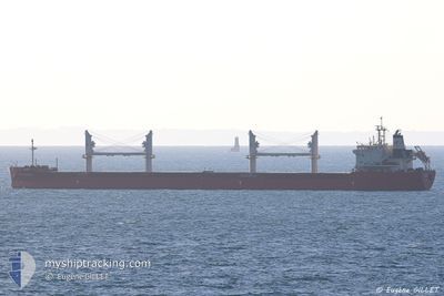
FEDERAL CHURCHILL
Cargo
Current Trip
| Time Travelled | 11 days |
|---|---|
| Remaining Time | --- |
| Distance Travelled | 2233.04 nm |
| Remaining Distance | --- |
| AVG Speed | 11.3 Knots |
| MAX Speed | 15.2 Knots |
| AVG Wind | 11.6 knots |
| MAX Wind | 20 knots |
| MIN Temp | 21.4°C / 70.52°F |
| MAX Temp | 28.8°C / 83.84°F |
| Dybgang | 9.2 m |
| Position Modtaget | 3 d siden |
Current Position
| Longitude | -79.34361° |
|---|---|
| Latitude | 27.46370° |
| Status | Under way using engine |
| Fart | 13.8 Knots |
| Kurs | 14.9° |
| Område | North Atlantic Ocean |
| Station | T-AIS |
| Position Modtaget | 3 d siden |
Info
Information
The current position of FEDERAL CHURCHILL is in North Atlantic Ocean with coordinates 27.46370° / -79.34361° as reported on 2024-06-05 22:41 by AIS to our vessel tracker app. The vessel's current speed is 13.8 Knots and is heading at the port of PORT-ALFRED. The estimated time of arrival as calculated by MyShipTracking vessel tracking app is 2024-06-14 14:00 LT
The vessel FEDERAL CHURCHILL (IMO: 9671060, MMSI: 538006469) is a Cargo It's sailing under the flag of [MH] Marshall Is.
In this page you can find informations about the vessels current position, last detected port calls, and current voyage information. If the vessels is not in coverage by AIS you will find the latest position.
The current position of FEDERAL CHURCHILL is detected by our AIS receivers and we are not responsible for the reliability of the data. The last position was recorded while the vessel was in Coverage by the Ais receivers of our vessel tracking app.
The current draught of FEDERAL CHURCHILL as reported by AIS is 9.2 meters
Weather
| Temperature | 20.9°C / 69.62°F |
|---|---|
| Wind Speed | 12 knots |
| Direction | 247° WSW |
| Pressure | 1010.3 hPa |
| Humidity | 75.7 % |
| Cloud Coverage | 2 % |
Featured Company
Most Visited Ports (Last year)
| Port | Arrivals | |
|---|---|---|
| 5 | ||
| 4 | ||
| 4 | ||
| 2 | ||
| 2 | ||
| 1 |
Events
| Tid | Hændelsen | Detaljer | Position / Dest | Info |
|---|---|---|---|---|
| 2024-06-05 23:24 | Status er ændret | Default Under way using engine |
27.57676 / -79.22317
CAPAF
|
Fart: 13.8 kn Kurs: 14.9° |
| 2024-06-05 22:41 | Udenfor Dækning |
27.46370 / -79.34361
North Atlantic Ocean
CAPAF
|
Fart: 13.8 kn Kurs: 14.9° |
|
| 2024-06-05 21:42 | Status er ændret | Under way using engine Default |
27.23727 / -79.38609
CAPAF
|
Fart: 14.3 kn Kurs: 2° |
| 2024-06-05 21:31 | Indenfor Dækning |
27.24328 / -79.38589
North Atlantic Ocean
CAPAF
|
Fart: 14.4 kn Kurs: 2.2° |
|
| 2024-06-05 17:52 | Status er ændret | Default Under way using engine |
26.31388 / -79.43965
CAPAF
|
Fart: 15 kn Kurs: 23.5° |
| 2024-06-05 17:45 | Udenfor Dækning |
26.28556 / -79.45347
North Atlantic Ocean
CAPAF
|
Fart: 15 kn Kurs: 23.5° |
|
| 2024-06-05 15:59 | Ændre havområde | Bahamas part of the North Atlantic Ocean United States part of the North Atlantic Ocean |
25.91085 / -79.68686
North Atlantic Ocean
CAPAF
|
Fart: 14.5 kn Kurs: 58.8° |
| 2024-06-05 14:12 | START Sejllads | 5.33 nm, North East of MIAMI |
25.80611 / -80.07931
CAPAF
|
Fart: 3.1 kn Kurs: 80° |
| 2024-06-05 14:03 | Status er ændret | Under way using engine At anchor |
25.80363 / -80.08091
CAPAF
|
Fart: 0.4 kn Kurs: 24° |
| 2024-06-05 13:42 | Destination er ændret | CAPAF USMIA |
25.80406 / -80.08072
CAPAF
|
Fart: Kurs: 40° |