
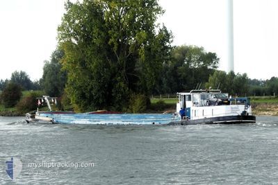
DAUNTLESS
Cargo
Current Trip
DAUNTLESS is out of coverage. Learn how you can join the community and extend the coverage to your area by clicking here!
NOOIT MEER NAAR HUIS
Unknown Port
ETA*
---
| Time Travelled | 3 days |
|---|---|
| Remaining Time | --- |
| Distance Travelled | 28.19 nm |
| Remaining Distance | --- |
| AVG Speed | 5.5 Knots |
| MAX Speed | 7.4 Knots |
| AVG Wind | 2.9 knots |
| MAX Wind | 9 knots |
| MIN Temp | 8.9°C / 48.02°F |
| MAX Temp | 10.6°C / 51.08°F |
| Draught | 0 m |
| Position Received | 1 d ago |
Current Position
| Longitude | --- |
|---|---|
| Latitude | --- |
| Status | Under way using engine |
| Speed | 6.3 Knots |
| Course | 28° |
| Area | North Sea |
| Station | T-AIS |
| Position Received | 1 d ago |
Info
info
Information
The current position of DAUNTLESS is in North Sea with coordinates 51.10563° / 5.84862° as reported on 2025-12-16 15:14 by AIS to our vessel tracker app. The vessel's current speed is 6.3 Knots
The vessel DAUNTLESS (MMSI: 244000606) is a Cargo It's sailing under the flag of [NL] Netherlands.
In this page you can find informations about the vessels current position, last detected port calls, and current voyage information. If the vessels is not in coverage by AIS you will find the latest position.
The current position of DAUNTLESS is detected by our AIS receivers and we are not responsible for the reliability of the data. The last position was recorded while the vessel was in Coverage by the Ais receivers of our vessel tracking app.
Weather
| Temperature | 9.7°C / 49.46°F |
|---|---|
| Wind Speed | 2 knots |
| Direction | 116° ESE |
| Pressure | 1013.2 hPa |
| Humidity | 70.5 % |
| Cloud Coverage | 78 % |
Featured Company
Limited time offer - Install a base station receiver to your area and list your company on MyShipTracking Free forever!
Last Port Calls
| Port | Arrival | Departure | Time In Port |
|---|---|---|---|
| 2025-12-13 13:53 | 2025-12-14 11:53 | 21 h | |
| 2025-11-28 17:51 | 2025-11-28 19:21 | 1 h | |
| 2025-11-25 08:48 | 2025-11-25 10:35 | 1 h | |
| 2025-11-20 21:34 | 2025-11-21 08:15 | 10 h | |
| 2025-11-19 08:57 | 2025-11-19 09:35 | 38 m | |
| 2025-11-19 06:43 | 2025-11-19 07:30 | 47 m | |
| 2025-11-18 09:19 | 2025-11-19 04:41 | 19 h | |
| 2025-11-18 08:38 | 2025-11-18 08:54 | 15 m | |
| 2025-11-17 15:31 | |||
| 2025-11-17 06:54 | 2025-11-17 14:09 | 7 h |
Most Visited Ports (Last year)
| Port | Arrivals | |
|---|---|---|
| 4 | ||
| 3 | ||
| 3 | ||
| 2 | ||
| 2 | ||
| 2 |
Last Trips
| Origin | Departure | Destination | Arrival | Distance | |
|---|---|---|---|---|---|
| 2025-11-28 19:21 | 2025-12-13 13:53 | 91.16 nm | |||
| 2025-11-25 10:35 | 2025-11-28 17:51 | 168.26 nm | |||
| 2025-11-21 08:15 | 2025-11-25 08:48 | 1.38 nm | |||
| 2025-11-19 09:35 | 2025-11-20 21:34 | 128.33 nm | |||
| 2025-11-19 07:30 | 2025-11-19 08:57 | 1.35 nm | |||
| 2025-11-19 04:41 | 2025-11-19 06:43 | 14.94 nm | |||
| 2025-11-18 08:54 | 2025-11-18 09:19 | 2.85 nm | |||
| 2025-11-17 14:09 | 2025-11-18 08:38 | 2.42 nm | |||
| 2025-11-17 14:09 | 2025-11-17 15:31 | 1.98 nm | |||
| 2025-11-17 04:55 | 2025-11-17 06:54 | 5.66 nm |
Events
| Time | Event | Details | Position / Dest | Info |
|---|---|---|---|---|
| 2025-12-16 15:14 | OUT of Coverage |
51.10563 / 5.84862
North Sea
|
Speed: 6.3 kn Course: 28° |
|
| 2025-12-16 14:32 | IN Coverage |
51.04648 / 5.80301
North Sea
|
Speed: 2.8 kn Course: 33.8° |
|
| 2025-12-15 14:12 | OUT of Coverage |
51.44314 / 5.69231
North Sea
|
Speed: 7.4 kn Course: 175.2° |
|
| 2025-12-15 14:12 | IN Coverage |
51.44314 / 5.69231
North Sea
|
Speed: 7.4 kn Course: 175.2° |
|
| 2025-12-14 10:57 | OUT of Coverage |
51.62759 / 4.88671
North Sea
|
Speed: 5.8 kn Course: 105.5° |
|
| 2025-12-14 10:53 | PORT DEPARTURE |
|
51.62950 / 4.87540
NOOIT MEER NAAR HUIS
|
Speed: 5.5 kn Course: 104.4° |
| 2025-12-14 10:14 | IN Coverage |
51.64675 / 4.84033
North Sea
[NL] OOSTERHOUT
|
Speed: 1.8 kn Course: 180.8° |
|
| 2025-12-14 07:22 | OUT of Coverage |
51.64913 / 4.84217
North Sea
[NL] OOSTERHOUT
|
Speed: Course: 511° |
|
| 2025-12-14 00:34 | IN Coverage |
51.64909 / 4.84217
North Sea
[NL] OOSTERHOUT
|
Speed: Course: 511° |
|
| 2025-12-13 12:53 | OUT of Coverage |
51.64912 / 4.84220
North Sea
[NL] OOSTERHOUT
|
Speed: 0.3 kn Course: 511° |