
AUTUMN STREAM
Reefer
Current Trip
| Time Travelled | 8 days |
|---|---|
| Remaining Time | 1 day |
| Distance Travelled | 3027.91 nm |
| Remaining Distance | 379.76 nm |
| AVG Speed | 16.4 Knots |
| MAX Speed | 18.9 Knots |
| AVG Wind | 9.6 knots |
| MAX Wind | 22 knots |
| MIN Temp | 15.4°C / 59.72°F |
| MAX Temp | 31.4°C / 88.52°F |
| Draught | 9.3 m |
| Position Received | 19 h, 42 m ago |
Current Position
| Longitude | --- |
|---|---|
| Latitude | --- |
| Status | Under way using engine |
| Speed | 17.2 Knots |
| Course | 28.4° |
| Area | Caribbean Sea |
| Station | T-AIS |
| Position Received | 19 h, 42 m ago |
Info
Information
The current position of AUTUMN STREAM is in Caribbean Sea with coordinates 9.83016° / -79.66169° as reported on 2025-03-02 11:46 by AIS to our vessel tracker app. The vessel's current speed is 17.2 Knots and is heading at the port of BALBOA. The estimated time of arrival as calculated by MyShipTracking vessel tracking app is 2025-03-04 02:45 LT
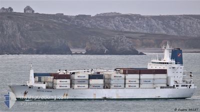
The vessel AUTUMN STREAM (IMO: 9038323, MMSI: 308315000) is a Reefer that was built in 1993 ( 32 years old ). It's sailing under the flag of [BS] Bahamas.
In this page you can find informations about the vessels current position, last detected port calls, and current voyage information. If the vessels is not in coverage by AIS you will find the latest position.
The current position of AUTUMN STREAM is detected by our AIS receivers and we are not responsible for the reliability of the data. The last position was recorded while the vessel was in Coverage by the Ais receivers of our vessel tracking app.
The current draught of AUTUMN STREAM as reported by AIS is 9.3 meters
Weather
| Temperature | 26.5°C / 79.7°F |
|---|---|
| Wind Speed | 12 knots |
| Direction | 59° ENE |
| Pressure | 1011.9 hPa |
| Humidity | 76.6 % |
| Cloud Coverage | 8 % |
Featured Company
Last Port Calls
| Port | Arrival | Departure | Time In Port |
|---|---|---|---|
| 2025-02-21 15:34 | 2025-02-23 03:25 | 1 d | |
| 2025-02-18 10:12 | 2025-02-21 13:16 | 3 d | |
| 2025-01-09 23:25 | 2025-01-19 03:13 | 9 d |
Most Visited Ports (Last year)
| Port | Arrivals | |
|---|---|---|
| 5 | ||
| 4 | ||
| 4 | ||
| 3 | ||
| 3 | ||
| 2 |
Last Trips
| Origin | Departure | Destination | Arrival | Distance | |
|---|---|---|---|---|---|
| 2025-02-21 13:16 | 2025-02-21 15:34 | 7.51 nm | |||
| 2025-01-19 03:13 | 2025-02-18 10:12 | 9126.04 nm | |||
| 2024-12-24 07:20 | 2025-01-09 23:25 | 3850.70 nm |
Events
| Time | Event | Details | Position / Dest | Info |
|---|---|---|---|---|
| 2025-03-02 11:48 | Status Changed | Default Under way using engine |
9.84119 / -79.65571
PABLB
|
Speed: 17.2 kn Course: 28.4° |
| 2025-03-02 11:46 | OUT of Coverage |
9.83016 / -79.66169
Caribbean Sea
|
Speed: 17.2 kn Course: 28.4° |
|
| 2025-03-02 11:36 | Status Changed | Under way using engine Default |
9.78797 / -79.68505
PABLB
|
Speed: 17.1 kn Course: 29° |
| 2025-03-02 11:32 | Status Changed | Default Under way using engine |
9.76861 / -79.69603
PABLB
|
Speed: 17.3 kn Course: 28.3° |
| 2025-03-02 11:09 | Status Changed | Under way using engine Default |
9.67042 / -79.74971
PABLB
|
Speed: 17.2 kn Course: 27° |
| 2025-03-02 11:05 | Status Changed | Default Under way using engine |
9.65814 / -79.75635
PABLB
|
Speed: 17.1 kn Course: 28.4° |
| 2025-03-02 10:48 | Status Changed | Under way using engine Default |
9.58701 / -79.79519
PABLB
|
Speed: 16.8 kn Course: 30° |
| 2025-03-02 10:45 | Status Changed | Default Under way using engine |
9.57290 / -79.80315
PABLB
|
Speed: 17 kn Course: 29.6° |
| 2025-03-02 09:38 | Change Sea Area | Panamanian part of the Caribbean Sea Panamanian part of the North Pacific Ocean |
9.37168 / -79.91840
Caribbean Sea
|
Speed: 9.6 kn Course: 4.6° |
| 2025-03-02 08:43 | START Moving | 3.94 nm, South of CRISTOBAL |
9.28163 / -79.92212
PABLB
|
Speed: 3.4 kn Course: 10° |