
AUTUMN STREAM
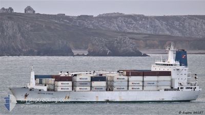
Reefer
Current Trip
| Time Travelled | 6 days |
|---|---|
| Remaining Time | 5 days |
| Distance Travelled | 1672.42 nm |
| Remaining Distance | 2757.34 nm |
| AVG Speed | 14.9 Knop |
| MAX Speed | 18.5 Knop |
| AVG Wind | 11.6 knots |
| MAX Wind | 19.1 knots |
| MIN Temp | 15.1°C / 59.18°F |
| MAX Temp | 25.7°C / 78.26°F |
| Djupgående | 9.8 m |
| Position mottagen | 3 d sen |
Current Position
| Longitud | 4.97454° |
|---|---|
| Latitude | -18.80132° |
| Status | Under way using engine |
| Fart | 17.2 Knop |
| Kurs | 319.9° |
| Område | South Atlantic Ocean |
| Station | T-AIS |
| Position mottagen | 3 d sen |
Info
Information
The current position of AUTUMN STREAM is in South Atlantic Ocean with coordinates -18.80132° / 4.97454° as reported on 2024-04-21 12:15 by AIS to our vessel tracker app. The vessel's current speed is 17.2 Knop and is heading at the port of LAS PALMAS. The estimated time of arrival as calculated by MyShipTracking vessel tracking app is 2024-04-29 23:38 LT
The vessel AUTUMN STREAM (IMO: 9038323, MMSI: 308315000) is a Reefer that was built in 1993 ( 31 År gammal ). It's sailing under the flag of [BS] Bahamas.
In this page you can find informations about the vessels current position, last detected port calls, and current voyage information. If the vessels is not in coverage by AIS you will find the latest position.
The current position of AUTUMN STREAM is detected by our AIS receivers and we are not responsible for the reliability of the data. The last position was recorded while the vessel was in Coverage by the Ais receivers of our vessel tracking app.
The current draught of AUTUMN STREAM as reported by AIS is 9.8 meters
Weather
| Temperature | 25.7°C / 78.26°F |
|---|---|
| Wind Speed | 18 knots |
| Direction | 135° SE |
| Pressure | 1012 hPa |
| Humidity | 80 % |
| Cloud Coverage | 100 % |
Featured Company
Last Port Calls
| Port | Arrival | Departure | Time In Port |
|---|---|---|---|
| 2024-04-14 01:04 | 2024-04-18 14:54 | 4 d | |
| 2024-04-06 18:55 | 2024-04-10 21:27 | 4 d | |
| 2024-03-13 15:49 | 2024-03-26 11:23 | 12 d | |
| 2024-02-21 05:27 | 2024-02-21 11:19 | 5 h | |
| 2024-02-06 15:42 | 2024-02-16 13:34 | 9 d | |
| 2024-02-06 08:38 |
Most Visited Ports (Last year)
| Port | Arrivals | |
|---|---|---|
| 3 | ||
| 3 | ||
| 2 | ||
| 2 | ||
| 2 | ||
| 2 |
Last Trips
| Origin | Departure | Destination | Arrival | Distance | |
|---|---|---|---|---|---|
| 2024-04-10 23:27 | 2024-04-14 03:04 | 834.69 nm | |||
| 2024-03-26 12:23 | 2024-04-06 20:55 | 2874.54 nm | |||
| 2024-02-21 11:19 | 2024-03-13 16:49 | 5118.55 nm | |||
| 2024-02-16 14:34 | 2024-02-21 05:27 | 1101.60 nm | |||
| 2024-02-06 10:38 | 2024-02-06 16:42 | 71.15 nm |
Events
| Tid | Event | Detaljer | Position / Dest | Information |
|---|---|---|---|---|
| 2024-04-21 12:23 | Status ändrad | Default Under way using engine |
-18.77452 / 4.95096
LAS PALMAS
|
Fart: 17.2 kn Kurs: 319.9° |
| 2024-04-21 12:15 | UTANFÖR täckningsområde |
-18.80132 / 4.97455
South Atlantic Ocean
LAS PALMAS
|
Fart: 17.2 kn Kurs: 319.9° |
|
| 2024-04-21 12:15 | Djupgående ändrat | 9.8 9.7 |
-18.80470 / 4.97750
LAS PALMAS
|
Fart: 17.2 kn Kurs: 319.8° |
| 2024-04-21 12:13 | Status ändrad | Under way using engine Default |
-18.80842 / 4.98072
LAS PALMAS
|
Fart: 17.2 kn Kurs: 319° |
| 2024-04-21 11:55 | I täckningsområde |
-18.80842 / 4.98072
South Atlantic Ocean
LAS PALMAS
|
Fart: 17.2 kn Kurs: 322.3° |
|
| 2024-04-21 05:07 | Status ändrad | Default Under way using engine |
-20.38566 / 6.28513
LAS PALMAS
|
Fart: 17 kn Kurs: 322° |
| 2024-04-21 05:06 | UTANFÖR täckningsområde |
-20.39103 / 6.28951
South Atlantic Ocean
LAS PALMAS
|
Fart: 17 kn Kurs: 322° |
|
| 2024-04-21 05:00 | Byter havsområde | High seas of the South Atlantic Ocean South African part of the South Atlantic Ocean |
-20.41257 / 6.30682
South Atlantic Ocean
LAS PALMAS
|
Fart: 16.9 kn Kurs: 321.6° |
| 2024-04-21 05:00 | Status ändrad | Under way using engine Default |
-20.41257 / 6.30682
LAS PALMAS
|
Fart: 16.9 kn Kurs: 323° |
| 2024-04-21 04:51 | I täckningsområde |
-20.41257 / 6.30682
South Atlantic Ocean
LAS PALMAS
|
Fart: 16.9 kn Kurs: 321.6° |