
MORNING COURIER
Vehicles Carrier
Current Trip
| Time Travelled | 9 days |
|---|---|
| Remaining Time | --- |
| Distance Travelled | 3328.96 nm |
| Remaining Distance | --- |
| AVG Speed | 15.3 Knopen |
| MAX Speed | 19.2 Knopen |
| AVG Wind | 11.7 knots |
| MAX Wind | 23.8 knots |
| MIN Temp | 5.8°C / 42.44°F |
| MAX Temp | 20.7°C / 69.26°F |
| Diepgang | 8.2 M |
| Positie ontvangen | 11 d geleden |
Current Position
| Lengtegraad | 124.91770° |
|---|---|
| Breedtegraat | 36.66824° |
| Status | Under way using engine |
| Snelheid | 17.3 Knopen |
| Koers | 334° |
| Gebied | Yellow Sea |
| Station | T-AIS |
| Positie ontvangen | 11 d geleden |
Info
Information
The current position of MORNING COURIER is in Yellow Sea with coordinates 36.66824° / 124.91770° as reported on 2024-05-01 14:11 by AIS to our vessel tracker app. The vessel's current speed is 17.3 Knopen and is heading at the port of MOKPO.
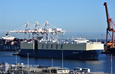
The vessel MORNING COURIER (IMO: 9285639, MMSI: 311921000) is a Vehicles Carrier that was built in 2005 ( 19 Jaar oud ). It's sailing under the flag of [BS] Bahamas.
In this page you can find informations about the vessels current position, last detected port calls, and current voyage information. If the vessels is not in coverage by AIS you will find the latest position.
The current position of MORNING COURIER is detected by our AIS receivers and we are not responsible for the reliability of the data. The last position was recorded while the vessel was in Coverage by the Ais receivers of our vessel tracking app.
The current draught of MORNING COURIER as reported by AIS is 8.2 meters
Weather
| Temperature | 6.2°C / 43.16°F |
|---|---|
| Wind Speed | 7 knots |
| Direction | 15° NNE |
| Pressure | 1038.1 hPa |
| Humidity | 70.2 % |
| Cloud Coverage | 86 % |
Featured Company
Last Port Calls
| Port | Arrival | Departure | Time In Port |
|---|---|---|---|
| 2024-05-02 13:12 | 2024-05-03 21:41 | 1 d | |
| 2024-05-01 08:16 | 2024-05-01 17:29 | 9 h | |
| 2024-04-27 13:34 | 2024-04-28 18:25 | 1 d | |
| 2024-04-26 00:17 | 2024-04-26 08:24 | 8 h | |
| 2024-04-21 14:25 | 2024-04-22 00:29 | 10 h | |
| 2024-04-16 06:22 | 2024-04-16 15:06 | 8 h | |
| 2024-04-13 13:46 | 2024-04-14 08:17 | 18 h | |
| 2024-04-12 07:58 | 2024-04-12 20:42 | 12 h | |
| 2024-03-11 00:12 | 2024-03-12 01:59 | 1 d | |
| 2024-03-08 19:13 | 2024-03-10 02:12 | 1 d |
Most Visited Ports (Last year)
| Port | Arrivals | |
|---|---|---|
| 3 | ||
| 3 | ||
| 3 | ||
| 2 | ||
| 2 | ||
| 2 |
Last Trips
| Origin | Departure | Destination | Arrival | Distance | |
|---|---|---|---|---|---|
| 2024-05-01 17:29 | 2024-05-02 13:12 | 303.28 nm | |||
| 2024-04-28 18:25 | 2024-05-01 08:16 | 529.76 nm | |||
| 2024-04-26 08:24 | 2024-04-27 13:34 | 453.37 nm | |||
| 2024-04-22 00:29 | 2024-04-26 00:17 | 1554.29 nm | |||
| 2024-04-16 15:06 | 2024-04-21 14:25 | 1862.49 nm | |||
| 2024-04-14 08:17 | 2024-04-16 06:22 | 614.51 nm | |||
| 2024-04-12 20:42 | 2024-04-13 13:46 | 200.65 nm | |||
| 2024-03-12 01:59 | 2024-04-12 07:58 | 11780.63 nm | |||
| 2024-03-10 02:12 | 2024-03-11 00:12 | 350.99 nm | |||
| 2024-03-07 18:13 | 2024-03-08 19:13 | 381.18 nm |
Events
| Tijd | Evenement | Details | Positie / Bestemming | Info |
|---|---|---|---|---|
| 2024-05-06 14:08 | Start beweging | 17.82 nm, East of CAOJING |
30.82842 / 121.83538
KR MOK
|
Snelheid: 3.1 kn Koers: 23° |
| 2024-05-05 14:39 | Stop beweging | 17.94 nm, East of CAOJING |
30.83613 / 121.83646
KR MOK
|
Snelheid: Koers: 271° |
| 2024-05-03 13:41 | Vertrekhaven |
|
37.58764 / 121.44109
KR MOK
|
Snelheid: 11.8 kn Koers: 69° |
| 2024-05-03 13:20 | Start beweging |
37.56483 / 121.38023
[CN] YANTAI
|
Snelheid: 3.7 kn Koers: 88° |