
MORNING COURIER
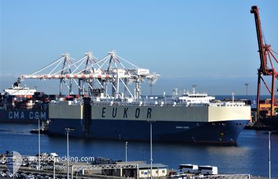
Vehicles Carrier
Current Trip
| Trip Time | 3 days |
|---|---|
| Trip Distance | 1554.29 nm |
| AVG Speed | 15.7 Knots |
| MAX Speed | 22.2 Knots |
| Draught | 8.6 m |
| AVG Wind | 10.6 knots |
| MAX Wind | 25 knots |
| MIN Temp | 10.2°C / 50.36°F |
| MAX Temp | 27.1°C / 80.78°F |
| Position Received | 3 d ago |
Current Position
| Longitude | 119.91512° |
|---|---|
| Latitude | 23.56313° |
| Status | Under way using engine |
| Speed | 22.2 Knots |
| Course | 1.7° |
| Area | South China Sea |
| Station | T-AIS |
| Position Received | 3 d ago |
Info
Information
The current position of MORNING COURIER is in South China Sea with coordinates 23.56313° / 119.91512° as reported on 2024-04-22 12:58 by AIS to our vessel tracker app. The vessel's current speed is 22.2 Knots and is currently inside the port of TIANJIN.
The vessel MORNING COURIER (IMO: 9285639, MMSI: 311921000) is a Vehicles Carrier that was built in 2005 ( 19 years old ). It's sailing under the flag of [BS] Bahamas.
In this page you can find informations about the vessels current position, last detected port calls, and current voyage information. If the vessels is not in coverage by AIS you will find the latest position.
The current position of MORNING COURIER is detected by our AIS receivers and we are not responsible for the reliability of the data. The last position was recorded while the vessel was in Coverage by the Ais receivers of our vessel tracking app.
The current draught of MORNING COURIER as reported by AIS is 8.6 meters
Weather
| Temperature | 18.8°C / 65.84°F |
|---|---|
| Wind Speed | 10 knots |
| Direction | 202° SSW |
| Pressure | 1002.1 hPa |
| Humidity | 55.5 % |
| Cloud Coverage | 20 % |
Featured Company
Last Port Calls
| Port | Arrival | Departure | Time In Port |
|---|---|---|---|
| 2024-04-25 16:17 | |||
| 2024-04-21 06:25 | 2024-04-21 16:29 | 10 h | |
| 2024-04-15 23:22 | 2024-04-16 08:06 | 8 h | |
| 2024-04-13 05:46 | 2024-04-14 00:17 | 18 h | |
| 2024-04-11 23:58 | 2024-04-12 12:42 | 12 h | |
| 2024-03-10 23:12 | 2024-03-12 00:59 | 1 d | |
| 2024-03-08 18:13 | 2024-03-10 01:12 | 1 d | |
| 2024-03-07 04:20 | 2024-03-07 17:13 | 12 h | |
| 2024-03-04 05:45 | 2024-03-04 17:06 | 11 h | |
| 2024-02-21 10:56 | 2024-02-21 22:45 | 11 h |
Most Visited Ports (Last year)
| Port | Arrivals | |
|---|---|---|
| 3 | ||
| 3 | ||
| 2 | ||
| 2 | ||
| 2 | ||
| 1 |
Last Trips
| Origin | Departure | Destination | Arrival | Distance | |
|---|---|---|---|---|---|
| 2024-04-22 00:29 | 2024-04-26 00:17 | 1554.29 nm | |||
| 2024-04-16 15:06 | 2024-04-21 14:25 | 1862.49 nm | |||
| 2024-04-14 08:17 | 2024-04-16 06:22 | 614.51 nm | |||
| 2024-04-12 20:42 | 2024-04-13 13:46 | 200.65 nm | |||
| 2024-03-12 01:59 | 2024-04-12 07:58 | 11780.63 nm | |||
| 2024-03-10 02:12 | 2024-03-11 00:12 | 350.99 nm | |||
| 2024-03-07 18:13 | 2024-03-08 19:13 | 381.18 nm | |||
| 2024-03-04 17:06 | 2024-03-07 05:20 | 738.50 nm | |||
| 2024-02-21 17:45 | 2024-03-04 05:45 | 3792.95 nm | |||
| 2024-02-16 00:43 | 2024-02-21 05:56 | 889.47 nm |
Events
| Time | Event | Details | Position / Dest | Info |
|---|---|---|---|---|
| 2024-04-25 16:17 | STOP Moving |
39.02108 / 117.76828
[CN] TIANJIN
|
Speed: Course: 115° |
|
| 2024-04-25 16:17 | PORT ARRIVAL |
|
39.02108 / 117.76828
[CN] TIANJIN
|
Speed: 0.9 kn Course: 112° |
| 2024-04-22 13:00 | Status Changed | Default Under way using engine |
23.57500 / 119.91500
CN TNJ
|
Speed: 22.2 kn Course: 1.7° |
| 2024-04-22 12:58 | OUT of Coverage |
23.56313 / 119.91512
South China Sea
CN TNJ
|
Speed: 22.2 kn Course: 1.7° |
|
| 2024-04-22 12:46 | ETA Changed | 2024/04/25 13:30 2024/04/25 18:30 |
23.48551 / 119.91295
CN TNJ
|
Speed: 22.2 kn Course: 1.5° |
| 2024-04-22 12:35 | Change Sea Area | Taiwanese part of the South China Sea Chinese part of the South China Sea |
23.41989 / 119.90835
South China Sea
CN TNJ
|
Speed: 22 kn Course: 7.8° |
| 2024-04-22 12:34 | Status Changed | Under way using engine Default |
23.41385 / 119.90747
CN TNJ
|
Speed: 22 kn Course: 7° |
| 2024-04-22 12:21 | IN Coverage |
23.41989 / 119.90835
South China Sea
CN TNJ
|
Speed: 22 kn Course: 7.8° |
|
| 2024-04-21 19:32 | Status Changed | Default Under way using engine |
22.01831 / 114.63099
CN TNJ
|
Speed: 18.1 kn Course: 118.7° |
| 2024-04-21 19:27 | OUT of Coverage |
22.03236 / 114.60361
South China Sea
CN TNJ
|
Speed: 18.1 kn Course: 118.7° |