
MORNING COURIER
Vehicles Carrier
Current Trip
| Time Travelled | 25 days |
|---|---|
| Remaining Time | --- |
| Distance Travelled | 9545.79 nm |
| Remaining Distance | 4.69 nm |
| AVG Speed | 15.7 Knop |
| MAX Speed | 20.5 Knop |
| AVG Wind | 14.2 knots |
| MAX Wind | 37.2 knots |
| MIN Temp | 8.4°C / 47.12°F |
| MAX Temp | 28°C / 82.4°F |
| Djupgående | 9.4 m |
| Position mottagen | 9 d sen |
Current Position
| Longitud | --- |
|---|---|
| Latitude | --- |
| Status | Under way using engine |
| Fart | 16.4 Knop |
| Kurs | 129.7° |
| Område | North Pacific Ocean |
| Station | T-AIS |
| Position mottagen | 9 d sen |
Info
Information
The current position of MORNING COURIER is in North Pacific Ocean with coordinates 25.82505° / -116.00721° as reported on 2025-11-29 21:13 by AIS to our vessel tracker app. The vessel's current speed is 16.4 Knop and is heading at the port of CALLAO. The estimated time of arrival as calculated by MyShipTracking vessel tracking app is 2025-12-08 05:00 LT
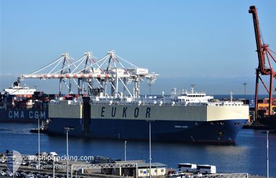
The vessel MORNING COURIER (IMO: 9285639, MMSI: 311921000) is a Vehicles Carrier that was built in 2005 ( 20 År gammal ). It's sailing under the flag of [BS] Bahamas.
In this page you can find informations about the vessels current position, last detected port calls, and current voyage information. If the vessels is not in coverage by AIS you will find the latest position.
The current position of MORNING COURIER is detected by our AIS receivers and we are not responsible for the reliability of the data. The last position was recorded while the vessel was in Coverage by the Ais receivers of our vessel tracking app.
The current draught of MORNING COURIER as reported by AIS is 9.4 meters
Weather
| Temperature | 19.1°C / 66.38°F |
|---|---|
| Wind Speed | 8 knots |
| Direction | 159° SSE |
| Pressure | 1013.7 hPa |
| Humidity | 82.8 % |
| Cloud Coverage | 92 % |
Featured Company
Last Port Calls
| Port | Arrival | Departure | Time In Port |
|---|---|---|---|
| 2025-11-13 06:48 | 2025-11-13 18:48 | 12 h | |
| 2025-11-09 04:19 | 2025-11-09 17:24 | 13 h | |
| 2025-11-06 21:38 | 2025-11-07 22:13 | 1 d | |
| 2025-11-05 05:49 | 2025-11-05 17:19 | 11 h | |
| 2025-10-19 04:59 | 2025-10-19 20:19 | 15 h | |
| 2025-10-14 09:42 | 2025-10-15 05:16 | 19 h | |
| 2025-10-09 08:28 | 2025-10-12 15:16 | 3 d | |
| 2025-10-05 20:33 | 2025-10-07 15:26 | 1 d | |
| 2025-10-03 04:14 | 2025-10-04 00:14 | 20 h |
Most Visited Ports (Last year)
| Port | Arrivals | |
|---|---|---|
| 4 | ||
| 2 | ||
| 2 | ||
| 2 | ||
| 2 | ||
| 2 |
Last Trips
| Origin | Departure | Destination | Arrival | Distance | |
|---|---|---|---|---|---|
| 2025-11-09 17:24 | 2025-11-13 06:48 | 801.10 nm | |||
| 2025-11-07 22:13 | 2025-11-09 04:19 | 458.96 nm | |||
| 2025-11-05 17:19 | 2025-11-06 21:38 | 174.55 nm | |||
| 2025-10-19 20:19 | 2025-11-05 05:49 | 4326.88 nm | |||
| 2025-10-15 05:16 | 2025-10-19 04:59 | 1384.33 nm | |||
| 2025-10-12 15:16 | 2025-10-14 09:42 | 535.85 nm | |||
| 2025-10-07 15:26 | 2025-10-09 08:28 | 570.59 nm | |||
| 2025-10-04 00:14 | 2025-10-05 20:33 | 570.21 nm | |||
| 2025-09-21 00:00 | 2025-10-03 04:14 | 4200.74 nm |
Events
| Tid | Event | Detaljer | Position / Dest | Information |
|---|---|---|---|---|
| 2025-12-08 08:09 | STOPPAR förflyttning | 4.24 nm, North West of CALLAO |
-12.02512 / -77.22045
PECLL
|
Fart: 0.3 kn Kurs: 181° |
| 2025-12-08 07:50 | STARTAR förflyttning | 4.57 nm, North West of CALLAO |
-12.00759 / -77.21557
PECLL
|
Fart: 5.1 kn Kurs: 193° |
| 2025-12-08 07:18 | STOPPAR förflyttning | 4.66 nm, North West of CALLAO |
-12.00534 / -77.21565
PECLL
|
Fart: 0.3 kn Kurs: 19° |
| 2025-11-29 21:18 | Status ändrad | Default Under way using engine |
25.81152 / -115.98909
PECLL
|
Fart: 16.4 kn Kurs: 129.7° |
| 2025-11-29 21:13 | Status ändrad | Under way using engine Default |
25.82505 / -116.00721
PECLL
|
Fart: 16.5 kn Kurs: 130° |
| 2025-11-29 21:13 | UTANFÖR täckningsområde |
25.82505 / -116.00721
North Pacific Ocean
PECLL
|
Fart: 16.4 kn Kurs: 129.7° |
|
| 2025-11-29 21:07 | I täckningsområde |
25.82505 / -116.00721
North Pacific Ocean
PECLL
|
Fart: 16.4 kn Kurs: 129.7° |
|
| 2025-11-29 19:50 | Status ändrad | Default Under way using engine |
26.06167 / -116.33334
PECLL
|
Fart: 16.1 kn Kurs: 128.8° |
| 2025-11-29 19:45 | UTANFÖR täckningsområde |
26.07549 / -116.35325
North Pacific Ocean
PECLL
|
Fart: 16.1 kn Kurs: 128.8° |
|
| 2025-11-29 18:33 | Status ändrad | Under way using engine Default |
26.27931 / -116.63522
PECLL
|
Fart: 16.1 kn Kurs: 128° |