
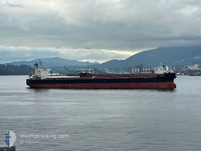
EFRAIM A
Bulk Carrier
Current Trip
| Time Travelled | 19 days |
|---|---|
| Remaining Time | --- |
| Distance Travelled | 5144.06 nm |
| Remaining Distance | --- |
| AVG Speed | 11 Noeuds |
| MAX Speed | 14.7 Noeuds |
| AVG Wind | 14.1 knots |
| MAX Wind | 32 knots |
| MIN Temp | -0.5°C / 31.1°F |
| MAX Temp | 18.3°C / 64.94°F |
| Tirant d eau | 7.2 m |
| Position reçue | 2 m depuis |
Current Position
| Longitude | --- |
|---|---|
| Latitude | --- |
| Etat | At anchor |
| Vitesse | 0.1 Noeuds |
| Parcours | 189° |
| Zone | The Coastal Waters of Southeast Alaska and British Columbia |
| Station | T-AIS |
| Position reçue | 2 m depuis |
Info
Information
The current position of EFRAIM A is in The Coastal Waters of Southeast Alaska and British Columbia with coordinates 47.30926° / -122.49735° as reported on 2026-01-07 01:47 by AIS to our vessel tracker app. The vessel's current speed is 0.1 Noeuds
The vessel EFRAIM A (IMO: 9520778, MMSI: 210043000) is a Bulk Carrier that was built in 2010 ( 16 Age ). It's sailing under the flag of [CY] Cyprus.
In this page you can find informations about the vessels current position, last detected port calls, and current voyage information. If the vessels is not in coverage by AIS you will find the latest position.
The current position of EFRAIM A is detected by our AIS receivers and we are not responsible for the reliability of the data. The last position was recorded while the vessel was in Coverage by the Ais receivers of our vessel tracking app.
The current draught of EFRAIM A as reported by AIS is 7.2 meters
Weather
| Temperature | 7.1°C / 44.78°F |
|---|---|
| Wind Speed | 10 knots |
| Direction | 222° SW |
| Pressure | 1005.3 hPa |
| Humidity | 89.8 % |
| Cloud Coverage | 100 % |
Featured Company
Most Visited Ports (Last year)
| Port | Arrivals | |
|---|---|---|
| 1 | ||
| 1 | ||
| 1 | ||
| 1 | ||
| 1 | ||
| 1 |
Events
| Heure | Evenement | Détails | Position/ Destination | Info |
|---|---|---|---|---|
| 2026-01-07 01:20 | Etat Changé | At anchor Default |
47.30908 / -122.49838
US TIW
|
Vitesse: 0.1 kn Parcours: 163° |
| 2026-01-07 01:16 | Etat Changé | Default At anchor |
47.30918 / -122.49860
US TIW
|
Vitesse: 0.1 kn Parcours: 159° |
| 2026-01-06 23:31 | Etat Changé | At anchor Default |
47.30914 / -122.49831
US TIW
|
Vitesse: 0.1 kn Parcours: 172° |
| 2026-01-06 23:28 | Etat Changé | Default At anchor |
47.30915 / -122.49815
US TIW
|
Vitesse: Parcours: 170° |
| 2026-01-06 22:43 | Etat Changé | At anchor Default |
47.30920 / -122.49698
US TIW
|
Vitesse: 0.1 kn Parcours: 199° |
| 2026-01-06 22:40 | Etat Changé | Default At anchor |
47.30914 / -122.49677
US TIW
|
Vitesse: 0.1 kn Parcours: 188° |
| 2026-01-06 21:28 | Etat Changé | At anchor Default |
47.30824 / -122.49635
US TIW
|
Vitesse: 0.2 kn Parcours: 234° |
| 2026-01-06 21:25 | Etat Changé | Default At anchor |
47.30806 / -122.49604
US TIW
|
Vitesse: Parcours: 232° |
| 2026-01-06 20:55 | Etat Changé | At anchor Default |
47.30804 / -122.49644
US TIW
|
Vitesse: 0.3 kn Parcours: 199° |
| 2026-01-06 20:52 | Etat Changé | Default At anchor |
47.30824 / -122.49687
US TIW
|
Vitesse: 0.3 kn Parcours: 190° |