
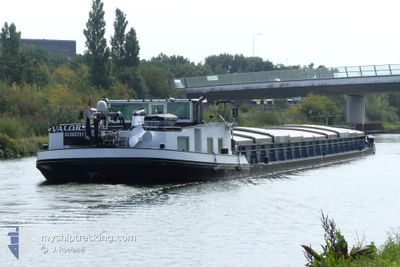
VALOR
Cargo
Current Position
| Longitude | --- |
|---|---|
| Latitude | --- |
| Status | Moored |
| Speed | |
| Course | --- |
| Area | North Sea |
| Station | T-AIS |
| Position Received | 7 m ago |
Info
Information
The current position of VALOR is in North Sea with coordinates 52.24611° / 6.18602° as reported on 2025-12-24 02:05 by AIS to our vessel tracker app. The vessel's current speed is 0 Knots and is currently inside the port of DEVENTER.
The vessel VALOR (MMSI: 244670676) is a Cargo It's sailing under the flag of [NL] Netherlands.
In this page you can find informations about the vessels current position, last detected port calls, and current voyage information. If the vessels is not in coverage by AIS you will find the latest position.
The current position of VALOR is detected by our AIS receivers and we are not responsible for the reliability of the data. The last position was recorded while the vessel was in Coverage by the Ais receivers of our vessel tracking app.
The current draught of VALOR as reported by AIS is 2.1 meters
Weather
| Temperature | 0.2°C / 32.36°F |
|---|---|
| Wind Speed | 14 knots |
| Direction | 69° ENE |
| Pressure | 1030.1 hPa |
| Humidity | 76.3 % |
| Cloud Coverage | 7 % |
Featured Company
Last Port Calls
| Port | Arrival | Departure | Time In Port |
|---|---|---|---|
| 2025-12-17 08:31 | 2025-12-17 12:02 | 3 h | |
| 2025-12-16 18:52 | 2025-12-17 08:07 | 13 h | |
| 2025-12-16 10:16 | 2025-12-16 11:57 | 1 h | |
| 2025-12-09 12:15 | 2025-12-16 08:24 | 6 d | |
| 2025-12-08 11:29 | 2025-12-09 07:37 | 20 h | |
| 2025-11-20 10:25 | 2025-11-20 15:06 | 4 h | |
| 2025-11-19 18:42 | 2025-11-20 06:59 | 12 h | |
| 2025-11-19 14:10 | 2025-11-19 18:27 | 4 h | |
| 2025-10-22 19:56 | 2025-11-19 11:43 | 27 d | |
| 2025-10-21 18:18 | 2025-10-22 15:41 | 21 h |
Last Trips
| Origin | Departure | Destination | Arrival | Distance | |
|---|---|---|---|---|---|
| 2025-12-17 08:07 | 2025-12-17 08:31 | 1.76 nm | |||
| 2025-12-16 11:57 | 2025-12-16 18:52 | 63.88 nm | |||
| 2025-12-16 08:24 | 2025-12-16 10:16 | 11.79 nm | |||
| 2025-12-09 07:37 | 2025-12-09 12:15 | 26.40 nm | |||
| 2025-11-20 15:06 | 2025-12-08 11:29 | 772.23 nm | |||
| 2025-11-20 06:59 | 2025-11-20 10:25 | 21.06 nm | |||
| 2025-11-19 18:27 | 2025-11-19 18:42 | 0.64 nm | |||
| 2025-11-19 11:43 | 2025-11-19 14:10 | 20.09 nm | |||
| 2025-10-22 15:41 | 2025-10-22 19:56 | 31.38 nm | |||
| 2025-10-21 07:05 | 2025-10-21 18:18 | 90.11 nm |
Events
| Time | Event | Details | Position / Dest | Info |
|---|---|---|---|---|
| 2025-12-24 02:05 | IN Coverage |
52.24611 / 6.18602
North Sea
[NL] DEVENTER
|
Speed: Course: 511° |
|
| 2025-12-23 22:59 | OUT of Coverage |
52.24613 / 6.18602
North Sea
[NL] DEVENTER
|
Speed: Course: 511° |
|
| 2025-12-23 21:07 | IN Coverage |
52.24623 / 6.18592
North Sea
[NL] DEVENTER
|
Speed: Course: 511° |
|
| 2025-12-18 12:59 | OUT of Coverage |
52.16777 / 6.19124
North Sea
LOSPLAATS
|
Speed: 8.3 kn Course: 33.1° |
|
| 2025-12-18 09:59 | START Moving | 1.38 nm, South of WESTERVOORT |
51.94787 / 5.95675
LOSPLAATS
|
Speed: 5 kn Course: 324.6° |
| 2025-12-18 09:56 | STOP Moving | 1.47 nm, South of WESTERVOORT |
51.94613 / 5.95767
LOSPLAATS
|
Speed: 0.2 kn Course: 511° |
| 2025-12-18 08:49 | START Moving | 0.42 nm, North West of DRIEL |
51.96809 / 5.80800
LOSPLAATS
|
Speed: 4.5 kn Course: 58.4° |
| 2025-12-18 08:37 | STOP Moving | 0.47 nm, North West of DRIEL |
51.96708 / 5.80551
LOSPLAATS
|
Speed: Course: 511° |
| 2025-12-18 05:35 | START Moving | 0.46 nm, North of MAURIK |
51.97666 / 5.40971
LOSPLAATS
|
Speed: 3.1 kn Course: 67.3° |
| 2025-12-18 05:08 | Status Changed | Under way using engine Moored |
51.97496 / 5.40255
LOSPLAATS
|
Speed: Course: 511° |