
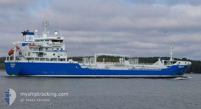
TELLUS
Oil/Chemical Tanker
Current Trip
| Time Travelled | 14 h, 48 mins |
|---|---|
| Remaining Time | 9 h, 12 mins |
| Distance Travelled | 180.78 nm |
| Remaining Distance | 123.74 nm |
| AVG Speed | 12.5 Knots |
| MAX Speed | 13.1 Knots |
| AVG Wind | 16.2 knots |
| MAX Wind | 21 knots |
| MIN Temp | -10°C / 14°F |
| MAX Temp | -3°C / 26.6°F |
| Draught | 8.2 m |
| Position Received | 1 h, 41 m ago |
Current Position
| Longitude | --- |
|---|---|
| Latitude | --- |
| Status | Under way using engine |
| Speed | 12.6 Knots |
| Course | 247.4° |
| Area | Baltic Sea |
| Station | T-AIS |
| Position Received | 1 h, 41 m ago |
Info
Information
The current position of TELLUS is in Baltic Sea with coordinates 59.23382° / 21.05717° as reported on 2026-01-05 03:25 by AIS to our vessel tracker app. The vessel's current speed is 12.6 Knots and is heading at the port of SODERTALJE. The estimated time of arrival as calculated by MyShipTracking vessel tracking app is 2026-01-05 15:19 LT
The vessel TELLUS (IMO: 9321615, MMSI: 266471000) is a Oil/Chemical Tanker that was built in 2006 ( 20 years old ). It's sailing under the flag of [SE] Sweden.
In this page you can find informations about the vessels current position, last detected port calls, and current voyage information. If the vessels is not in coverage by AIS you will find the latest position.
The current position of TELLUS is detected by our AIS receivers and we are not responsible for the reliability of the data. The last position was recorded while the vessel was in Coverage by the Ais receivers of our vessel tracking app.
The current draught of TELLUS as reported by AIS is 8.2 meters
Weather
| Temperature | -2.4°C / 27.68°F |
|---|---|
| Wind Speed | 21 knots |
| Direction | 56° NE |
| Pressure | 1009.1 hPa |
| Humidity | 68.4 % |
| Cloud Coverage | 100 % |
Featured Company
Last Port Calls
| Port | Arrival | Departure | Time In Port |
|---|---|---|---|
| 2026-01-03 13:39 | 2026-01-04 16:19 | 1 d | |
| 2026-01-02 08:52 | 2026-01-02 09:40 | 47 m | |
| 2025-12-30 18:48 | 2026-01-02 02:20 | 2 d | |
| 2025-12-30 11:50 | 2025-12-30 12:15 | 24 m | |
| 2025-12-29 00:16 | 2025-12-29 18:07 | 17 h | |
| 2025-12-27 11:34 | 2025-12-27 22:31 | 10 h | |
| 2025-12-22 18:42 | 2025-12-23 02:16 | 7 h | |
| 2025-12-21 03:11 | 2025-12-21 18:17 | 15 h | |
| 2025-12-19 09:39 | 2025-12-19 23:07 | 13 h | |
| 2025-12-14 23:43 | 2025-12-17 12:11 | 2 d |
Last Trips
| Origin | Departure | Destination | Arrival | Distance | |
|---|---|---|---|---|---|
| 2026-01-02 09:40 | 2026-01-03 13:39 | 301.79 nm | |||
| 2026-01-02 02:20 | 2026-01-02 08:52 | 66.06 nm | |||
| 2025-12-30 12:15 | 2025-12-30 18:48 | 65.75 nm | |||
| 2025-12-29 18:07 | 2025-12-30 11:50 | 215.83 nm | |||
| 2025-12-27 22:31 | 2025-12-29 00:16 | 214.21 nm | |||
| 2025-12-23 02:16 | 2025-12-27 11:34 | 587.84 nm | |||
| 2025-12-21 18:17 | 2025-12-22 18:42 | 294.37 nm | |||
| 2025-12-19 23:07 | 2025-12-21 03:11 | 335.01 nm | |||
| 2025-12-17 12:11 | 2025-12-19 09:39 | 461.47 nm | |||
| 2025-12-12 14:31 | 2025-12-14 23:43 | 468.84 nm |
Events
| Time | Event | Details | Position / Dest | Info |
|---|---|---|---|---|
| 2026-01-05 03:43 | Status Changed | Default Under way using engine |
59.20838 / 20.94548
SODERTALJE
|
Speed: 12.6 kn Course: 247.4° |
| 2026-01-05 03:25 | OUT of Coverage |
59.23382 / 21.05717
Baltic Sea
SODERTALJE
|
Speed: 12.6 kn Course: 247.4° |
|
| 2026-01-05 00:20 | Status Changed | Under way using engine Default |
59.45513 / 22.22840
SODERTALJE
|
Speed: 13 kn Course: 251° |
| 2026-01-05 00:15 | Status Changed | Default Under way using engine |
59.46102 / 22.25903
SODERTALJE
|
Speed: 12.8 kn Course: 248.1° |
| 2026-01-04 22:10 | Detected in Sea | Finnish part of the Baltic Sea |
59.59970 / 23.07183
Baltic Sea
SODERTALJE
|
Speed: 12.5 kn Course: 253.5° |
| 2026-01-04 17:59 | Change Sea Area | Finnish part of the Gulf of Finland Estonian part of the Gulf of Finland |
59.82482 / 24.74878
Gulf of Finland
SODERTALJE
|
Speed: 12.8 kn Course: 260.9° |
| 2026-01-04 16:49 | Detected in Sea | Estonian part of the Gulf of Finland |
59.88288 / 25.21820
Gulf of Finland
SODERTALJE
|
Speed: 12.3 kn Course: 237.6° |
| 2026-01-04 14:19 | PORT DEPARTURE |
|
60.29933 / 25.55317
SODERTALJE
|
Speed: 7.6 kn Course: 189° |
| 2026-01-04 14:15 | Draught Changed | 8.2 6.4 |
60.30632 / 25.55770
[FI] PORVOO
|
Speed: 5.1 kn Course: 205° |
| 2026-01-04 14:15 | Destination Changed | SODERTALJE PORVOO |
60.30632 / 25.55770
[FI] PORVOO
|
Speed: 5.1 kn Course: 205° |