
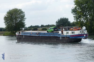
STEVEN ROOS
Cargo
Current Trip
AVIGNON
| Time Travelled | 52 days |
|---|---|
| Remaining Time | --- |
| Distance Travelled | 15.16 nm |
| Remaining Distance | --- |
| AVG Speed | 5.3 Knots |
| MAX Speed | 6 Knots |
| AVG Wind | 7.2 knots |
| MAX Wind | 17.5 knots |
| MIN Temp | 7°C / 44.6°F |
| MAX Temp | 11°C / 51.8°F |
| Draught | 2.5 m |
| Position Received | 2 m ago |
Current Position
| Longitude | --- |
|---|---|
| Latitude | --- |
| Status | Under way using engine |
| Speed | |
| Course | --- |
| Area | North Sea |
| Station | T-AIS |
| Position Received | 2 m ago |
Info
Information
The current position of STEVEN ROOS is in North Sea with coordinates 50.80630° / 5.69163° as reported on 2025-12-21 06:34 by AIS to our vessel tracker app. The vessel's current speed is 0 Knots
The vessel STEVEN ROOS (MMSI: 244690105) is a Cargo It's sailing under the flag of [NL] Netherlands.
In this page you can find informations about the vessels current position, last detected port calls, and current voyage information. If the vessels is not in coverage by AIS you will find the latest position.
The current position of STEVEN ROOS is detected by our AIS receivers and we are not responsible for the reliability of the data. The last position was recorded while the vessel was in Coverage by the Ais receivers of our vessel tracking app.
The current draught of STEVEN ROOS as reported by AIS is 2.5 meters
Weather
| Temperature | 9°C / 48.2°F |
|---|---|
| Wind Speed | 4 knots |
| Direction | 139° SE |
| Pressure | 1011.5 hPa |
| Humidity | 90.9 % |
| Cloud Coverage | 100 % |
Featured Company
Most Visited Ports (Last year)
| Port | Arrivals | |
|---|---|---|
| 3 | ||
| 2 | ||
| 2 | ||
| 2 | ||
| 1 | ||
| 1 |
Events
| Time | Event | Details | Position / Dest | Info |
|---|---|---|---|---|
| 2025-12-20 13:23 | Status Changed | Under way using engine Default |
50.80617 / 5.69160
AVIGNON
|
Speed: Course: -1° |
| 2025-12-20 13:07 | Status Changed | Default Under way using engine |
50.80618 / 5.69161
AVIGNON
|
Speed: Course: 511° |
| 2025-12-18 13:57 | Status Changed | Under way using engine Default |
50.80602 / 5.69157
AVIGNON
|
Speed: Course: -1° |
| 2025-12-18 13:52 | Status Changed | Default Under way using engine |
50.80599 / 5.69162
AVIGNON
|
Speed: Course: 511° |
| 2025-12-18 13:20 | Status Changed | Under way using engine Default |
50.80607 / 5.69158
AVIGNON
|
Speed: Course: -1° |
| 2025-12-18 13:04 | Status Changed | Default Under way using engine |
50.80600 / 5.69154
AVIGNON
|
Speed: Course: 511° |
| 2025-12-18 12:01 | Status Changed | Under way using engine Default |
50.80601 / 5.69157
AVIGNON
|
Speed: Course: -1° |
| 2025-12-18 11:54 | Status Changed | Default Under way using engine |
50.80603 / 5.69155
AVIGNON
|
Speed: Course: 511° |
| 2025-12-18 11:27 | Status Changed | Under way using engine Default |
50.80602 / 5.69156
AVIGNON
|
Speed: Course: -1° |
| 2025-12-18 11:25 | Status Changed | Default Under way using engine |
50.80603 / 5.69157
AVIGNON
|
Speed: Course: 511° |