
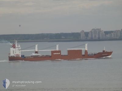
SNOEKGRACHT
General Cargo
Current Trip
| Time Travelled | 2 days |
|---|---|
| Remaining Time | 3 h, 19 mins |
| Distance Travelled | 945.20 nm |
| Remaining Distance | 46.09 nm |
| AVG Speed | 14.4 Knots |
| MAX Speed | 18 Knots |
| AVG Wind | 10 knots |
| MAX Wind | 24 knots |
| MIN Temp | 15.4°C / 59.72°F |
| MAX Temp | 19.2°C / 66.56°F |
| Draught | 7.1 m |
| Position Received | 2 m ago |
Current Position
| Longitude | 12.89847° |
|---|---|
| Latitude | 44.96260° |
| Status | Under way using engine |
| Speed | 12.8 Knots |
| Course | 336.1° |
| Area | Adriatic Sea |
| Station | T-AIS |
| Position Received | 2 m ago |
Info
Information
The current position of SNOEKGRACHT is in Adriatic Sea with coordinates 44.96260° / 12.89847° as reported on 2024-05-10 23:25 by AIS to our vessel tracker app. The vessel's current speed is 12.8 Knots and is heading at the port of VENEZIA. The estimated time of arrival as calculated by MyShipTracking vessel tracking app is 2024-05-11 02:46 LT
The vessel SNOEKGRACHT (IMO: 9202546, MMSI: 245816000) is a General Cargo that was built in 2000 ( 24 years old ). It's sailing under the flag of [NL] Netherlands.
In this page you can find informations about the vessels current position, last detected port calls, and current voyage information. If the vessels is not in coverage by AIS you will find the latest position.
The current position of SNOEKGRACHT is detected by our AIS receivers and we are not responsible for the reliability of the data. The last position was recorded while the vessel was in Coverage by the Ais receivers of our vessel tracking app.
The current draught of SNOEKGRACHT as reported by AIS is 7.1 meters
Weather
| Temperature | 18.6°C / 65.48°F |
|---|---|
| Wind Speed | 10 knots |
| Direction | 70° ENE |
| Pressure | 1018.7 hPa |
| Humidity | 68.9 % |
| Cloud Coverage | 44 % |
Featured Company
Last Port Calls
| Port | Arrival | Departure | Time In Port |
|---|---|---|---|
| 2024-05-05 13:40 | 2024-05-08 07:01 | 2 d | |
| 2024-04-30 03:05 | 2024-04-30 21:18 | 18 h | |
| 2024-04-16 04:21 | 2024-04-17 02:48 | 22 h | |
| 2024-04-13 01:56 | 2024-04-14 13:22 | 1 d | |
| 2024-04-07 22:08 | 2024-04-09 18:35 | 1 d | |
| 2024-04-04 22:39 | 2024-04-05 22:51 | 1 d | |
| 2024-03-30 12:59 | 2024-04-02 05:09 | 2 d | |
| 2024-03-27 17:20 | 2024-03-28 18:49 | 1 d | |
| 2024-03-07 22:19 | 2024-03-09 10:34 | 1 d | |
| 2024-03-03 15:23 | 2024-03-06 19:40 | 3 d |
Most Visited Ports (Last year)
| Port | Arrivals | |
|---|---|---|
| 5 | ||
| 3 | ||
| 3 | ||
| 3 | ||
| 3 | ||
| 3 |
Last Trips
| Origin | Departure | Destination | Arrival | Distance | |
|---|---|---|---|---|---|
| 2024-04-30 22:18 | 2024-05-05 14:40 | 1579.58 nm | |||
| 2024-04-16 21:48 | 2024-04-30 04:05 | 4706.56 nm | |||
| 2024-04-14 08:22 | 2024-04-15 23:21 | 577.64 nm | |||
| 2024-04-09 13:35 | 2024-04-12 20:56 | 810.60 nm | |||
| 2024-04-05 16:51 | 2024-04-07 17:08 | 808.35 nm | |||
| 2024-04-02 00:09 | 2024-04-04 16:39 | 512.85 nm | |||
| 2024-03-28 12:49 | 2024-03-30 07:59 | 653.10 nm | |||
| 2024-03-09 11:34 | 2024-03-27 11:20 | 6307.29 nm | |||
| 2024-03-06 20:40 | 2024-03-07 23:19 | 388.26 nm | |||
| 2024-03-02 17:33 | 2024-03-03 16:23 | 189.46 nm |
Events
| Time | Event | Details | Position / Dest | Info |
|---|---|---|---|---|
| 2024-05-10 21:52 | Status Changed | Under way using engine Default |
44.66303 / 13.07856
ITPMA
|
Speed: 12.6 kn Course: 342° |
| 2024-05-10 21:39 | Status Changed | Default Under way using engine |
44.61845 / 13.09910
ITPMA
|
Speed: 12.6 kn Course: 342.8° |
| 2024-05-10 21:20 | Change Sea Area | Italian part of the Adriatic Sea Croatian part of the Adriatic Sea |
44.55484 / 13.12689
Adriatic Sea
ITPMA
|
Speed: 12.8 kn Course: 343.1° |
| 2024-05-10 21:02 | Detected in Sea | Croatian part of the Adriatic Sea |
44.49339 / 13.15315
Adriatic Sea
ITPMA
|
Speed: 12.7 kn Course: 343° |
| 2024-05-10 20:14 | Status Changed | Under way using engine Default |
44.32469 / 13.22709
ITPMA
|
Speed: 13.5 kn Course: 343° |
| 2024-05-10 19:50 | Status Changed | Default Under way using engine |
44.25613 / 13.29605
ITPMA
|
Speed: 13.7 kn Course: 308.8° |
| 2024-05-10 15:56 | Change Sea Area | Italian part of the Adriatic Sea Croatian part of the Adriatic Sea |
43.75234 / 14.32053
Adriatic Sea
ITPMA
|
Speed: 13.6 kn Course: 316.7° |
| 2024-05-10 08:49 | ETA Changed | 2024/05/11 02:00 2024/05/11 04:00 |
42.57611 / 15.85782
ITPMA
|
Speed: 14.1 kn Course: 317.6° |
| 2024-05-10 08:00 | ETA Changed | 2024/05/11 04:00 2024/05/10 19:00 |
42.44612 / 16.02948
ITPMA
|
Speed: 12.7 kn Course: 313.8° |
| 2024-05-10 06:14 | Change Sea Area | Croatian part of the Adriatic Sea Italian part of the Adriatic Sea |
42.17437 / 16.38986
Adriatic Sea
ITPMA
|
Speed: 12.7 kn Course: 313.8° |