
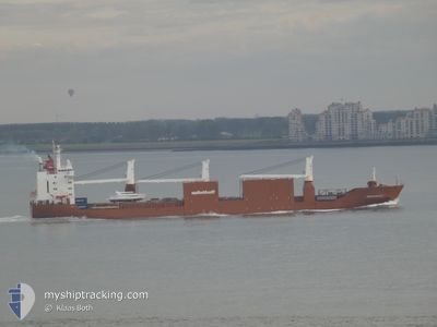
SNOEKGRACHT
General Cargo
Current Trip
| Time Travelled | 6 days |
|---|---|
| Remaining Time | 5 days |
| Distance Travelled | 2541.27 nm |
| Remaining Distance | 2120.37 nm |
| AVG Speed | 14.8 Noeuds |
| MAX Speed | 18.1 Noeuds |
| AVG Wind | 9.3 knots |
| MAX Wind | 20.2 knots |
| MIN Temp | 19.4°C / 66.92°F |
| MAX Temp | 25.6°C / 78.08°F |
| Tirant d eau | 10.9 m |
| Position reçue | 3 d depuis |
Current Position
| Longitude | -76.95968° |
|---|---|
| Latitude | 25.79734° |
| Etat | Under way using engine |
| Vitesse | 15.2 Noeuds |
| Parcours | 54.2° |
| Zone | North Atlantic Ocean |
| Station | T-AIS |
| Position reçue | 3 d depuis |
Info
Information
The current position of SNOEKGRACHT is in North Atlantic Ocean with coordinates 25.79734° / -76.95968° as reported on 2024-04-20 01:12 by AIS to our vessel tracker app. The vessel's current speed is 15.2 Noeuds and is heading at the port of AGADIR. The estimated time of arrival as calculated by MyShipTracking vessel tracking app is 2024-04-29 00:52 LT
The vessel SNOEKGRACHT (IMO: 9202546, MMSI: 245816000) is a General Cargo that was built in 2000 ( 24 Age ). It's sailing under the flag of [NL] Netherlands.
In this page you can find informations about the vessels current position, last detected port calls, and current voyage information. If the vessels is not in coverage by AIS you will find the latest position.
The current position of SNOEKGRACHT is detected by our AIS receivers and we are not responsible for the reliability of the data. The last position was recorded while the vessel was in Coverage by the Ais receivers of our vessel tracking app.
The current draught of SNOEKGRACHT as reported by AIS is 10.9 meters
Weather
| Temperature | 19.3°C / 66.74°F |
|---|---|
| Wind Speed | 9 knots |
| Direction | 132° SE |
| Pressure | 1025.9 hPa |
| Humidity | 66.6 % |
| Cloud Coverage | 47 % |
Featured Company
Last Port Calls
| Port | Arrival | Departure | Time In Port |
|---|---|---|---|
| 2024-04-16 04:21 | 2024-04-17 02:48 | 22 h | |
| 2024-04-13 01:56 | 2024-04-14 13:22 | 1 d | |
| 2024-04-07 22:08 | 2024-04-09 18:35 | 1 d | |
| 2024-04-04 22:39 | 2024-04-05 22:51 | 1 d | |
| 2024-03-30 12:59 | 2024-04-02 05:09 | 2 d | |
| 2024-03-27 17:20 | 2024-03-28 18:49 | 1 d | |
| 2024-03-07 22:19 | 2024-03-09 10:34 | 1 d | |
| 2024-03-03 15:23 | 2024-03-06 19:40 | 3 d | |
| 2024-03-02 15:34 | 2024-03-02 16:33 | 58 m | |
| 2024-02-26 01:19 | 2024-02-28 17:44 | 2 d |
Most Visited Ports (Last year)
| Port | Arrivals | |
|---|---|---|
| 5 | ||
| 4 | ||
| 4 | ||
| 3 | ||
| 3 | ||
| 3 |
Last Trips
| Origin | Departure | Destination | Arrival | Distance | |
|---|---|---|---|---|---|
| 2024-04-14 08:22 | 2024-04-15 23:21 | 577.64 nm | |||
| 2024-04-09 13:35 | 2024-04-12 20:56 | 810.60 nm | |||
| 2024-04-05 16:51 | 2024-04-07 17:08 | 808.35 nm | |||
| 2024-04-02 00:09 | 2024-04-04 16:39 | 512.85 nm | |||
| 2024-03-28 12:49 | 2024-03-30 07:59 | 653.10 nm | |||
| 2024-03-09 11:34 | 2024-03-27 11:20 | 6307.29 nm | |||
| 2024-03-06 20:40 | 2024-03-07 23:19 | 388.26 nm | |||
| 2024-03-02 17:33 | 2024-03-03 16:23 | 189.46 nm | |||
| 2024-02-28 19:44 | 2024-03-02 16:34 | 972.93 nm | |||
| 2024-02-20 17:52 | 2024-02-26 03:19 | 732.89 nm |
Events
| Heure | Evenement | Détails | Position/ Destination | Info |
|---|---|---|---|---|
| 2024-04-20 01:15 | Etat Changé | Default Under way using engine |
25.80536 / -76.94709
MAAGA
|
Vitesse: 15.2 kn Parcours: 54.2° |
| 2024-04-20 01:12 | Etat Changé | Under way using engine Default |
25.79734 / -76.95968
MAAGA
|
Vitesse: 15.2 kn Parcours: 58° |
| 2024-04-20 01:12 | Hors de la zone couverte |
25.79734 / -76.95968
North Atlantic Ocean
MAAGA
|
Vitesse: 15.2 kn Parcours: 54.2° |
|
| 2024-04-20 00:58 | Dans la zone couverte |
25.79734 / -76.95968
North Atlantic Ocean
MAAGA
|
Vitesse: 15.2 kn Parcours: 54.2° |
|
| 2024-04-19 23:29 | Etat Changé | Default Under way using engine |
25.80827 / -77.46094
MAAGA
|
Vitesse: 16 kn Parcours: 109.5° |
| 2024-04-19 23:24 | Etat Changé | Under way using engine Default |
25.81438 / -77.48047
MAAGA
|
Vitesse: 16.1 kn Parcours: 109° |
| 2024-04-19 23:24 | Hors de la zone couverte |
25.81438 / -77.48047
North Atlantic Ocean
MAAGA
|
Vitesse: 16 kn Parcours: 109.5° |
|
| 2024-04-19 23:11 | Etat Changé | Default Under way using engine |
25.83385 / -77.54408
MAAGA
|
Vitesse: 16.1 kn Parcours: 108.3° |
| 2024-04-19 22:57 | Etat Changé | Under way using engine Default |
25.85354 / -77.61014
MAAGA
|
Vitesse: 16.1 kn Parcours: 108° |
| 2024-04-19 22:49 | Etat Changé | Default Under way using engine |
25.86394 / -77.64425
MAAGA
|
Vitesse: 16.1 kn Parcours: 109.1° |