
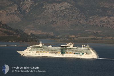
SERENADE OF THE SEAS
Passengers Ship
Current Trip
| Time Travelled | 2 days |
|---|---|
| Remaining Time | --- |
| Distance Travelled | 389.88 nm |
| Remaining Distance | 89.18 nm |
| AVG Speed | 8.1 Knots |
| MAX Speed | 13 Knots |
| AVG Wind | 21.1 knots |
| MAX Wind | 30.8 knots |
| MIN Temp | 26°C / 78.8°F |
| MAX Temp | 27.7°C / 81.86°F |
| Draught | 8.5 m |
| Position Received | Now |
Current Position
| Longitude | --- |
|---|---|
| Latitude | --- |
| Status | Under way using engine |
| Speed | 6.7 Knots |
| Course | 115.9° |
| Area | Caribbean Sea |
| Station | T-AIS |
| Position Received | Now |
Info
Information
The current position of SERENADE OF THE SEAS is in Caribbean Sea with coordinates 12.51034° / -70.34220° as reported on 2025-12-24 00:29 by AIS to our vessel tracker app. The vessel's current speed is 6.7 Knots and is heading at the port of WILLEMSTAD. The estimated time of arrival as calculated by MyShipTracking vessel tracking app is 2025-12-24 11:00 LT
The vessel SERENADE OF THE SEAS (IMO: 9228344, MMSI: 311492000) is a Passengers Ship that was built in 2003 ( 22 years old ). It's sailing under the flag of [BS] Bahamas.
In this page you can find informations about the vessels current position, last detected port calls, and current voyage information. If the vessels is not in coverage by AIS you will find the latest position.
The current position of SERENADE OF THE SEAS is detected by our AIS receivers and we are not responsible for the reliability of the data. The last position was recorded while the vessel was in Coverage by the Ais receivers of our vessel tracking app.
The current draught of SERENADE OF THE SEAS as reported by AIS is 8.5 meters
Weather
| Temperature | 26.4°C / 79.52°F |
|---|---|
| Wind Speed | 17 knots |
| Direction | 75° ENE |
| Pressure | 1012.6 hPa |
| Humidity | 79 % |
| Cloud Coverage | 17 % |
Featured Company
Last Port Calls
| Port | Arrival | Departure | Time In Port |
|---|---|---|---|
| 2025-12-21 12:57 | 2025-12-21 23:20 | 10 h | |
| 2025-12-20 11:16 | 2025-12-20 21:06 | 9 h | |
| 2025-12-18 10:15 | 2025-12-18 20:09 | 9 h | |
| 2025-12-14 12:43 | 2025-12-14 23:28 | 10 h | |
| 2025-12-12 10:57 | 2025-12-12 21:23 | 10 h | |
| 2025-12-10 10:22 | 2025-12-10 20:09 | 9 h | |
| 2025-12-07 12:53 | 2025-12-07 23:28 | 10 h | |
| 2025-12-06 11:11 | 2025-12-06 21:19 | 10 h | |
| 2025-12-03 11:10 | 2025-12-04 00:09 | 12 h | |
| 2025-11-30 12:46 | 2025-12-01 00:19 | 11 h |
Last Trips
| Origin | Departure | Destination | Arrival | Distance | |
|---|---|---|---|---|---|
| 2025-12-20 16:06 | 2025-12-21 07:57 | 279.99 nm | |||
| 2025-12-18 16:09 | 2025-12-20 06:16 | 703.52 nm | |||
| 2025-12-14 18:28 | 2025-12-18 06:15 | 744.65 nm | |||
| 2025-12-12 16:23 | 2025-12-14 07:43 | 361.28 nm | |||
| 2025-12-10 16:09 | 2025-12-12 05:57 | 701.68 nm | |||
| 2025-12-07 18:28 | 2025-12-10 06:22 | 479.35 nm | |||
| 2025-12-06 16:19 | 2025-12-07 07:53 | 278.85 nm | |||
| 2025-12-03 20:09 | 2025-12-06 06:11 | 702.20 nm | |||
| 2025-11-30 19:19 | 2025-12-03 07:10 | 621.41 nm | |||
| 2025-11-29 16:11 | 2025-11-30 07:46 | 279.19 nm |
Events
| Time | Event | Details | Position / Dest | Info |
|---|---|---|---|---|
| 2025-12-24 00:24 | Detected in Sea | Aruban part of the Caribbean Sea |
12.51474 / -70.35128
Caribbean Sea
CW WIL
|
Speed: 6.5 kn Course: 115.9° |
| 2025-12-24 00:24 | Status Changed | Under way using engine Default |
12.51474 / -70.35128
CW WIL
|
Speed: 5.9 kn Course: 116° |
| 2025-12-24 00:12 | IN Coverage |
12.51474 / -70.35128
Caribbean Sea
CW WIL
|
Speed: 6.5 kn Course: 115.9° |
|
| 2025-12-22 05:41 | Status Changed | Default Under way using engine |
11.00824 / -75.45377
CW WIL
|
Speed: 9.3 kn Course: 49.6° |
| 2025-12-22 05:37 | OUT of Coverage |
11.00128 / -75.46162
Caribbean Sea
CW WIL
|
Speed: 9.3 kn Course: 49.6° |
|
| 2025-12-22 05:20 | Status Changed | Under way using engine Default |
10.97504 / -75.49456
CW WIL
|
Speed: 9.3 kn Course: 52° |
| 2025-12-22 05:18 | Status Changed | Default Under way using engine |
10.97039 / -75.50043
CW WIL
|
Speed: 9.1 kn Course: 50.1° |
| 2025-12-22 05:14 | Status Changed | Under way using engine Default |
10.96527 / -75.50684
CW WIL
|
Speed: 9.2 kn Course: 51° |
| 2025-12-22 05:06 | Status Changed | Default Under way using engine |
10.95169 / -75.52381
CW WIL
|
Speed: 9.2 kn Course: 50.1° |
| 2025-12-22 04:49 | Status Changed | Under way using engine Default |
10.92282 / -75.55850
CW WIL
|
Speed: 9.7 kn Course: 50° |