
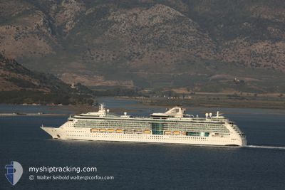
SERENADE OF THE SEAS
Passengers Ship
Current Trip
AW ORJ
| Time Travelled | 1 day |
|---|---|
| Remaining Time | --- |
| Distance Travelled | 242.45 nm |
| Remaining Distance | --- |
| AVG Speed | 9 Noeuds |
| MAX Speed | 11 Noeuds |
| AVG Wind | 7.6 knots |
| MAX Wind | 15 knots |
| MIN Temp | 25.8°C / 78.44°F |
| MAX Temp | 28.2°C / 82.76°F |
| Tirant d eau | 8.5 m |
| Position reçue | 1 d depuis |
Current Position
| Longitude | --- |
|---|---|
| Latitude | --- |
| Etat | Under way using engine |
| Vitesse | 8.7 Noeuds |
| Parcours | 86.6° |
| Zone | Caribbean Sea |
| Station | T-AIS |
| Position reçue | 1 d depuis |
Info
Information
The current position of SERENADE OF THE SEAS is in Caribbean Sea with coordinates 9.90905° / -79.04612° as reported on 2025-12-13 05:00 by AIS to our vessel tracker app. The vessel's current speed is 8.7 Noeuds
The vessel SERENADE OF THE SEAS (IMO: 9228344, MMSI: 311492000) is a Passengers Ship that was built in 2003 ( 22 Age ). It's sailing under the flag of [BS] Bahamas.
In this page you can find informations about the vessels current position, last detected port calls, and current voyage information. If the vessels is not in coverage by AIS you will find the latest position.
The current position of SERENADE OF THE SEAS is detected by our AIS receivers and we are not responsible for the reliability of the data. The last position was recorded while the vessel was in Coverage by the Ais receivers of our vessel tracking app.
The current draught of SERENADE OF THE SEAS as reported by AIS is 8.5 meters
Weather
| Temperature | 27.2°C / 80.96°F |
|---|---|
| Wind Speed | 5 knots |
| Direction | 65° ENE |
| Pressure | 1008.8 hPa |
| Humidity | 83.8 % |
| Cloud Coverage | 95 % |
Featured Company
Last Port Calls
| Port | Arrival | Departure | Time In Port |
|---|---|---|---|
| 2025-12-12 05:57 | 2025-12-12 16:23 | 10 h | |
| 2025-12-10 06:22 | 2025-12-10 16:09 | 9 h | |
| 2025-12-07 07:53 | 2025-12-07 18:28 | 10 h | |
| 2025-12-06 06:11 | 2025-12-06 16:19 | 10 h | |
| 2025-12-03 07:10 | 2025-12-03 20:09 | 12 h | |
| 2025-11-30 07:46 | 2025-11-30 19:19 | 11 h | |
| 2025-11-29 06:11 | 2025-11-29 16:11 | 9 h | |
| 2025-11-27 06:15 | 2025-11-27 16:23 | 10 h | |
| 2025-11-23 07:45 | 2025-11-23 18:24 | 10 h | |
| 2025-11-22 06:02 | 2025-11-22 16:14 | 10 h |
Last Trips
| Origin | Departure | Destination | Arrival | Distance | |
|---|---|---|---|---|---|
| 2025-12-10 16:09 | 2025-12-12 05:57 | 701.68 nm | |||
| 2025-12-07 18:28 | 2025-12-10 06:22 | 479.35 nm | |||
| 2025-12-06 16:19 | 2025-12-07 07:53 | 278.85 nm | |||
| 2025-12-03 20:09 | 2025-12-06 06:11 | 702.20 nm | |||
| 2025-11-30 19:19 | 2025-12-03 07:10 | 621.41 nm | |||
| 2025-11-29 16:11 | 2025-11-30 07:46 | 279.19 nm | |||
| 2025-11-27 16:23 | 2025-11-29 06:11 | 702.21 nm | |||
| 2025-11-23 18:24 | 2025-11-27 06:15 | 483.12 nm | |||
| 2025-11-22 16:14 | 2025-11-23 07:45 | 280.05 nm | |||
| 2025-11-19 18:09 | 2025-11-22 06:02 | 702.18 nm |
Events
| Heure | Evenement | Détails | Position/ Destination | Info |
|---|---|---|---|---|
| 2025-12-13 05:04 | Etat Changé | Default Under way using engine |
9.90929 / -79.03677
AW ORJ
|
Vitesse: 8.7 kn Parcours: 86.6° |
| 2025-12-13 05:00 | Hors de la zone couverte |
9.90905 / -79.04612
Caribbean Sea
|
Vitesse: 8.7 kn Parcours: 86.6° |
|
| 2025-12-13 03:43 | Etat Changé | Under way using engine Default |
9.88625 / -79.21801
AW ORJ
|
Vitesse: 7.5 kn Parcours: 72° |
| 2025-12-13 03:27 | Etat Changé | Default Under way using engine |
9.87667 / -79.25166
AW ORJ
|
Vitesse: 7.6 kn Parcours: 78.2° |
| 2025-12-13 03:24 | Etat Changé | Under way using engine Default |
9.87449 / -79.25818
AW ORJ
|
Vitesse: 8 kn Parcours: 79° |
| 2025-12-13 03:24 | Dans la zone couverte |
9.87449 / -79.25818
Caribbean Sea
|
Vitesse: 7.6 kn Parcours: 78.2° |
|
| 2025-12-13 02:15 | Etat Changé | Default Under way using engine |
9.82167 / -79.42167
AW ORJ
|
Vitesse: 8.8 kn Parcours: 66.6° |
| 2025-12-13 02:11 | Hors de la zone couverte |
9.81850 / -79.43069
Caribbean Sea
|
Vitesse: 8.8 kn Parcours: 66.6° |
|
| 2025-12-13 01:59 | Etat Changé | Under way using engine Default |
9.80760 / -79.45678
AW ORJ
|
Vitesse: 8.3 kn Parcours: 67° |
| 2025-12-13 01:54 | Etat Changé | Default Under way using engine |
9.80330 / -79.46704
AW ORJ
|
Vitesse: 8.2 kn Parcours: 68° |