
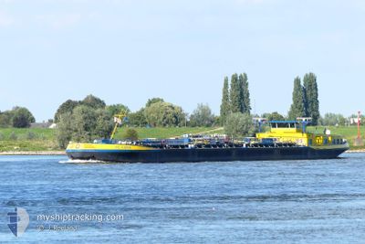
PIZ ALBANA
Tanker
Current Trip
| Time Travelled | 3 days |
|---|---|
| Remaining Time | --- |
| Distance Travelled | 225.19 nm |
| Remaining Distance | --- |
| AVG Speed | 4.7 Knots |
| MAX Speed | 6.1 Knots |
| AVG Wind | 9.5 knots |
| MAX Wind | 17 knots |
| MIN Temp | 5.2°C / 41.36°F |
| MAX Temp | 13°C / 55.4°F |
| Draught | 2.4 m |
| Position Received | 22 h, 55 m ago |
Current Position
| Longitude | --- |
|---|---|
| Latitude | --- |
| Status | Under way using engine |
| Speed | 2.6 Knots |
| Course | --- |
| Area | North Sea |
| Station | T-AIS |
| Position Received | 22 h, 55 m ago |
Info
Information
The current position of PIZ ALBANA is in North Sea with coordinates 49.48983° / 8.48724° as reported on 2025-12-08 06:59 by AIS to our vessel tracker app. The vessel's current speed is 2.6 Knots and is heading at the port of WIJK BIJ DUURSTEDE. The estimated time of arrival as calculated by MyShipTracking vessel tracking app is 2025-12-08 15:32 LT
The vessel PIZ ALBANA (MMSI: 244313877) is a Tanker It's sailing under the flag of [NL] Netherlands.
In this page you can find informations about the vessels current position, last detected port calls, and current voyage information. If the vessels is not in coverage by AIS you will find the latest position.
The current position of PIZ ALBANA is detected by our AIS receivers and we are not responsible for the reliability of the data. The last position was recorded while the vessel was in Coverage by the Ais receivers of our vessel tracking app.
The current draught of PIZ ALBANA as reported by AIS is 2.4 meters
Weather
| Temperature | 12.4°C / 54.32°F |
|---|---|
| Wind Speed | 7 knots |
| Direction | 203° SSW |
| Pressure | 1017.2 hPa |
| Humidity | 91.5 % |
| Cloud Coverage | 100 % |
Featured Company
Last Port Calls
| Port | Arrival | Departure | Time In Port |
|---|---|---|---|
| 2025-12-06 02:10 | 2025-12-06 02:52 | 42 m | |
| 2025-12-05 19:48 | 2025-12-05 20:27 | 38 m | |
| 2025-12-05 03:17 | 2025-12-05 15:38 | 12 h | |
| 2025-12-04 23:56 | 2025-12-05 00:34 | 37 m | |
| 2025-12-04 14:11 | 2025-12-04 14:34 | 23 m | |
| 2025-11-25 17:34 | 2025-12-04 12:32 | 8 d | |
| 2025-11-21 10:54 | 2025-11-25 12:53 | 4 d | |
| 2025-11-20 01:44 | 2025-11-20 17:25 | 15 h | |
| 2025-11-19 14:02 | 2025-11-19 14:57 | 55 m | |
| 2025-11-19 07:56 | 2025-11-19 08:17 | 21 m |
Most Visited Ports (Last year)
| Port | Arrivals | |
|---|---|---|
| 30 | ||
| 22 | ||
| 18 | ||
| 15 | ||
| 14 | ||
| 12 |
Last Trips
| Origin | Departure | Destination | Arrival | Distance | |
|---|---|---|---|---|---|
| 2025-12-05 21:27 | 2025-12-06 03:10 | 31.08 nm | |||
| 2025-12-05 16:38 | 2025-12-05 20:48 | 30.00 nm | |||
| 2025-12-05 01:34 | 2025-12-05 04:17 | 22.65 nm | |||
| 2025-12-04 15:34 | 2025-12-05 00:56 | 69.42 nm | |||
| 2025-12-04 13:32 | 2025-12-04 15:11 | 12.29 nm | |||
| 2025-11-25 13:53 | 2025-11-25 18:34 | 32.05 nm | |||
| 2025-11-20 18:25 | 2025-11-21 11:54 | 115.75 nm | |||
| 2025-11-19 15:57 | 2025-11-20 02:44 | 53.64 nm | |||
| 2025-11-19 09:17 | 2025-11-19 15:02 | 31.13 nm | |||
| 2025-11-19 04:35 | 2025-11-19 08:56 | 31.08 nm |
Events
| Time | Event | Details | Position / Dest | Info |
|---|---|---|---|---|
| 2025-12-08 06:59 | OUT of Coverage |
49.48983 / 8.48724
North Sea
STRAENBRUCKE ILVESHE
|
Speed: 2.6 kn Course: 118.1° |
|
| 2025-12-08 06:59 | Status Changed | Under way using engine Default |
49.48983 / 8.48724
STRAENBRUCKE ILVESHE
|
Speed: 5.2 kn Course: 154° |
| 2025-12-08 06:26 | Status Changed | Default Under way using engine |
49.51355 / 8.43649
STRAENBRUCKE ILVESHE
|
Speed: 5.1 kn Course: 159.6° |
| 2025-12-08 06:21 | Status Changed | Under way using engine Default |
49.52014 / 8.43292
STRAENBRUCKE ILVESHE
|
Speed: 5 kn Course: 164° |
| 2025-12-08 06:12 | Status Changed | Default Under way using engine |
49.53203 / 8.42720
STRAENBRUCKE ILVESHE
|
Speed: 4.6 kn Course: 155.3° |
| 2025-12-08 03:43 | Status Changed | Under way using engine Default |
49.70378 / 8.37182
STRAENBRUCKE ILVESHE
|
Speed: 4 kn Course: -1° |
| 2025-12-08 03:39 | Status Changed | Default Under way using engine |
49.70500 / 8.37833
STRAENBRUCKE ILVESHE
|
Speed: 5 kn Course: 243.4° |
| 2025-12-07 19:01 | Status Changed | Under way using engine Default |
49.98663 / 7.86257
STRAENBRUCKE ILVESHE
|
Speed: 4 kn Course: -1° |
| 2025-12-07 19:01 | IN Coverage |
49.98663 / 7.86257
North Sea
STRAENBRUCKE ILVESHE
|
Speed: 3 kn Course: 181.7° |
|
| 2025-12-07 17:51 | OUT of Coverage |
50.04130 / 7.79886
North Sea
STRAENBRUCKE ILVESHE
|
Speed: 3.5 kn Course: 132.9° |