
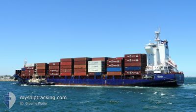
OPHELIA
Cargo
Current Trip
| Time Travelled | 1 day |
|---|---|
| Remaining Time | --- |
| Distance Travelled | 491.61 nm |
| Remaining Distance | --- |
| AVG Speed | 16.2 Knots |
| MAX Speed | 18.3 Knots |
| AVG Wind | 20 knots |
| MAX Wind | 34 knots |
| MIN Temp | 19.1°C / 66.38°F |
| MAX Temp | 27.8°C / 82.04°F |
| Draught | 7 m |
| Position Received | 15 d ago |
Current Position
| Longitude | --- |
|---|---|
| Latitude | --- |
| Status | Under way using engine |
| Speed | 10.6 Knots |
| Course | 178.4° |
| Area | Gulf of Thailand |
| Station | T-AIS |
| Position Received | 15 d ago |
Info
Information
The current position of OPHELIA is in Gulf of Thailand with coordinates 13.37345° / 100.59373° as reported on 2025-11-23 08:32 by AIS to our vessel tracker app. The vessel's current speed is 10.6 Knots and is heading at the port of NINGBO. The estimated time of arrival as calculated by MyShipTracking vessel tracking app is 2025-11-29 04:00 LT
The vessel OPHELIA (IMO: 9765586, MMSI: 538090606) is a Cargo It's sailing under the flag of [MH] Marshall Is.
In this page you can find informations about the vessels current position, last detected port calls, and current voyage information. If the vessels is not in coverage by AIS you will find the latest position.
The current position of OPHELIA is detected by our AIS receivers and we are not responsible for the reliability of the data. The last position was recorded while the vessel was in Coverage by the Ais receivers of our vessel tracking app.
The current draught of OPHELIA as reported by AIS is 7 meters
Weather
| Temperature | 27.7°C / 81.86°F |
|---|---|
| Wind Speed | 8 knots |
| Direction | 67° ENE |
| Pressure | 1009.9 hPa |
| Humidity | 76.4 % |
| Cloud Coverage | 31 % |
Featured Company
Last Port Calls
| Port | Arrival | Departure | Time In Port |
|---|---|---|---|
| 2025-12-07 12:07 | 2025-12-07 17:57 | 5 h | |
| 2025-12-05 11:50 | 2025-12-05 22:05 | 10 h | |
| 2025-11-22 06:24 | 2025-11-23 14:36 | 1 d | |
| 2025-11-20 20:44 | 2025-11-21 19:46 | 23 h | |
| 2025-11-15 04:38 | 2025-11-16 01:22 | 20 h | |
| 2025-11-12 07:20 | 2025-11-13 09:36 | 1 d | |
| 2025-11-02 00:00 | 2025-11-02 06:52 | 6 h | |
| 2025-10-30 05:56 | 2025-10-30 22:28 | 16 h | |
| 2025-10-23 07:34 | 2025-10-24 09:24 | 1 d | |
| 2025-10-18 15:19 | 2025-10-18 21:53 | 6 h |
Most Visited Ports (Last year)
| Port | Arrivals | |
|---|---|---|
| 10 | ||
| 9 | ||
| 9 | ||
| 8 | ||
| 5 | ||
| 4 |
Last Trips
| Origin | Departure | Destination | Arrival | Distance | |
|---|---|---|---|---|---|
| 2025-12-05 22:05 | 2025-12-07 12:07 | 612.32 nm | |||
| 2025-11-23 14:36 | 2025-12-05 11:50 | 2450.99 nm | |||
| 2025-11-21 19:46 | 2025-11-22 06:24 | 36.75 nm | |||
| 2025-11-16 01:22 | 2025-11-20 20:44 | 1517.73 nm | |||
| 2025-11-13 09:36 | 2025-11-15 04:38 | 680.87 nm | |||
| 2025-11-02 06:52 | 2025-11-12 07:20 | 1325.31 nm | |||
| 2025-10-30 22:28 | 2025-11-02 00:00 | 422.83 nm | |||
| 2025-10-24 09:24 | 2025-10-30 05:56 | 1447.28 nm | |||
| 2025-10-18 21:53 | 2025-10-23 07:34 | 1278.62 nm | |||
| 2025-10-16 23:12 | 2025-10-18 15:19 | 414.61 nm |
Events
| Time | Event | Details | Position / Dest | Info |
|---|---|---|---|---|
| 2025-12-07 09:57 | PORT DEPARTURE |
|
24.48827 / 118.06445
CN NBG
|
Speed: 5.7 kn Course: 217° |
| 2025-12-07 09:45 | START Moving |
24.51339 / 118.07610
[CN] XIAMEN
|
Speed: 5.3 kn Course: 221° |
|
| 2025-12-07 04:10 | STOP Moving |
24.51662 / 118.07971
[CN] XIAMEN
|
Speed: Course: 195° |
|
| 2025-12-07 04:07 | PORT ARRIVAL |
|
24.51669 / 118.07967
[CN] XIAMEN
|
Speed: 1 kn Course: 187° |
| 2025-12-05 14:13 | START Moving | 4.72 nm, South East of SHANGHAI |
31.32945 / 121.68642
CN NBG
|
Speed: 4.1 kn Course: 99° |
| 2025-12-05 14:05 | PORT DEPARTURE |
|
31.32820 / 121.67969
CN NBG
|
Speed: 1.1 kn Course: 105° |
| 2025-12-05 04:08 | STOP Moving |
31.32590 / 121.67558
[CN] SHANGHAI
|
Speed: Course: 125° |
|
| 2025-12-05 03:50 | PORT ARRIVAL |
|
31.32590 / 121.67558
[CN] SHANGHAI
|
Speed: 3.9 kn Course: 142° |
| 2025-12-04 03:45 | START Moving | 4.38 nm, East of NINGBO |
29.94300 / 121.93066
CN NBG
|
Speed: 7.1 kn Course: 26° |
| 2025-12-03 11:12 | STOP Moving | 4.49 nm, East of NINGBO |
29.93873 / 121.93258
CN NBG
|
Speed: Course: 235° |