
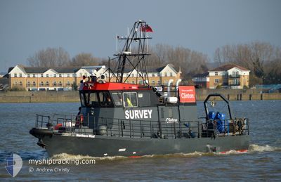
NORTHERN WIND
Dredging or underwater ops
Current Trip
SURVEY AREA
| Time Travelled | 1 day |
|---|---|
| Remaining Time | --- |
| Distance Travelled | 291.81 nm |
| Remaining Distance | --- |
| AVG Speed | 9.6 Knots |
| MAX Speed | 16.4 Knots |
| AVG Wind | 7.3 knots |
| MAX Wind | 12.6 knots |
| MIN Temp | 9.4°C / 48.92°F |
| MAX Temp | 12.7°C / 54.86°F |
| Draught | 1.6 m |
| Position Received | 1 m ago |
Current Position
| Longitude | -3.64300° |
|---|---|
| Latitude | 58.69648° |
| Status | Restricted manoeuverability |
| Speed | 9.1 Knots |
| Course | 265.9° |
| Area | North Atlantic Ocean |
| Station | T-AIS |
| Position Received | 1 m ago |
Info
Information
The current position of NORTHERN WIND is in North Atlantic Ocean with coordinates 58.69648° / -3.64300° as reported on 2024-05-10 21:53 by AIS to our vessel tracker app. The vessel's current speed is 9.1 Knots
The vessel NORTHERN WIND (MMSI: 235111562) is a Dredging or underwater ops It's sailing under the flag of [GB] United Kingdom.
In this page you can find informations about the vessels current position, last detected port calls, and current voyage information. If the vessels is not in coverage by AIS you will find the latest position.
The current position of NORTHERN WIND is detected by our AIS receivers and we are not responsible for the reliability of the data. The last position was recorded while the vessel was in Coverage by the Ais receivers of our vessel tracking app.
The current draught of NORTHERN WIND as reported by AIS is 1.6 meters
Weather
| Temperature | 11.9°C / 53.42°F |
|---|---|
| Wind Speed | 8 knots |
| Direction | 131° SE |
| Pressure | 1020.1 hPa |
| Humidity | 87 % |
| Cloud Coverage | 100 % |
Featured Company
Last Port Calls
| Port | Arrival | Departure | Time In Port |
|---|---|---|---|
| 2024-05-09 13:30 | 2024-05-09 13:36 | 6 m | |
| 2024-05-07 16:26 | 2024-05-08 13:17 | 20 h | |
| 2024-05-01 22:13 | 2024-05-03 18:31 | 1 d | |
| 2024-04-28 01:31 | 2024-04-28 22:12 | 20 h | |
| 2024-04-14 12:24 | 2024-04-27 11:06 | 12 d | |
| 2024-04-09 07:41 | 2024-04-11 05:30 | 1 d | |
| 2024-04-05 02:26 | 2024-04-08 03:32 | 3 d | |
| 2024-03-31 17:21 | 2024-04-01 13:56 | 20 h | |
| 2024-03-26 14:15 | 2024-03-29 20:55 | 3 d | |
| 2024-03-24 21:31 | 2024-03-25 04:51 | 7 h |
Most Visited Ports (Last year)
| Port | Arrivals | |
|---|---|---|
| 30 | ||
| 16 | ||
| 12 | ||
| 9 | ||
| 7 | ||
| 4 |
Last Trips
| Origin | Departure | Destination | Arrival | Distance | |
|---|---|---|---|---|---|
| 2024-05-08 14:17 | 2024-05-09 14:30 | 219.94 nm | |||
| 2024-05-03 19:31 | 2024-05-07 17:26 | 478.54 nm | |||
| 2024-04-28 23:12 | 2024-05-01 23:13 | 449.94 nm | |||
| 2024-04-27 12:06 | 2024-04-28 02:31 | 98.26 nm | |||
| 2024-04-11 06:30 | 2024-04-14 13:24 | 558.04 nm | |||
| 2024-04-08 04:32 | 2024-04-09 08:41 | 150.27 nm | |||
| 2024-04-01 14:56 | 2024-04-05 03:26 | 133.98 nm | |||
| 2024-03-29 20:55 | 2024-03-31 18:21 | 110.53 nm | |||
| 2024-03-25 04:51 | 2024-03-26 14:15 | 340.51 nm | |||
| 2024-03-24 15:59 | 2024-03-24 21:31 | 49.88 nm |
Events
| Time | Event | Details | Position / Dest | Info |
|---|---|---|---|---|
| 2024-05-10 21:05 | Change Sea Area | United Kingdom part of the North Atlantic Ocean United Kingdom part of the North Sea |
58.70233 / -3.41096
North Atlantic Ocean
|
Speed: 7.9 kn Course: 269.5° |
| 2024-05-10 20:50 | Detected in Sea | United Kingdom part of the North Sea |
58.70189 / -3.39412
North Sea
|
Speed: 10.7 kn Course: 82.3° |
| 2024-05-10 19:13 | Change Sea Area | United Kingdom part of the North Atlantic Ocean United Kingdom part of the North Sea |
58.70000 / -3.41647
North Atlantic Ocean
|
Speed: 10.6 kn Course: 264.9° |
| 2024-05-10 19:02 | Detected in Sea | United Kingdom part of the North Sea |
58.69961 / -3.39592
North Sea
|
Speed: 12.3 kn Course: 83.5° |
| 2024-05-10 17:26 | Change Sea Area | United Kingdom part of the North Atlantic Ocean United Kingdom part of the North Sea |
58.69799 / -3.41243
North Atlantic Ocean
|
Speed: 12.5 kn Course: 266.3° |
| 2024-05-10 16:44 | Change Sea Area | United Kingdom part of the North Sea United Kingdom part of the North Atlantic Ocean |
58.69733 / -3.40009
North Sea
|
Speed: 10.8 kn Course: 85.9° |
| 2024-05-10 15:13 | Change Sea Area | United Kingdom part of the North Atlantic Ocean United Kingdom part of the North Sea |
58.69554 / -3.42322
North Atlantic Ocean
|
Speed: 10.4 kn Course: 271.2° |
| 2024-05-10 14:56 | Change Sea Area | United Kingdom part of the North Sea United Kingdom part of the North Atlantic Ocean |
58.69489 / -3.40676
North Sea
|
Speed: 8.9 kn Course: 85° |
| 2024-05-10 12:59 | Change Sea Area | United Kingdom part of the North Atlantic Ocean United Kingdom part of the North Sea |
58.69360 / -3.41391
North Atlantic Ocean
|
Speed: 9.9 kn Course: 265.5° |
| 2024-05-10 12:47 | Change Sea Area | United Kingdom part of the North Sea United Kingdom part of the North Atlantic Ocean |
58.69309 / -3.40207
North Sea
|
Speed: 9.8 kn Course: 83.6° |