
MYGAS
Tanker
Current Trip
| Trip Time | 19 days |
|---|---|
| Trip Distance | 4679.11 nm |
| AVG Speed | 10.7 Knots |
| MAX Speed | 14 Knots |
| Draught | 7.6 m |
| AVG Wind | 14.6 knots |
| MAX Wind | 30.9 knots |
| MIN Temp | 14.2°C / 57.56°F |
| MAX Temp | 25.3°C / 77.54°F |
| Position Received | 3 m ago |
Current Position
| Longitude | -8.87820° |
|---|---|
| Latitude | 37.94951° |
| Status | Moored |
| Speed | |
| Course | 208° |
| Area | North Atlantic Ocean |
| Station | T-AIS |
| Position Received | 3 m ago |
Info
Information
The current position of MYGAS is in North Atlantic Ocean with coordinates 37.94951° / -8.87820° as reported on 2024-05-10 23:29 by AIS to our vessel tracker app. The vessel's current speed is 0 Knots and is currently inside the port of SINES.
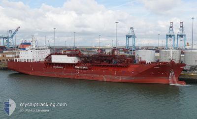
The vessel MYGAS (IMO: 9694397, MMSI: 305377000) is a Tanker It's sailing under the flag of [AG] Antigua Barbuda.
In this page you can find informations about the vessels current position, last detected port calls, and current voyage information. If the vessels is not in coverage by AIS you will find the latest position.
The current position of MYGAS is detected by our AIS receivers and we are not responsible for the reliability of the data. The last position was recorded while the vessel was in Coverage by the Ais receivers of our vessel tracking app.
The current draught of MYGAS as reported by AIS is 7.6 meters
Weather
| Temperature | 16.9°C / 62.42°F |
|---|---|
| Wind Speed | 15 knots |
| Direction | 330° NNW |
| Pressure | 1015.1 hPa |
| Humidity | 83.6 % |
| Cloud Coverage | --- |
Featured Company
Events
| Time | Event | Details | Position / Dest | Info |
|---|---|---|---|---|
| 2024-05-10 19:50 | Status Changed | Moored Under way using engine |
37.94952 / -8.87824
[PT] SINES
|
Speed: 0.3 kn Course: 207° |
| 2024-05-10 19:40 | STOP Moving |
37.94917 / -8.87785
[PT] SINES
|
Speed: 0.3 kn Course: 217° |
|
| 2024-05-10 19:24 | PORT ARRIVAL |
|
37.93355 / -8.87869
[PT] SINES
|
Speed: 7.2 kn Course: 4.1° |
| 2024-05-10 18:56 | START Moving | 2.59 nm, South of SINES |
37.90138 / -8.87627
US HOU > PT SIE
|
Speed: 3.7 kn Course: 345° |
| 2024-05-10 18:56 | Status Changed | Under way using engine At anchor |
37.90095 / -8.87592
US HOU > PT SIE
|
Speed: 3.4 kn Course: 336° |
| 2024-05-10 17:37 | Status Changed | At anchor Under way using engine |
37.89894 / -8.87332
US HOU > PT SIE
|
Speed: Course: 338° |
| 2024-05-10 17:37 | Status Changed | Under way using engine At anchor |
37.89896 / -8.87333
US HOU > PT SIE
|
Speed: Course: 337° |
| 2024-05-10 15:39 | Status Changed | At anchor Default |
37.89903 / -8.87335
US HOU > PT SIE
|
Speed: Course: 344° |
| 2024-05-10 15:36 | Status Changed | Default At anchor |
37.89905 / -8.87345
US HOU > PT SIE
|
Speed: 0.1 kn Course: 341° |
| 2024-05-10 06:27 | Status Changed | At anchor Default |
37.90120 / -8.87330
US HOU > PT SIE
|
Speed: 0.1 kn Course: 235° |