
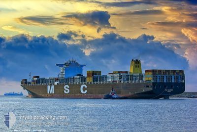
MSC CLORINDA
Container Ship
Current Trip
| Time Travelled | 12 days |
|---|---|
| Remaining Time | --- |
| Distance Travelled | 1910.29 nm |
| Remaining Distance | 0.99 nm |
| AVG Speed | 9 Knots |
| MAX Speed | 17.1 Knots |
| AVG Wind | 17.3 knots |
| MAX Wind | 32.9 knots |
| MIN Temp | 2.1°C / 35.78°F |
| MAX Temp | 16.8°C / 62.24°F |
| Draught | 9.9 m |
| Position Received | 4 m ago |
Current Position
| Longitude | --- |
|---|---|
| Latitude | --- |
| Status | Moored |
| Speed | |
| Course | 41° |
| Area | Strait of Gibraltar |
| Station | T-AIS |
| Position Received | 4 m ago |
Info
Information
The current position of MSC CLORINDA is in Strait of Gibraltar with coordinates 35.86971° / -5.53250° as reported on 2025-03-04 23:56 by AIS to our vessel tracker app. The vessel's current speed is 0 Knots and is heading at the port of TANGER MED. The estimated time of arrival as calculated by MyShipTracking vessel tracking app is 2025-03-04 21:30 LT
The vessel MSC CLORINDA (IMO: 9484429, MMSI: 373233000) is a Container Ship that was built in 2012 ( 13 years old ). It's sailing under the flag of [PA] Panama.
In this page you can find informations about the vessels current position, last detected port calls, and current voyage information. If the vessels is not in coverage by AIS you will find the latest position.
The current position of MSC CLORINDA is detected by our AIS receivers and we are not responsible for the reliability of the data. The last position was recorded while the vessel was in Coverage by the Ais receivers of our vessel tracking app.
The current draught of MSC CLORINDA as reported by AIS is 9.9 meters
Weather
| Temperature | 13.7°C / 56.66°F |
|---|---|
| Wind Speed | 17 knots |
| Direction | 99° E |
| Pressure | 1011 hPa |
| Humidity | 88.4 % |
| Cloud Coverage | 97 % |
Featured Company
Last Port Calls
| Port | Arrival | Departure | Time In Port |
|---|---|---|---|
| 2025-02-18 16:01 | 2025-02-20 07:07 | 1 d | |
| 2025-01-16 17:50 | 2025-01-18 05:44 | 1 d | |
| 2025-01-12 02:25 | 2025-01-12 11:41 | 9 h | |
| 2025-01-02 06:15 | 2025-01-03 02:36 | 20 h |
Most Visited Ports (Last year)
| Port | Arrivals | |
|---|---|---|
| 5 | ||
| 3 | ||
| 2 | ||
| 1 | ||
| 1 | ||
| 1 |
Last Trips
| Origin | Departure | Destination | Arrival | Distance | |
|---|---|---|---|---|---|
| 2025-01-18 05:44 | 2025-02-18 16:01 | 11892.17 nm | |||
| 2025-01-12 11:41 | 2025-01-16 17:50 | 1501.53 nm | |||
| 2025-01-03 02:36 | 2025-01-12 02:25 | 992.15 nm | |||
| 2024-12-29 09:19 | 2025-01-02 06:15 | 872.05 nm |
Events
| Time | Event | Details | Position / Dest | Info |
|---|---|---|---|---|
| 2025-03-04 23:08 | Status Changed | Moored Default |
35.86966 / -5.53261
TANGER MED
|
Speed: Course: 41° |
| 2025-03-04 22:59 | Status Changed | Default Moored |
35.86969 / -5.53250
TANGER MED
|
Speed: Course: 41° |
| 2025-03-04 22:53 | Status Changed | Moored Under way using engine |
35.86967 / -5.53254
TANGER MED
|
Speed: Course: 41° |
| 2025-03-04 22:35 | STOP Moving | 0.93 nm, South West of TANGER MED |
35.86972 / -5.53278
TANGER MED
|
Speed: 0.1 kn Course: 42° |
| 2025-03-04 20:02 | ETA Changed | 2025/03/04 21:30 2025/03/04 14:00 |
35.90604 / -5.83815
TANGER MED
|
Speed: 12.5 kn Course: 91.2° |
| 2025-03-04 19:56 | Status Changed | Under way using engine Default |
35.90614 / -5.86422
TANGER MED
|
Speed: 16.4 kn Course: 84° |
| 2025-03-04 19:53 | Status Changed | Default Under way using engine |
35.90507 / -5.87844
TANGER MED
|
Speed: 15.9 kn Course: 66.1° |
| 2025-03-04 19:43 | Change Sea Area | Moroccan part of the Strait of Gibraltar Moroccan part of the North Atlantic Ocean |
35.89126 / -5.93275
Strait of Gibraltar
|
Speed: 14.3 kn Course: 64.6° |
| 2025-03-04 19:43 | Status Changed | Under way using engine Default |
35.89126 / -5.93275
TANGER MED
|
Speed: 12.4 kn Course: 56° |
| 2025-03-04 19:36 | Status Changed | Default Under way using engine |
35.87920 / -5.95956
TANGER MED
|
Speed: 12.4 kn Course: 50.9° |