
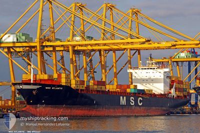
MSC ATLANTIC III
Container Ship
Current Trip
| Time Travelled | 3 days |
|---|---|
| Remaining Time | 8 h, 16 mins |
| Distance Travelled | 517.28 nm |
| Remaining Distance | 156.01 nm |
| AVG Speed | 17 Knots |
| MAX Speed | 19.5 Knots |
| AVG Wind | 16 knots |
| MAX Wind | 21 knots |
| MIN Temp | 1.8°C / 35.24°F |
| MAX Temp | 7.1°C / 44.78°F |
| Draught | 8.9 m |
| Position Received | 3 d ago |
Current Position
| Longitude | --- |
|---|---|
| Latitude | --- |
| Status | Under way using engine |
| Speed | 18.6 Knots |
| Course | 358.4° |
| Area | Baltic Sea |
| Station | T-AIS |
| Position Received | 3 d ago |
Info
Information
The current position of MSC ATLANTIC III is in Baltic Sea with coordinates 55.21717° / 18.94274° as reported on 2025-12-02 19:56 by AIS to our vessel tracker app. The vessel's current speed is 18.6 Knots and is heading at the port of RIGA. The estimated time of arrival as calculated by MyShipTracking vessel tracking app is 2025-12-06 07:52 LT
The vessel MSC ATLANTIC III (IMO: 8913447, MMSI: 355249000) is a Container Ship that was built in 1991 ( 34 years old ). It's sailing under the flag of [PA] Panama.
In this page you can find informations about the vessels current position, last detected port calls, and current voyage information. If the vessels is not in coverage by AIS you will find the latest position.
The current position of MSC ATLANTIC III is detected by our AIS receivers and we are not responsible for the reliability of the data. The last position was recorded while the vessel was in Coverage by the Ais receivers of our vessel tracking app.
The current draught of MSC ATLANTIC III as reported by AIS is 8.9 meters
Weather
| Temperature | 7.1°C / 44.78°F |
|---|---|
| Wind Speed | 16 knots |
| Direction | 142° SE |
| Pressure | 1017.3 hPa |
| Humidity | 89.9 % |
| Cloud Coverage | 100 % |
Featured Company
Last Port Calls
| Port | Arrival | Departure | Time In Port |
|---|---|---|---|
| 2025-12-01 16:50 | 2025-12-02 17:58 | 1 d | |
| 2025-11-27 23:53 | 2025-11-28 20:48 | 20 h | |
| 2025-11-25 12:53 | 2025-11-26 12:23 | 23 h | |
| 2025-11-18 07:28 | 2025-11-18 20:08 | 12 h | |
| 2025-11-16 04:23 | 2025-11-16 19:24 | 15 h | |
| 2025-11-11 19:44 | 2025-11-13 11:40 | 1 d | |
| 2025-11-02 23:45 | 2025-11-07 22:35 | 4 d | |
| 2025-10-30 06:53 | 2025-10-30 18:10 | 11 h | |
| 2025-10-28 08:14 | 2025-10-29 00:36 | 16 h | |
| 2025-10-26 21:07 | 2025-10-27 23:29 | 1 d |
Most Visited Ports (Last year)
| Port | Arrivals | |
|---|---|---|
| 7 | ||
| 7 | ||
| 6 | ||
| 5 | ||
| 5 | ||
| 4 |
Last Trips
| Origin | Departure | Destination | Arrival | Distance | |
|---|---|---|---|---|---|
| 2025-11-28 20:48 | 2025-12-01 16:50 | 1106.56 nm | |||
| 2025-11-26 12:23 | 2025-11-27 23:53 | 291.05 nm | |||
| 2025-11-18 20:08 | 2025-11-25 12:53 | 1758.05 nm | |||
| 2025-11-16 19:24 | 2025-11-18 07:28 | 497.54 nm | |||
| 2025-11-13 11:40 | 2025-11-16 04:23 | 895.71 nm | |||
| 2025-11-07 22:35 | 2025-11-11 19:44 | 1554.15 nm | |||
| 2025-10-30 18:10 | 2025-11-02 23:45 | 1173.52 nm | |||
| 2025-10-29 00:36 | 2025-10-30 06:53 | 472.03 nm | |||
| 2025-10-27 23:29 | 2025-10-28 08:14 | 100.83 nm | |||
| 2025-10-22 19:40 | 2025-10-26 21:07 | 1693.26 nm |
Events
| Time | Event | Details | Position / Dest | Info |
|---|---|---|---|---|
| 2025-12-05 12:25 | START Moving | 3.73 nm, North of RIGA |
57.01017 / 24.09215
LVRIX
|
Speed: 3.9 kn Course: 330° |
| 2025-12-03 14:53 | STOP Moving | 3.61 nm, North of RIGA |
57.00834 / 24.09430
LVRIX
|
Speed: 0.3 kn Course: 304° |
| 2025-12-02 20:05 | Status Changed | Default Under way using engine |
55.26119 / 18.94078
LVRIX
|
Speed: 18.6 kn Course: 358.4° |
| 2025-12-02 19:56 | OUT of Coverage |
55.21717 / 18.94274
Baltic Sea
LVRIX
|
Speed: 18.6 kn Course: 358.4° |
|
| 2025-12-02 17:30 | ETA Changed | 2025/12/03 14:30 2025/12/03 16:00 |
54.52909 / 18.75899
LVRIX
|
Speed: 17.9 kn Course: 92.4° |
| 2025-12-02 16:58 | PORT DEPARTURE |
|
54.53583 / 18.56653
LVRIX
|
Speed: 8.6 kn Course: 92° |
| 2025-12-02 16:41 | START Moving |
54.54341 / 18.51211
[PL] GDYNIA
|
Speed: 4 kn Course: 122° |
|
| 2025-12-02 16:26 | Status Changed | Under way using engine Moored |
54.54469 / 18.50969
[PL] GDYNIA
|
Speed: Course: 115° |
| 2025-12-02 16:04 | Draught Changed | 8.9 10.9 |
54.54464 / 18.50971
[PL] GDYNIA
|
Speed: Course: 115° |
| 2025-12-02 15:39 | ETA Changed | 2025/12/03 16:00 2025/12/01 15:00 |
54.54471 / 18.50967
[PL] GDYNIA
|
Speed: Course: 115° |