
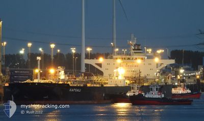
KAPSALI
Crude Oil Tanker
Current Trip
| Time Travelled | 47 days |
|---|---|
| Remaining Time | --- |
| Distance Travelled | 5618.60 nm |
| Remaining Distance | --- |
| AVG Speed | 10.7 Knots |
| MAX Speed | 13.8 Knots |
| AVG Wind | 12.6 knots |
| MAX Wind | 33 knots |
| MIN Temp | 4.5°C / 40.1°F |
| MAX Temp | 29°C / 84.2°F |
| Draught | 9 m |
| Position Received | 3 m ago |
Current Position
| Longitude | --- |
|---|---|
| Latitude | --- |
| Status | At anchor |
| Speed | 0.1 Knots |
| Course | 278° |
| Area | Gulf of Oman |
| Station | T-AIS |
| Position Received | 3 m ago |
Info
Information
The current position of KAPSALI is in Gulf of Oman with coordinates 25.39910° / 56.58417° as reported on 2025-03-03 04:46 by AIS to our vessel tracker app. The vessel's current speed is 0.1 Knots
The vessel KAPSALI (IMO: 9587312, MMSI: 538008333) is a Crude Oil Tanker that was built in 2011 ( 14 years old ). It's sailing under the flag of [MH] Marshall Is.
In this page you can find informations about the vessels current position, last detected port calls, and current voyage information. If the vessels is not in coverage by AIS you will find the latest position.
The current position of KAPSALI is detected by our AIS receivers and we are not responsible for the reliability of the data. The last position was recorded while the vessel was in Coverage by the Ais receivers of our vessel tracking app.
The current draught of KAPSALI as reported by AIS is 9 meters
Weather
| Temperature | 19.5°C / 67.1°F |
|---|---|
| Wind Speed | 11 knots |
| Direction | 283° WNW |
| Pressure | 1018.4 hPa |
| Humidity | 48.1 % |
| Cloud Coverage | 65 % |
Featured Company
Most Visited Ports (Last year)
| Port | Arrivals | |
|---|---|---|
| 2 | ||
| 2 | ||
| 1 | ||
| 1 | ||
| 1 | ||
| 1 |
Last Trips
| Origin | Departure | Destination | Arrival | Distance | |
|---|---|---|---|---|---|
| 2024-12-24 10:35 | 2025-01-13 11:47 | 530.52 nm |
Events
| Time | Event | Details | Position / Dest | Info |
|---|---|---|---|---|
| 2025-03-02 10:16 | Status Changed | At anchor Default |
25.39874 / 56.58322
KHOR FAKKAN
|
Speed: 0.1 kn Course: 305° |
| 2025-03-02 10:10 | Status Changed | Default At anchor |
25.39855 / 56.58320
KHOR FAKKAN
|
Speed: 0.1 kn Course: 306° |
| 2025-03-01 19:55 | Status Changed | At anchor Default |
25.40233 / 56.58117
KHOR FAKKAN
|
Speed: Course: 173° |
| 2025-03-01 19:52 | Status Changed | Default At anchor |
25.40235 / 56.58112
KHOR FAKKAN
|
Speed: Course: 175° |
| 2025-03-01 10:36 | Status Changed | At anchor Default |
25.40036 / 56.57876
KHOR FAKKAN
|
Speed: Course: 96° |
| 2025-03-01 10:27 | Status Changed | Default At anchor |
25.40044 / 56.57882
KHOR FAKKAN
|
Speed: Course: 98° |
| 2025-03-01 07:15 | Status Changed | At anchor Default |
25.40212 / 56.58185
KHOR FAKKAN
|
Speed: Course: 196° |
| 2025-03-01 07:12 | Status Changed | Default At anchor |
25.40207 / 56.58187
KHOR FAKKAN
|
Speed: Course: 197° |
| 2025-03-01 04:27 | Status Changed | At anchor Under way using engine |
25.40110 / 56.58341
KHOR FAKKAN
|
Speed: 0.1 kn Course: 228° |
| 2025-03-01 03:34 | STOP Moving | 12.14 nm, East of KHORFAKKAN |
25.40071 / 56.58018
KHOR FAKKAN
|
Speed: 0.2 kn Course: 217° |