
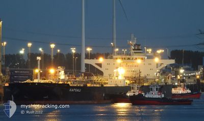
KAPSALI
Crude Oil Tanker
Current Trip
FOR ORDERS
| Time Travelled | 5 days |
|---|---|
| Remaining Time | --- |
| Distance Travelled | 399.86 nm |
| Remaining Distance | --- |
| AVG Speed | 8.2 Noeuds |
| MAX Speed | 14.2 Noeuds |
| AVG Wind | 7.3 knots |
| MAX Wind | 20.8 knots |
| MIN Temp | 14.4°C / 57.92°F |
| MAX Temp | 26.9°C / 80.42°F |
| Tirant d eau | 9 m |
| Position reçue | 1 d depuis |
Current Position
| Longitude | 29.01505° |
|---|---|
| Latitude | 41.49853° |
| Etat | Under way using engine |
| Vitesse | 10.1 Noeuds |
| Parcours | 319.3° |
| Zone | Black Sea |
| Station | T-AIS |
| Position reçue | 1 d depuis |
Info
Information
The current position of KAPSALI is in Black Sea with coordinates 41.49853° / 29.01505° as reported on 2024-04-17 06:49 by AIS to our vessel tracker app. The vessel's current speed is 10.1 Noeuds
The vessel KAPSALI (IMO: 9587312, MMSI: 538008333) is a Crude Oil Tanker that was built in 2011 ( 13 Age ). It's sailing under the flag of [MH] Marshall Is.
In this page you can find informations about the vessels current position, last detected port calls, and current voyage information. If the vessels is not in coverage by AIS you will find the latest position.
The current position of KAPSALI is detected by our AIS receivers and we are not responsible for the reliability of the data. The last position was recorded while the vessel was in Coverage by the Ais receivers of our vessel tracking app.
The current draught of KAPSALI as reported by AIS is 9 meters
Weather
| Temperature | 12.3°C / 54.14°F |
|---|---|
| Wind Speed | 12 knots |
| Direction | 4° N |
| Pressure | 999.4 hPa |
| Humidity | 89.7 % |
| Cloud Coverage | 100 % |
Featured Company
Last Port Calls
| Port | Arrival | Departure | Time In Port |
|---|---|---|---|
| 2024-04-11 10:58 | 2024-04-12 21:28 | 1 d | |
| 2024-03-15 22:57 | 2024-03-20 08:26 | 4 d | |
| 2024-03-09 03:06 | 2024-03-09 10:17 | 7 h |
Most Visited Ports (Last year)
| Port | Arrivals | |
|---|---|---|
| 3 | ||
| 1 | ||
| 1 | ||
| 1 | ||
| 1 | ||
| 1 |
Last Trips
| Origin | Departure | Destination | Arrival | Distance | |
|---|---|---|---|---|---|
| 2024-03-20 09:26 | 2024-04-11 13:58 | 3791.74 nm | |||
| 2024-03-09 10:17 | 2024-03-15 23:57 | 1781.54 nm | |||
| 2024-01-29 17:20 | 2024-03-09 03:06 | 5499.85 nm |
Events
| Heure | Evenement | Détails | Position/ Destination | Info |
|---|---|---|---|---|
| 2024-04-17 10:55 | Arret | 17.54 nm, South East of IGNEADA |
41.76725 / 28.38173
FOR ORDERS
|
Vitesse: 0.3 kn Parcours: 208° |
| 2024-04-17 06:54 | Etat Changé | Default Under way using engine |
41.50931 / 29.00133
FOR ORDERS
|
Vitesse: 10.1 kn Parcours: 319.3° |
| 2024-04-17 06:49 | Hors de la zone couverte |
41.49853 / 29.01505
Black Sea
FOR ORDERS
|
Vitesse: 10.1 kn Parcours: 319.3° |
|
| 2024-04-17 04:46 | Changement de zone | Turkish part of the Black Sea Turkish part of the Sea of Marmara |
41.23018 / 29.14239
Black Sea
FOR ORDERS
|
Vitesse: 10 kn Parcours: 32.3° |
| 2024-04-17 02:51 | Changement de destination | FOR ORDERS BOSPORUS |
40.94537 / 28.98831
FOR ORDERS
|
Vitesse: 7.2 kn Parcours: 5.1° |
| 2024-04-17 02:51 | Changement d'ETA | 2024/04/17 12:00 2024/04/16 00:01 |
40.94537 / 28.98831
FOR ORDERS
|
Vitesse: 7.2 kn Parcours: 5.1° |
| 2024-04-16 20:47 | Démarrage | 10 nm, South of YESILKOY |
40.79197 / 28.86917
BOSPORUS
|
Vitesse: 3.1 kn Parcours: 298° |
| 2024-04-16 17:47 | Arret | 10.14 nm, South of YESILKOY |
40.79480 / 28.89544
BOSPORUS
|
Vitesse: 0.3 kn Parcours: 257° |
| 2024-04-16 15:52 | Démarrage | 11.85 nm, South West of MALTEPE |
40.77590 / 28.94387
BOSPORUS
|
Vitesse: 3.1 kn Parcours: 320° |
| 2024-04-16 15:34 | Arret | 11.9 nm, South West of MALTEPE |
40.77283 / 28.94641
BOSPORUS
|
Vitesse: 0.3 kn Parcours: 33° |