
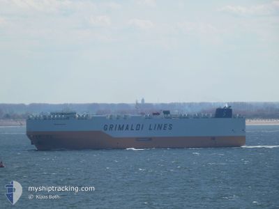
GRANDE HOUSTON
Cargo
Current Trip
| Time Travelled | 2 days |
|---|---|
| Remaining Time | 1 h, 7 mins |
| Distance Travelled | 939.28 nm |
| Remaining Distance | 61.73 nm |
| AVG Speed | 16.8 Knots |
| MAX Speed | 19.4 Knots |
| AVG Wind | 8.7 knots |
| MAX Wind | 19 knots |
| MIN Temp | 16.7°C / 62.06°F |
| MAX Temp | 20.8°C / 69.44°F |
| Draught | 7.9 m |
| Position Received | 19 h, 29 m ago |
Current Position
| Longitude | 25.64440° |
|---|---|
| Latitude | 34.14006° |
| Status | Under way using engine |
| Speed | 17.7 Knots |
| Course | 112.4° |
| Area | Mediterranean Sea - Eastern Basin |
| Station | T-AIS |
| Position Received | 19 h, 29 m ago |
Info
Information
The current position of GRANDE HOUSTON is in Mediterranean Sea - Eastern Basin with coordinates 34.14006° / 25.64440° as reported on 2024-05-11 21:22 by AIS to our vessel tracker app. The vessel's current speed is 17.7 Knots and is heading at the port of PORT SAID. The estimated time of arrival as calculated by MyShipTracking vessel tracking app is 2024-05-12 19:58 LT
The vessel GRANDE HOUSTON (IMO: 9782699, MMSI: 247408300) is a Cargo It's sailing under the flag of [IT] Italy.
In this page you can find informations about the vessels current position, last detected port calls, and current voyage information. If the vessels is not in coverage by AIS you will find the latest position.
The current position of GRANDE HOUSTON is detected by our AIS receivers and we are not responsible for the reliability of the data. The last position was recorded while the vessel was in Coverage by the Ais receivers of our vessel tracking app.
The current draught of GRANDE HOUSTON as reported by AIS is 7.9 meters
Weather
| Temperature | 20.3°C / 68.54°F |
|---|---|
| Wind Speed | 16 knots |
| Direction | 311° NW |
| Pressure | 1013 hPa |
| Humidity | 76.9 % |
| Cloud Coverage | --- |
Featured Company
Last Port Calls
| Port | Arrival | Departure | Time In Port |
|---|---|---|---|
| 2024-05-09 09:23 | 2024-05-10 14:14 | 1 d | |
| 2024-05-06 20:09 | 2024-05-07 03:13 | 7 h | |
| 2024-05-04 13:06 | 2024-05-06 19:23 | 2 d | |
| 2024-05-01 04:37 | 2024-05-01 14:26 | 9 h | |
| 2024-04-11 01:58 | 2024-04-12 02:06 | 1 d | |
| 2024-03-17 04:27 | 2024-03-17 13:20 | 8 h | |
| 2024-03-12 19:48 | 2024-03-15 01:01 | 2 d | |
| 2024-03-10 06:03 | 2024-03-10 15:02 | 8 h |
Most Visited Ports (Last year)
| Port | Arrivals | |
|---|---|---|
| 8 | ||
| 3 | ||
| 2 | ||
| 2 | ||
| 2 | ||
| 1 |
Last Trips
| Origin | Departure | Destination | Arrival | Distance | |
|---|---|---|---|---|---|
| 2024-05-07 03:13 | 2024-05-09 09:23 | 895.50 nm | |||
| 2024-05-06 19:23 | 2024-05-06 20:09 | 2.10 nm | |||
| 2024-04-12 02:06 | 2024-05-04 13:06 | 7911.67 nm | |||
| 2024-04-12 02:06 | 2024-05-01 04:37 | 6976.31 nm | |||
| 2024-03-15 01:01 | 2024-04-11 01:58 | 8126.38 nm | |||
| 2024-03-15 01:01 | 2024-03-17 04:27 | 857.91 nm | |||
| 2024-02-18 15:26 | 2024-03-12 19:48 | 8013.31 nm | |||
| 2024-02-18 15:26 | 2024-03-10 06:03 | 7087.78 nm |
Events
| Time | Event | Details | Position / Dest | Info |
|---|---|---|---|---|
| 2024-05-11 21:45 | Status Changed | Default Under way using engine |
34.09679 / 25.77281
ITGIT>EGPSD
|
Speed: 17.7 kn Course: 112.4° |
| 2024-05-11 21:22 | OUT of Coverage |
34.14006 / 25.64440
Mediterranean Sea - Eastern Basin
ITGIT>EGPSD
|
Speed: 17.7 kn Course: 112.4° |
|
| 2024-05-11 20:47 | Status Changed | Under way using engine Default |
34.20390 / 25.45221
ITGIT>EGPSD
|
Speed: 17.9 kn Course: 114° |
| 2024-05-11 20:15 | Status Changed | Default Under way using engine |
34.26406 / 25.28121
ITGIT>EGPSD
|
Speed: 18 kn Course: 112.3° |
| 2024-05-11 19:22 | Status Changed | Under way using engine Default |
34.37026 / 24.98509
ITGIT>EGPSD
|
Speed: 18.1 kn Course: 114° |
| 2024-05-11 18:40 | Status Changed | Default Under way using engine |
34.45615 / 24.75374
ITGIT>EGPSD
|
Speed: 18.3 kn Course: 110.5° |
| 2024-05-11 18:21 | Status Changed | Under way using engine Default |
34.49329 / 24.64346
ITGIT>EGPSD
|
Speed: 18.3 kn Course: 111° |
| 2024-05-11 18:13 | Status Changed | Default Under way using engine |
34.50806 / 24.59699
ITGIT>EGPSD
|
Speed: 18.2 kn Course: 110.8° |
| 2024-05-11 17:41 | Status Changed | Under way using engine Default |
34.56580 / 24.41959
ITGIT>EGPSD
|
Speed: 17.5 kn Course: 116° |
| 2024-05-11 17:27 | Status Changed | Default Under way using engine |
34.59276 / 24.34357
ITGIT>EGPSD
|
Speed: 17.4 kn Course: 117.4° |