
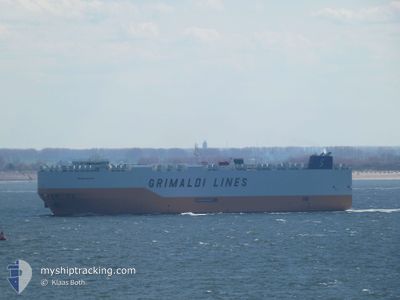
GRANDE HOUSTON
Cargo
Current Trip
| Time Travelled | 13 days |
|---|---|
| Remaining Time | --- |
| Distance Travelled | 5189.85 nm |
| Remaining Distance | 2114.57 nm |
| AVG Speed | 16.5 Knop |
| MAX Speed | 18.6 Knop |
| AVG Wind | 6.8 knots |
| MAX Wind | 15 knots |
| MIN Temp | 13.5°C / 56.3°F |
| MAX Temp | 30.6°C / 87.08°F |
| Djupgående | 9.4 m |
| Position mottagen | 3 d sen |
Current Position
| Longitud | 77.23219° |
|---|---|
| Latitude | 6.87904° |
| Status | Under way using engine |
| Fart | 17.6 Knop |
| Kurs | 285° |
| Område | Laccadive Sea |
| Station | T-AIS |
| Position mottagen | 3 d sen |
Info
Information
The current position of GRANDE HOUSTON is in Laccadive Sea with coordinates 6.87904° / 77.23219° as reported on 2024-04-21 16:07 by AIS to our vessel tracker app. The vessel's current speed is 17.6 Knop and is heading at the port of SUEZ CANAL. The estimated time of arrival as calculated by MyShipTracking vessel tracking app is 2024-04-30 08:00 LT
The vessel GRANDE HOUSTON (IMO: 9782699, MMSI: 247408300) is a Cargo It's sailing under the flag of [IT] Italy.
In this page you can find informations about the vessels current position, last detected port calls, and current voyage information. If the vessels is not in coverage by AIS you will find the latest position.
The current position of GRANDE HOUSTON is detected by our AIS receivers and we are not responsible for the reliability of the data. The last position was recorded while the vessel was in Coverage by the Ais receivers of our vessel tracking app.
The current draught of GRANDE HOUSTON as reported by AIS is 9.4 meters
Weather
| Temperature | 28.8°C / 83.84°F |
|---|---|
| Wind Speed | 1 knots |
| Direction | 21° NNE |
| Pressure | 1009.5 hPa |
| Humidity | 69.6 % |
| Cloud Coverage | 2 % |
Featured Company
Last Port Calls
| Port | Arrival | Departure | Time In Port |
|---|---|---|---|
| 2024-04-10 17:58 | 2024-04-11 18:06 | 1 d | |
| 2024-03-17 02:27 | 2024-03-17 11:20 | 8 h | |
| 2024-03-12 16:48 | 2024-03-14 22:01 | 2 d | |
| 2024-03-10 04:03 | 2024-03-10 13:02 | 8 h | |
| 2024-02-16 23:36 | 2024-02-18 07:26 | 1 d |
Most Visited Ports (Last year)
| Port | Arrivals | |
|---|---|---|
| 7 | ||
| 2 | ||
| 2 | ||
| 2 | ||
| 2 | ||
| 2 |
Last Trips
| Origin | Departure | Destination | Arrival | Distance | |
|---|---|---|---|---|---|
| 2024-03-15 01:01 | 2024-04-11 01:58 | 8126.38 nm | |||
| 2024-03-15 01:01 | 2024-03-17 04:27 | 857.91 nm | |||
| 2024-02-18 15:26 | 2024-03-12 19:48 | 8013.31 nm | |||
| 2024-02-18 15:26 | 2024-03-10 06:03 | 7087.78 nm | |||
| 2024-01-23 08:46 | 2024-02-17 07:36 | 9125.86 nm |
Events
| Tid | Event | Detaljer | Position / Dest | Information |
|---|---|---|---|---|
| 2024-04-21 16:10 | Status ändrad | Default Under way using engine |
6.88236 / 77.21989
CNSHA>EGSUZ
|
Fart: 17.6 kn Kurs: 285° |
| 2024-04-21 16:07 | UTANFÖR täckningsområde |
6.87904 / 77.23219
Laccadive Sea
CNSHA>EGSUZ
|
Fart: 17.6 kn Kurs: 285° |
|
| 2024-04-21 15:53 | Status ändrad | Under way using engine Default |
6.86058 / 77.30148
CNSHA>EGSUZ
|
Fart: 17.5 kn Kurs: 284° |
| 2024-04-21 15:51 | I täckningsområde |
6.86212 / 77.29565
Laccadive Sea
CNSHA>EGSUZ
|
Fart: 17.5 kn Kurs: 284.8° |
|
| 2024-04-21 13:19 | Status ändrad | Default Under way using engine |
6.67605 / 78.02045
CNSHA>EGSUZ
|
Fart: 16.8 kn Kurs: 290.9° |
| 2024-04-21 13:12 | Upptäckt i hav | Indian part of the Laccadive Sea |
6.66462 / 78.05041
Laccadive Sea
CNSHA>EGSUZ
|
Fart: 16.8 kn Kurs: 290.9° |
| 2024-04-21 13:12 | Status ändrad | Under way using engine Default |
6.66462 / 78.05041
CNSHA>EGSUZ
|
Fart: 16.8 kn Kurs: 290° |
| 2024-04-21 13:12 | I täckningsområde |
6.66462 / 78.05041
Laccadive Sea
CNSHA>EGSUZ
|
Fart: 16.8 kn Kurs: 290.9° |
|
| 2024-04-21 13:12 | UTANFÖR täckningsområde |
6.66462 / 78.05041
Laccadive Sea
CNSHA>EGSUZ
|
Fart: 16.8 kn Kurs: 290.9° |
|
| 2024-04-17 13:56 | UTANFÖR täckningsområde |
1.24907 / 103.40120
Malacca Strait
CNSHA>EGSUZ
|
Fart: 14.8 kn Kurs: 308.8° |