
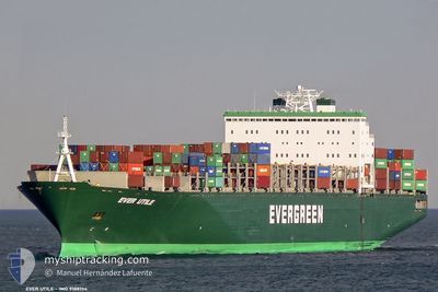
EVER UTILE
Container Ship
Current Trip
| Time Travelled | 2 days |
|---|---|
| Remaining Time | 12 mins |
| Distance Travelled | 251.65 nm |
| Remaining Distance | 736.90 nm |
| AVG Speed | 13.7 Knots |
| MAX Speed | 18.9 Knots |
| AVG Wind | 13.3 knots |
| MAX Wind | 17 knots |
| MIN Temp | 27.7°C / 81.86°F |
| MAX Temp | 30.1°C / 86.18°F |
| Draught | 10.1 m |
| Position Received | 1 d ago |
Current Position
| Longitude | 104.41649° |
|---|---|
| Latitude | 1.35207° |
| Status | Under way using engine |
| Speed | 17.1 Knots |
| Course | 50° |
| Area | South China Sea |
| Station | T-AIS |
| Position Received | 1 d ago |
Info
Information
The current position of EVER UTILE is in South China Sea with coordinates 1.35207° / 104.41649° as reported on 2024-07-25 10:14 by AIS to our vessel tracker app. The vessel's current speed is 17.1 Knots and is heading at the port of LAEM CHABANG. The estimated time of arrival as calculated by MyShipTracking vessel tracking app is 2024-07-27 06:08 LT
The vessel EVER UTILE (IMO: 9188154, MMSI: 351934000) is a Container Ship that was built in 2000 ( 24 years old ). It's sailing under the flag of [PA] Panama.
In this page you can find informations about the vessels current position, last detected port calls, and current voyage information. If the vessels is not in coverage by AIS you will find the latest position.
The current position of EVER UTILE is detected by our AIS receivers and we are not responsible for the reliability of the data. The last position was recorded while the vessel was in Coverage by the Ais receivers of our vessel tracking app.
The current draught of EVER UTILE as reported by AIS is 10.1 meters
Weather
| Temperature | 28.3°C / 82.94°F |
|---|---|
| Wind Speed | 14 knots |
| Direction | 285° WNW |
| Pressure | 1007.3 hPa |
| Humidity | 77.5 % |
| Cloud Coverage | 100 % |
Featured Company
Last Port Calls
| Port | Arrival | Departure | Time In Port |
|---|---|---|---|
| 2024-07-23 14:02 | 2024-07-24 18:18 | 1 d | |
| 2024-07-15 23:14 | 2024-07-16 22:54 | 23 h | |
| 2024-07-13 00:10 | 2024-07-15 00:49 | 2 d | |
| 2024-07-06 18:27 | 2024-07-10 11:06 | 3 d | |
| 2024-06-27 01:29 | 2024-06-28 08:17 | 1 d | |
| 2024-06-22 04:17 | 2024-06-23 10:33 | 1 d | |
| 2024-06-18 08:23 | 2024-06-19 04:31 | 20 h | |
| 2024-06-09 20:45 | 2024-06-12 18:48 | 2 d | |
| 2024-06-07 08:21 | |||
| 2024-05-25 17:00 | 2024-05-26 13:37 | 20 h |
Most Visited Ports (Last year)
| Port | Arrivals | |
|---|---|---|
| 17 | ||
| 15 | ||
| 14 | ||
| 9 | ||
| 8 | ||
| 8 |
Last Trips
| Origin | Departure | Destination | Arrival | Distance | |
|---|---|---|---|---|---|
| 2024-07-17 04:24 | 2024-07-23 22:02 | 2644.92 nm | |||
| 2024-07-15 05:49 | 2024-07-16 04:44 | 250.62 nm | |||
| 2024-07-10 15:06 | 2024-07-13 05:10 | 768.96 nm | |||
| 2024-06-28 13:47 | 2024-07-06 22:27 | 2043.09 nm | |||
| 2024-06-23 18:33 | 2024-06-27 06:59 | 1414.80 nm | |||
| 2024-06-19 12:31 | 2024-06-22 12:17 | 224.84 nm | |||
| 2024-06-13 01:48 | 2024-06-18 16:23 | 835.67 nm | |||
| 2024-06-07 16:21 | 2024-06-10 03:45 | 1028.17 nm | |||
| 2024-05-24 22:24 | 2024-05-25 22:30 | 252.47 nm | |||
| 2024-05-21 00:38 | 2024-05-22 22:17 | 765.79 nm |
Events
| Time | Event | Details | Position / Dest | Info |
|---|---|---|---|---|
| 2024-07-25 10:19 | Status Changed | Default Under way using engine |
1.36824 / 104.43639
MYPKG>>THLCH
|
Speed: 17.1 kn Course: 50° |
| 2024-07-25 10:14 | OUT of Coverage |
1.35207 / 104.41649
South China Sea
MYPKG>>THLCH
|
Speed: 17.1 kn Course: 50° |
|
| 2024-07-25 09:59 | Change Sea Area | Malaysian part of the South China Sea Malaysian part of the Singapore Strait |
1.30790 / 104.36335
South China Sea
MYPKG>>THLCH
|
Speed: 16.8 kn Course: 40° |
| 2024-07-25 09:20 | Change Sea Area | Malaysian part of the Singapore Strait Indonesian part of the Singapore Strait |
1.25644 / 104.19323
Singapore Strait
MYPKG>>THLCH
|
Speed: 16.8 kn Course: 85° |
| 2024-07-25 05:13 | Draught Changed | 10.1 11.4 |
1.15451 / 103.44606
MYPKG>>THLCH
|
Speed: 14.1 kn Course: 121° |
| 2024-07-25 05:13 | Destination Changed | MYPKG>>THLCH AEJEA>>PKKHI |
1.15451 / 103.44606
MYPKG>>THLCH
|
Speed: 14.1 kn Course: 121° |
| 2024-07-25 05:13 | ETA Changed | 2024/07/27 09:00 2024/07/12 16:30 |
1.15451 / 103.44606
MYPKG>>THLCH
|
Speed: 14.1 kn Course: 121° |
| 2024-07-25 05:08 | Change Sea Area | Indonesian part of the Singapore Strait Indonesian part of the Malacca Strait |
1.16648 / 103.42864
Singapore Strait
|
Speed: 12.2 kn Course: 129° |
| 2024-07-25 04:41 | Change Sea Area | Indonesian part of the Malacca Strait Sri Lankan part of the Indian Ocean |
1.23453 / 103.35665
Malacca Strait
|
Speed: 14.8 kn Course: 138° |
| 2024-07-25 04:41 | IN Coverage |
1.23453 / 103.35665
Malacca Strait
|
Speed: 14.8 kn Course: 138° |