
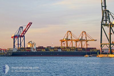
CONTI COURAGE
Container Ship
Current Trip
THLCH
| Time Travelled | 1 day |
|---|---|
| Remaining Time | --- |
| Distance Travelled | 613.65 nm |
| Remaining Distance | --- |
| AVG Speed | 17.6 Knots |
| MAX Speed | 21 Knots |
| AVG Wind | 18.5 knots |
| MAX Wind | 26.7 knots |
| MIN Temp | -2°C / 28.4°F |
| MAX Temp | 9.8°C / 49.64°F |
| Draught | 9.8 m |
| Position Received | 2025-10-22 15:12 |
Current Position
| Longitude | --- |
|---|---|
| Latitude | --- |
| Status | Under way using engine |
| Speed | 14.4 Knots |
| Course | 49.8° |
| Area | Singapore Strait |
| Station | T-AIS |
| Position Received | 2025-10-22 15:12 |
Info
Information
The current position of CONTI COURAGE is in Singapore Strait with coordinates 1.30432° / 104.36293° as reported on 2025-10-22 15:12 by AIS to our vessel tracker app. The vessel's current speed is 14.4 Knots
The vessel CONTI COURAGE (IMO: 9293789, MMSI: 636093042) is a Container Ship that was built in 2005 ( 21 years old ). It's sailing under the flag of [LR] Liberia.
In this page you can find informations about the vessels current position, last detected port calls, and current voyage information. If the vessels is not in coverage by AIS you will find the latest position.
The current position of CONTI COURAGE is detected by our AIS receivers and we are not responsible for the reliability of the data. The last position was recorded while the vessel was in Coverage by the Ais receivers of our vessel tracking app.
The current draught of CONTI COURAGE as reported by AIS is 9.8 meters
Weather
| Temperature | -2°C / 28.4°F |
|---|---|
| Wind Speed | 22 knots |
| Direction | 308° NW |
| Pressure | 1012.3 hPa |
| Humidity | 74.8 % |
| Cloud Coverage | 100 % |
Featured Company
Last Port Calls
| Port | Arrival | Departure | Time In Port |
|---|---|---|---|
| 2026-01-03 01:56 | 2026-01-04 18:47 | 1 d | |
| 2025-12-29 15:16 | 2025-12-29 21:32 | 6 h |
Most Visited Ports (Last year)
| Port | Arrivals | |
|---|---|---|
| 4 | ||
| 3 | ||
| 2 | ||
| 2 | ||
| 2 | ||
| 2 |
Last Trips
| Origin | Departure | Destination | Arrival | Distance | |
|---|---|---|---|---|---|
| 2025-12-29 21:32 | 2026-01-03 01:56 | 496.85 nm | |||
| 2025-10-27 16:56 | 2025-12-29 15:16 | 1686.74 nm |
Events
| Time | Event | Details | Position / Dest | Info |
|---|---|---|---|---|
| 2026-01-04 09:47 | PORT DEPARTURE |
|
35.04979 / 128.78032
THLCH
|
Speed: 11 kn Course: 195° |
| 2026-01-04 09:29 | START Moving |
35.07403 / 128.82242
[KR] BUSAN NEW PORT
|
Speed: 4.7 kn Course: 265° |
|
| 2026-01-02 16:57 | STOP Moving |
35.07741 / 128.82895
[KR] BUSAN NEW PORT
|
Speed: Course: 89° |
|
| 2026-01-02 16:56 | PORT ARRIVAL |
|
35.07741 / 128.82895
[KR] BUSAN NEW PORT
|
Speed: 1.4 kn Course: 73° |
| 2025-12-29 16:19 | STOP Moving | 15.4 nm, South of SHENGSI |
30.48856 / 122.48342
THLCH
|
Speed: 0.2 kn Course: 321° |
| 2025-12-29 13:45 | START Moving | 3.52 nm, West of YANGSHAN |
30.61109 / 122.06671
THLCH
|
Speed: 6.8 kn Course: 124° |
| 2025-12-29 13:32 | PORT DEPARTURE |
|
30.61981 / 122.06154
THLCH
|
Speed: 0.9 kn Course: 302° |
| 2025-12-29 07:16 | PORT ARRIVAL |
|
30.62167 / 122.06333
[CN] YANGSHAN
|
Speed: Course: 309° |
| 2025-12-29 00:44 | STOP Moving | 3.8 nm, West of YANGSHAN |
30.62083 / 122.06287
THLCH
|
Speed: Course: 309° |
| 2025-12-29 00:15 | START Moving | 4.15 nm, West of YANGSHAN |
30.62106 / 122.05596
THLCH
|
Speed: 3.9 kn Course: 300° |