
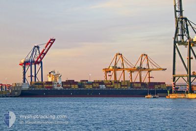
CONTI COURAGE
Container Ship
Current Trip
LAST UPDATE TIME
| Time Travelled | 11 days |
|---|---|
| Remaining Time | --- |
| Distance Travelled | 4381.24 nm |
| Remaining Distance | --- |
| AVG Speed | 15.9 Noeuds |
| MAX Speed | 19 Noeuds |
| AVG Wind | 13.2 knots |
| MAX Wind | 26.9 knots |
| MIN Temp | 21.1°C / 69.98°F |
| MAX Temp | 29.5°C / 85.1°F |
| Tirant d eau | 11.6 m |
| Position reçue | 8 d depuis |
Current Position
| Longitude | -62.58783° |
|---|---|
| Latitude | 19.02631° |
| Etat | Under way using engine |
| Vitesse | 15.9 Noeuds |
| Parcours | 117.2° |
| Zone | North Atlantic Ocean |
| Station | T-AIS |
| Position reçue | 8 d depuis |
Info
Information
The current position of CONTI COURAGE is in North Atlantic Ocean with coordinates 19.02631° / -62.58783° as reported on 2024-04-16 19:22 by AIS to our vessel tracker app. The vessel's current speed is 15.9 Noeuds
The vessel CONTI COURAGE (IMO: 9293789, MMSI: 636093042) is a Container Ship that was built in 2005 ( 19 Age ). It's sailing under the flag of [LR] Liberia.
In this page you can find informations about the vessels current position, last detected port calls, and current voyage information. If the vessels is not in coverage by AIS you will find the latest position.
The current position of CONTI COURAGE is detected by our AIS receivers and we are not responsible for the reliability of the data. The last position was recorded while the vessel was in Coverage by the Ais receivers of our vessel tracking app.
The current draught of CONTI COURAGE as reported by AIS is 11.6 meters
Weather
| Temperature | 26.2°C / 79.16°F |
|---|---|
| Wind Speed | 15 knots |
| Direction | 100° E |
| Pressure | 1014 hPa |
| Humidity | 71.7 % |
| Cloud Coverage | --- |
Featured Company
Last Port Calls
| Port | Arrival | Departure | Time In Port |
|---|---|---|---|
| 2024-04-02 05:55 | 2024-04-14 03:40 | 11 d | |
| 2024-03-26 14:21 | 2024-03-27 15:50 | 1 d | |
| 2024-03-20 11:43 | 2024-03-21 07:44 | 20 h | |
| 2024-03-14 20:52 | 2024-03-15 12:31 | 15 h | |
| 2024-03-12 14:08 | 2024-03-14 00:57 | 1 d | |
| 2024-03-03 19:26 | 2024-03-05 06:17 | 1 d | |
| 2024-02-01 20:18 | 2024-02-02 18:18 | 22 h |
Most Visited Ports (Last year)
| Port | Arrivals | |
|---|---|---|
| 6 | ||
| 5 | ||
| 5 | ||
| 4 | ||
| 4 | ||
| 4 |
Last Trips
| Origin | Departure | Destination | Arrival | Distance | |
|---|---|---|---|---|---|
| 2024-03-27 10:50 | 2024-04-02 01:55 | 1121.03 nm | |||
| 2024-03-21 03:44 | 2024-03-26 09:21 | 1098.10 nm | |||
| 2024-03-15 08:31 | 2024-03-20 07:43 | 532.23 nm | |||
| 2024-03-13 20:57 | 2024-03-14 16:52 | 130.15 nm | |||
| 2024-03-05 01:17 | 2024-03-12 10:08 | 702.44 nm | |||
| 2024-02-02 23:48 | 2024-03-03 14:26 | 11156.61 nm | |||
| 2024-01-28 05:22 | 2024-02-02 01:48 | 1262.00 nm |
Events
| Heure | Evenement | Détails | Position/ Destination | Info |
|---|---|---|---|---|
| 2024-04-16 19:27 | Etat Changé | Default Under way using engine |
19.01667 / -62.56667
LAST UPDATE TIME
|
Vitesse: 15.9 kn Parcours: 117.2° |
| 2024-04-16 19:22 | Hors de la zone couverte |
19.02631 / -62.58783
North Atlantic Ocean
|
Vitesse: 15.9 kn Parcours: 117.2° |
|
| 2024-04-16 18:47 | Etat Changé | Under way using engine Default |
19.09669 / -62.73140
LAST UPDATE TIME
|
Vitesse: 16 kn Parcours: 117° |
| 2024-04-16 18:40 | Etat Changé | Default Under way using engine |
19.11017 / -62.75957
LAST UPDATE TIME
|
Vitesse: 15.8 kn Parcours: 116.7° |
| 2024-04-16 18:35 | Etat Changé | Under way using engine Default |
19.12163 / -62.78346
LAST UPDATE TIME
|
Vitesse: 16 kn Parcours: 117° |
| 2024-04-16 18:33 | Etat Changé | Default Under way using engine |
19.12500 / -62.79167
LAST UPDATE TIME
|
Vitesse: 15.8 kn Parcours: 117.1° |
| 2024-04-16 18:25 | Changement de zone | Anguilla part of the North Atlantic Ocean Bahamas part of the North Atlantic Ocean |
19.14115 / -62.82389
North Atlantic Ocean
|
Vitesse: 15.7 kn Parcours: 117.7° |
| 2024-04-16 18:23 | Etat Changé | Under way using engine Default |
19.14476 / -62.83129
LAST UPDATE TIME
|
Vitesse: 15.8 kn Parcours: 118° |
| 2024-04-16 18:09 | Dans la zone couverte |
19.14115 / -62.82389
North Atlantic Ocean
|
Vitesse: 15.7 kn Parcours: 117.7° |