
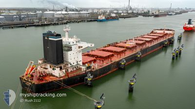
CAPE SANDRA
Bulk Carrier
Current Trip
CA PCA
| Time Travelled | 20 days |
|---|---|
| Remaining Time | --- |
| Distance Travelled | 4717.56 nm |
| Remaining Distance | --- |
| AVG Speed | 10.1 Knots |
| MAX Speed | 12.4 Knots |
| AVG Wind | 14.8 knots |
| MAX Wind | 38 knots |
| MIN Temp | --- |
| MAX Temp | 27.9°C / 82.22°F |
| Draught | 9.9 m |
| Position Received | 5 d ago |
Current Position
| Longitude | --- |
|---|---|
| Latitude | --- |
| Status | Under way using engine |
| Speed | 11.1 Knots |
| Course | 141.6° |
| Area | North Atlantic Ocean |
| Station | T-AIS |
| Position Received | 5 d ago |
Info
Information
The current position of CAPE SANDRA is in North Atlantic Ocean with coordinates 10.62507° / -20.56706° as reported on 2025-01-13 18:12 by AIS to our vessel tracker app. The vessel's current speed is 11.1 Knots
The vessel CAPE SANDRA (IMO: 9446908, MMSI: 538004220) is a Bulk Carrier that was built in 2011 ( 14 years old ). It's sailing under the flag of [MH] Marshall Is.
In this page you can find informations about the vessels current position, last detected port calls, and current voyage information. If the vessels is not in coverage by AIS you will find the latest position.
The current position of CAPE SANDRA is detected by our AIS receivers and we are not responsible for the reliability of the data. The last position was recorded while the vessel was in Coverage by the Ais receivers of our vessel tracking app.
The current draught of CAPE SANDRA as reported by AIS is 9.9 meters
Weather
| Temperature | 24.9°C / 76.82°F |
|---|---|
| Wind Speed | 8 knots |
| Direction | 156° SSE |
| Pressure | 1013.8 hPa |
| Humidity | 71.2 % |
| Cloud Coverage | 100 % |
Featured Company
Last Port Calls
| Port | Arrival | Departure | Time In Port |
|---|---|---|---|
| 2024-12-27 11:50 | 2024-12-29 11:55 | 2 d | |
| 2024-12-07 17:12 | 2024-12-10 00:58 | 2 d | |
| 2024-12-04 00:54 | 2024-12-07 17:04 | 3 d | |
| 2024-11-10 13:08 | 2024-11-13 19:55 | 3 d |
Most Visited Ports (Last year)
| Port | Arrivals | |
|---|---|---|
| 3 | ||
| 2 | ||
| 2 | ||
| 2 | ||
| 1 | ||
| 1 |
Last Trips
| Origin | Departure | Destination | Arrival | Distance | |
|---|---|---|---|---|---|
| 2024-12-10 00:58 | 2024-12-27 11:50 | 2890.21 nm | |||
| 2024-12-07 17:04 | 2024-12-07 17:12 | 1.13 nm | |||
| 2024-11-13 19:55 | 2024-12-04 00:54 | 4785.63 nm | |||
| 2024-09-19 04:06 | 2024-11-10 13:08 | 9126.69 nm |
Events
| Time | Event | Details | Position / Dest | Info |
|---|---|---|---|---|
| 2025-01-13 18:19 | Status Changed | Default Under way using engine |
10.60892 / -20.55403
CA PCA
|
Speed: 11.1 kn Course: 141.6° |
| 2025-01-13 18:12 | Status Changed | Under way using engine Default |
10.62507 / -20.56706
CA PCA
|
Speed: 11.1 kn Course: 142° |
| 2025-01-13 18:12 | OUT of Coverage |
10.62507 / -20.56706
North Atlantic Ocean
|
Speed: 11.1 kn Course: 141.6° |
|
| 2025-01-13 18:07 | Status Changed | Default Under way using engine |
10.63743 / -20.57655
CA PCA
|
Speed: 11.2 kn Course: 142.2° |
| 2025-01-13 18:06 | Status Changed | Under way using engine Default |
10.64000 / -20.57856
CA PCA
|
Speed: 11.1 kn Course: 143° |
| 2025-01-13 18:06 | Change Sea Area | High seas of the North Atlantic Ocean Cape Verdean part of the North Atlantic Ocean |
10.64000 / -20.57856
North Atlantic Ocean
|
Speed: 11.2 kn Course: 142.2° |
| 2025-01-13 17:47 | IN Coverage |
10.64000 / -20.57856
North Atlantic Ocean
|
Speed: 11.2 kn Course: 142.2° |
|
| 2025-01-12 21:11 | Status Changed | Default Under way using engine |
13.66772 / -22.95692
CA PCA
|
Speed: 10.6 kn Course: 141.9° |
| 2025-01-12 21:05 | Status Changed | Under way using engine Default |
13.68172 / -22.96884
CA PCA
|
Speed: 10.5 kn Course: 138° |
| 2025-01-12 21:05 | OUT of Coverage |
13.68172 / -22.96884
North Atlantic Ocean
|
Speed: 10.6 kn Course: 141.9° |