
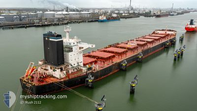
CAPE SANDRA
Bulk Carrier
Current Trip
TR IDM
| Time Travelled | 12 days |
|---|---|
| Remaining Time | --- |
| Distance Travelled | 2988.02 nm |
| Remaining Distance | --- |
| AVG Speed | 10 Knopen |
| MAX Speed | 12.1 Knopen |
| AVG Wind | 11.1 knots |
| MAX Wind | 18.9 knots |
| MIN Temp | 17.7°C / 63.86°F |
| MAX Temp | 29.7°C / 85.46°F |
| Diepgang | 17.5 M |
| Positie ontvangen | 4 m geleden |
Current Position
| Lengtegraad | -8.63985° |
|---|---|
| Breedtegraat | 33.68080° |
| Status | Under way using engine |
| Snelheid | 10.4 Knopen |
| Koers | 41° |
| Gebied | North Atlantic Ocean |
| Station | T-AIS |
| Positie ontvangen | 4 m geleden |
Info
Information
The current position of CAPE SANDRA is in North Atlantic Ocean with coordinates 33.68080° / -8.63985° as reported on 2024-04-18 23:55 by AIS to our vessel tracker app. The vessel's current speed is 10.4 Knopen
The vessel CAPE SANDRA (IMO: 9446908, MMSI: 538004220) is a Bulk Carrier that was built in 2011 ( 13 Jaar oud ). It's sailing under the flag of [MH] Marshall Is.
In this page you can find informations about the vessels current position, last detected port calls, and current voyage information. If the vessels is not in coverage by AIS you will find the latest position.
The current position of CAPE SANDRA is detected by our AIS receivers and we are not responsible for the reliability of the data. The last position was recorded while the vessel was in Coverage by the Ais receivers of our vessel tracking app.
The current draught of CAPE SANDRA as reported by AIS is 17.5 meters
Weather
| Temperature | 17.7°C / 63.86°F |
|---|---|
| Wind Speed | 4 knots |
| Direction | 59° ENE |
| Pressure | 1015.6 hPa |
| Humidity | 83 % |
| Cloud Coverage | 65 % |
Featured Company
Events
| Tijd | Evenement | Details | Positie / Bestemming | Info |
|---|---|---|---|---|
| 2024-04-18 15:56 | Destination Changed | TR IDM TR ISK |
32.68562 / -9.67357
TR IDM
|
Snelheid: 9.5 kn Koers: 53° |
| 2024-04-18 15:04 | Status Changed | Under way using engine Default |
32.59263 / -9.79268
TR ISK
|
Snelheid: 9.5 kn Koers: 42° |
| 2024-04-18 14:53 | Status Changed | Default Under way using engine |
32.57177 / -9.81683
TR ISK
|
Snelheid: 9.6 kn Koers: 43° |
| 2024-04-18 14:39 | Status Changed | Under way using engine Default |
32.54522 / -9.84593
TR ISK
|
Snelheid: 9 kn Koers: 42° |
| 2024-04-18 14:36 | Status Changed | Default Under way using engine |
32.53830 / -9.85350
TR ISK
|
Snelheid: 9.2 kn Koers: 41° |
| 2024-04-18 14:28 | Status Changed | Under way using engine Default |
32.52470 / -9.86822
TR ISK
|
Snelheid: 9.2 kn Koers: 41° |
| 2024-04-18 14:20 | Status Changed | Default Under way using engine |
32.50778 / -9.88538
TR ISK
|
Snelheid: 9.3 kn Koers: 40° |
| 2024-04-18 14:09 | Status Changed | Under way using engine Default |
32.48803 / -9.90588
TR ISK
|
Snelheid: 9.4 kn Koers: 38° |
| 2024-04-18 14:09 | Binnenbereik |
32.49005 / -9.90388
North Atlantic Ocean
TR ISK
|
Snelheid: 9.3 kn Koers: 40° |
|
| 2024-04-18 13:00 | Buitenbereik |
32.34418 / -10.04322
North Atlantic Ocean
TR ISK
|
Snelheid: 9.6 kn Koers: 39° |