
BONAFIDE
Not available
Current Trip
| Time Travelled | 2 days |
|---|---|
| Remaining Time | 4 mins |
| Distance Travelled | 177.48 nm |
| Remaining Distance | 5.32 nm |
| AVG Speed | 7.2 Knots |
| MAX Speed | 11.7 Knots |
| AVG Wind | 8.8 knots |
| MAX Wind | 25 knots |
| MIN Temp | -6.2°C / 20.84°F |
| MAX Temp | 3.5°C / 38.3°F |
| Draught | 1 m |
| Position Received | 2 m ago |
Current Position
| Longitude | --- |
|---|---|
| Latitude | --- |
| Status | Under way using engine |
| Speed | 10.7 Knots |
| Course | 178.4° |
| Area | North Sea |
| Station | T-AIS |
| Position Received | 2 m ago |
Info
Information
The current position of BONAFIDE is in North Sea with coordinates 51.48359° / 4.00440° as reported on 2026-01-07 12:25 by AIS to our vessel tracker app. The vessel's current speed is 10.7 Knots and is heading at the port of HANSWEERT. The estimated time of arrival as calculated by MyShipTracking vessel tracking app is 2026-01-07 13:32 LT
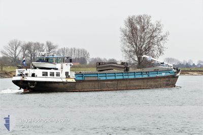
The vessel BONAFIDE (MMSI: 244700632) is a Not available It's sailing under the flag of [NL] Netherlands.
In this page you can find informations about the vessels current position, last detected port calls, and current voyage information. If the vessels is not in coverage by AIS you will find the latest position.
The current position of BONAFIDE is detected by our AIS receivers and we are not responsible for the reliability of the data. The last position was recorded while the vessel was in Coverage by the Ais receivers of our vessel tracking app.
The current draught of BONAFIDE as reported by AIS is 1 meters
Weather
| Temperature | 0.8°C / 33.44°F |
|---|---|
| Wind Speed | 21 knots |
| Direction | 205° SSW |
| Pressure | 1003.8 hPa |
| Humidity | 95.9 % |
| Cloud Coverage | 100 % |
Featured Company
Last Port Calls
| Port | Arrival | Departure | Time In Port |
|---|---|---|---|
| 2026-01-04 11:46 | 2026-01-04 16:40 | 4 h | |
| 2026-01-03 12:56 | 2026-01-04 11:24 | 22 h | |
| 2026-01-03 01:05 | 2026-01-03 12:10 | 11 h | |
| 2026-01-02 22:52 | 2026-01-02 23:19 | 27 m | |
| 2025-12-28 18:56 | 2025-12-28 19:23 | 26 m | |
| 2025-12-28 11:56 | 2025-12-28 15:45 | 3 h | |
| 2025-12-27 22:04 | 2025-12-28 11:30 | 13 h | |
| 2025-12-27 20:21 | 2025-12-27 21:32 | 1 h | |
| 2025-12-27 18:33 | 2025-12-27 18:42 | 9 m | |
| 2025-12-21 11:45 | 2025-12-21 16:05 | 4 h |
Most Visited Ports (Last year)
| Port | Arrivals | |
|---|---|---|
| 35 | ||
| 21 | ||
| 21 | ||
| 17 | ||
| 17 | ||
| 15 |
Last Trips
| Origin | Departure | Destination | Arrival | Distance | |
|---|---|---|---|---|---|
| 2026-01-04 11:24 | 2026-01-04 11:46 | 2.93 nm | |||
| 2026-01-03 12:10 | 2026-01-03 12:56 | 4.83 nm | |||
| 2026-01-02 23:19 | 2026-01-03 01:05 | 10.90 nm | |||
| 2025-12-28 19:23 | 2026-01-02 22:52 | 155.97 nm | |||
| 2025-12-28 15:45 | 2025-12-28 18:56 | 21.99 nm | |||
| 2025-12-28 11:30 | 2025-12-28 11:56 | 2.56 nm | |||
| 2025-12-27 21:32 | 2025-12-27 22:04 | 4.38 nm | |||
| 2025-12-27 18:42 | 2025-12-27 20:21 | 11.28 nm | |||
| 2025-12-21 16:05 | 2025-12-27 18:33 | 178.06 nm | |||
| 2025-12-21 11:20 | 2025-12-21 11:45 | 3.02 nm |
Events
| Time | Event | Details | Position / Dest | Info |
|---|---|---|---|---|
| 2026-01-07 09:19 | START Moving | 0.79 nm, East of OOLTGENSPLAAT |
51.67993 / 4.37358
LAAT MAAR WETEN VIA
|
Speed: 4.2 kn Course: 232.5° |
| 2026-01-06 23:50 | STOP Moving | 0.96 nm, East of OOLTGENSPLAAT |
51.68155 / 4.37866
LAAT MAAR WETEN VIA
|
Speed: 0.1 kn Course: 511° |
| 2026-01-06 17:54 | START Moving | 0.94 nm, North West of LITHOIJEN |
51.80835 / 5.45008
LAAT MAAR WETEN VIA
|
Speed: 7.4 kn Course: 274.2° |
| 2026-01-06 17:40 | STOP Moving | 0.82 nm, North West of LITHOIJEN |
51.80856 / 5.45395
LAAT MAAR WETEN VIA
|
Speed: 0.2 kn Course: 511° |
| 2026-01-06 16:54 | START Moving | 1.04 nm, North of OSS |
51.79763 / 5.54575
LAAT MAAR WETEN VIA
|
Speed: 5.5 kn Course: 17.7° |
| 2026-01-06 16:49 | STOP Moving | 0.92 nm, North of OSS |
51.79563 / 5.54488
LAAT MAAR WETEN VIA
|
Speed: 0.2 kn Course: 511° |
| 2026-01-06 16:46 | START Moving | 0.76 nm, North of OSS |
51.79292 / 5.54361
LAAT MAAR WETEN VIA
|
Speed: 4.9 kn Course: 12.4° |
| 2026-01-06 16:44 | STOP Moving | 0.63 nm, North of OSS |
51.79075 / 5.54330
LAAT MAAR WETEN VIA
|
Speed: 0.3 kn Course: 511° |
| 2026-01-06 16:41 | START Moving | 0.5 nm, North of OSS |
51.78854 / 5.54230
LAAT MAAR WETEN VIA
|
Speed: 4.2 kn Course: 7.6° |
| 2026-01-05 15:37 | STOP Moving | 0.39 nm, North of OSS |
51.78672 / 5.54214
LAAT MAAR WETEN VIA
|
Speed: 0.2 kn Course: 511° |