
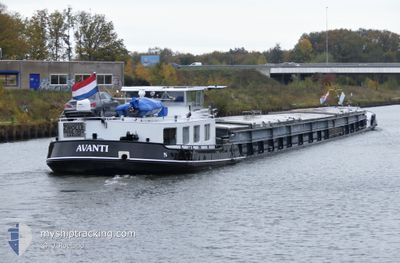
AVANTI
Cargo
Current Trip
| Time Travelled | 1 day |
|---|---|
| Remaining Time | --- |
| Distance Travelled | 11.20 nm |
| Remaining Distance | --- |
| AVG Speed | 4.4 Knots |
| MAX Speed | 4.4 Knots |
| AVG Wind | 11 knots |
| MAX Wind | 11 knots |
| MIN Temp | 7.7°C / 45.86°F |
| MAX Temp | 8.3°C / 46.94°F |
| Draught | 2 m |
| Position Received | 1 d ago |
Current Position
| Longitude | --- |
|---|---|
| Latitude | --- |
| Status | Under way using engine |
| Speed | 4.5 Knots |
| Course | 259.3° |
| Area | North Sea |
| Station | T-AIS |
| Position Received | 1 d ago |
Info
Information
The current position of AVANTI is in North Sea with coordinates 53.08817° / 7.84773° as reported on 2025-12-11 10:19 by AIS to our vessel tracker app. The vessel's current speed is 4.5 Knots
The vessel AVANTI (MMSI: 244630710) is a Cargo It's sailing under the flag of [NL] Netherlands.
In this page you can find informations about the vessels current position, last detected port calls, and current voyage information. If the vessels is not in coverage by AIS you will find the latest position.
The current position of AVANTI is detected by our AIS receivers and we are not responsible for the reliability of the data. The last position was recorded while the vessel was in Coverage by the Ais receivers of our vessel tracking app.
The current draught of AVANTI as reported by AIS is 2 meters
Weather
| Temperature | 8.3°C / 46.94°F |
|---|---|
| Wind Speed | 11 knots |
| Direction | 226° SW |
| Pressure | 1021.9 hPa |
| Humidity | 89 % |
| Cloud Coverage | 100 % |
Featured Company
Last Port Calls
| Port | Arrival | Departure | Time In Port |
|---|---|---|---|
| 2025-12-11 00:42 | 2025-12-11 08:18 | 7 h | |
| 2025-12-09 20:27 | 2025-12-10 21:20 | 1 d | |
| 2025-12-08 16:09 | 2025-12-09 19:28 | 1 d | |
| 2025-12-04 20:19 | 2025-12-08 12:14 | 3 d | |
| 2025-12-03 22:42 | 2025-12-04 06:58 | 8 h | |
| 2025-12-03 20:08 | 2025-12-03 20:37 | 28 m | |
| 2025-12-02 16:57 | 2025-12-02 17:38 | 41 m | |
| 2025-12-02 04:55 | 2025-12-02 05:25 | 29 m | |
| 2025-12-01 21:50 | 2025-12-01 22:16 | 26 m | |
| 2025-12-01 14:12 | 2025-12-01 20:37 | 6 h |
Last Trips
| Origin | Departure | Destination | Arrival | Distance | |
|---|---|---|---|---|---|
| 2025-12-10 21:20 | 2025-12-11 00:42 | 17.06 nm | |||
| 2025-12-09 19:28 | 2025-12-09 20:27 | 6.81 nm | |||
| 2025-12-08 12:14 | 2025-12-08 16:09 | 25.78 nm | |||
| 2025-12-04 06:58 | 2025-12-04 20:19 | 64.77 nm | |||
| 2025-12-03 20:37 | 2025-12-03 22:42 | 11.34 nm | |||
| 2025-12-02 17:38 | 2025-12-03 20:08 | 113.15 nm | |||
| 2025-12-02 05:25 | 2025-12-02 16:57 | 61.58 nm | |||
| 2025-12-01 22:16 | 2025-12-02 04:55 | 11.34 nm | |||
| 2025-12-01 20:37 | 2025-12-01 21:50 | 9.57 nm | |||
| 2025-12-01 13:13 | 2025-12-01 14:12 | 7.73 nm |
Events
| Time | Event | Details | Position / Dest | Info |
|---|---|---|---|---|
| 2025-12-11 10:19 | OUT of Coverage |
53.08817 / 7.84773
North Sea
HENGELO
|
Speed: 4.5 kn Course: 259.3° |
|
| 2025-12-11 09:59 | IN Coverage |
53.09122 / 7.89046
North Sea
HENGELO
|
Speed: 4.4 kn Course: 269.1° |
|
| 2025-12-11 07:24 | OUT of Coverage |
53.11251 / 8.18844
North Sea
HENGELO
|
Speed: 5 kn Course: 239.4° |
|
| 2025-12-11 07:18 | PORT DEPARTURE |
|
53.11715 / 8.19954
HENGELO
|
Speed: 4.6 kn Course: 224.7° |
| 2025-12-11 07:16 | START Moving |
53.11939 / 8.20309
[DE] OLDENBURG
|
Speed: 4.6 kn Course: 224.7° |
|
| 2025-12-11 06:56 | STOP Moving |
53.12284 / 8.20822
[DE] OLDENBURG
|
Speed: Course: 511° |
|
| 2025-12-11 06:16 | START Moving |
53.14048 / 8.23484
[DE] OLDENBURG
|
Speed: 3.6 kn Course: 257.8° |
|
| 2025-12-11 06:15 | Status Changed | Under way using engine Moored |
53.14070 / 8.23696
[DE] OLDENBURG
|
Speed: Course: 511° |
| 2025-12-11 06:00 | IN Coverage |
53.14115 / 8.23817
North Sea
[DE] OLDENBURG
|
Speed: Course: 262.8° |
|
| 2025-12-10 23:42 | OUT of Coverage |
53.14115 / 8.23813
North Sea
[DE] OLDENBURG
|
Speed: Course: 269.9° |