
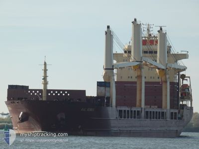
AAL GENOA
General Cargo
Current Trip
| Time Travelled | 46 days |
|---|---|
| Remaining Time | --- |
| Distance Travelled | 8076.50 nm |
| Remaining Distance | 1.81 nm |
| AVG Speed | 8.1 Knots |
| MAX Speed | 17.1 Knots |
| AVG Wind | 8.7 knots |
| MAX Wind | 26 knots |
| MIN Temp | 2°C / 35.6°F |
| MAX Temp | 28.2°C / 82.76°F |
| Draught | 7.4 m |
| Position Received | 1 m ago |
Current Position
| Longitude | --- |
|---|---|
| Latitude | --- |
| Status | Moored |
| Speed | |
| Course | --- |
| Area | North Sea |
| Station | T-AIS |
| Position Received | 1 m ago |
Info
Information
The current position of AAL GENOA is in North Sea with coordinates 53.84754° / 8.75158° as reported on 2025-03-03 02:46 by AIS to our vessel tracker app. The vessel's current speed is 0 Knots and is heading at the port of CUXHAVEN. The estimated time of arrival as calculated by MyShipTracking vessel tracking app is 2025-03-01 14:00 LT
The vessel AAL GENOA (IMO: 9393553, MMSI: 210843000) is a General Cargo that was built in 2009 ( 16 years old ). It's sailing under the flag of [CY] Cyprus.
In this page you can find informations about the vessels current position, last detected port calls, and current voyage information. If the vessels is not in coverage by AIS you will find the latest position.
The current position of AAL GENOA is detected by our AIS receivers and we are not responsible for the reliability of the data. The last position was recorded while the vessel was in Coverage by the Ais receivers of our vessel tracking app.
The current draught of AAL GENOA as reported by AIS is 7.4 meters
Weather
| Temperature | 1.7°C / 35.06°F |
|---|---|
| Wind Speed | 9 knots |
| Direction | 235° SW |
| Pressure | 1028.7 hPa |
| Humidity | 88.9 % |
| Cloud Coverage | 7 % |
Featured Company
Most Visited Ports (Last year)
| Port | Arrivals | |
|---|---|---|
| 1 | ||
| 1 | ||
| 1 | ||
| 1 | ||
| 1 | ||
| 1 |
Events
| Time | Event | Details | Position / Dest | Info |
|---|---|---|---|---|
| 2025-03-02 05:02 | Status Changed | Moored Under way using engine |
53.84752 / 8.75160
DE CUX
|
Speed: Course: 511° |
| 2025-03-01 15:57 | STOP Moving | 1.04 nm, North West of ALTENBRUCH |
53.85056 / 8.75146
DE CUX
|
Speed: 0.3 kn Course: 137° |
| 2025-03-01 11:05 | Status Changed | Under way using engine Default |
53.91368 / 7.50781
DE CUX
|
Speed: 7.9 kn Course: 77° |
| 2025-03-01 10:39 | Status Changed | Default Under way using engine |
53.89996 / 7.40785
DE CUX
|
Speed: 8.8 kn Course: 76.6° |
| 2025-03-01 10:10 | Status Changed | Under way using engine Default |
53.88372 / 7.29027
DE CUX
|
Speed: 8.7 kn Course: 78° |
| 2025-03-01 09:56 | Status Changed | Default Under way using engine |
53.87633 / 7.23316
DE CUX
|
Speed: 9 kn Course: 76.9° |
| 2025-03-01 07:35 | Detected in Sea | German part of the North Sea |
53.79442 / 6.63415
North Sea
DE CUX
|
Speed: 10.1 kn Course: 78.3° |
| 2025-03-01 07:33 | Status Changed | Under way using engine Default |
53.79323 / 6.62490
DE CUX
|
Speed: 10.1 kn Course: 78° |
| 2025-03-01 07:33 | IN Coverage |
53.79442 / 6.63415
North Sea
DE CUX
|
Speed: 10.1 kn Course: 78.3° |
|
| 2025-03-01 06:18 | OUT of Coverage |
53.73320 / 6.29128
North Sea
DE CUX
|
Speed: 10.2 kn Course: 70.7° |