
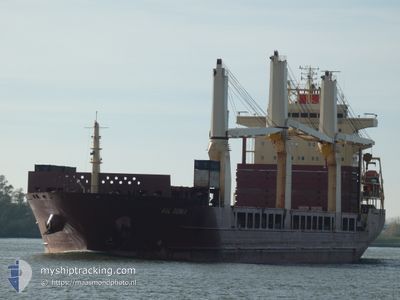
AAL GENOA
General Cargo
Current Trip
| Time Travelled | --- |
|---|---|
| Remaining Time | --- |
| Distance Travelled | --- |
| Remaining Distance | --- |
| AVG Speed | --- |
| MAX Speed | --- |
| AVG Wind | --- |
| MAX Wind | --- |
| MIN Temp | --- |
| MAX Temp | --- |
| Djupgående | 7.6 m |
| Position mottagen | 1 d sen |
Current Position
| Longitud | -10.60402° |
|---|---|
| Latitude | 41.16175° |
| Status | Under way using engine |
| Fart | 11.1 Knop |
| Kurs | 14.7° |
| Område | North Atlantic Ocean |
| Station | T-AIS |
| Position mottagen | 1 d sen |
Info
Information
The current position of AAL GENOA is in North Atlantic Ocean with coordinates 41.16175° / -10.60402° as reported on 2024-04-18 19:58 by AIS to our vessel tracker app. The vessel's current speed is 11.1 Knop and is heading at the port of CUXHAVEN. The estimated time of arrival as calculated by MyShipTracking vessel tracking app is 2024-04-22 14:00 LT
The vessel AAL GENOA (IMO: 9393553, MMSI: 210843000) is a General Cargo that was built in 2009 ( 15 År gammal ). It's sailing under the flag of [CY] Cyprus.
In this page you can find informations about the vessels current position, last detected port calls, and current voyage information. If the vessels is not in coverage by AIS you will find the latest position.
The current position of AAL GENOA is detected by our AIS receivers and we are not responsible for the reliability of the data. The last position was recorded while the vessel was in Coverage by the Ais receivers of our vessel tracking app.
The current draught of AAL GENOA as reported by AIS is 7.6 meters
Weather
| Temperature | 11.8°C / 53.24°F |
|---|---|
| Wind Speed | 15 knots |
| Direction | 74° ENE |
| Pressure | 1023.6 hPa |
| Humidity | 80.9 % |
| Cloud Coverage | 100 % |
Featured Company
Most Visited Ports (Last year)
| Port | Arrivals | |
|---|---|---|
| 3 | ||
| 3 | ||
| 2 | ||
| 2 | ||
| 1 | ||
| 1 |
Events
| Tid | Event | Detaljer | Position / Dest | Information |
|---|---|---|---|---|
| 2024-04-18 20:43 | Status ändrad | Default Under way using engine |
41.29167 / -10.55166
CUXHAVEN
|
Fart: 11.1 kn Kurs: 14.7° |
| 2024-04-18 19:58 | UTANFÖR täckningsområde |
41.16175 / -10.60402
North Atlantic Ocean
CUXHAVEN
|
Fart: 11.1 kn Kurs: 14.7° |
|
| 2024-04-18 17:26 | Status ändrad | Under way using engine Default |
40.72223 / -10.76475
CUXHAVEN
|
Fart: 10 kn Kurs: 13° |
| 2024-04-18 17:26 | I täckningsområde |
40.72223 / -10.76475
North Atlantic Ocean
CUXHAVEN
|
Fart: 10.9 kn Kurs: 12.4° |
|
| 2024-04-18 15:16 | Status ändrad | Default Under way using engine |
40.36333 / -10.91500
CUXHAVEN
|
Fart: 10.4 kn Kurs: 20° |
| 2024-04-18 15:01 | Status ändrad | Under way using engine Default |
40.32632 / -10.93437
CUXHAVEN
|
Fart: 10 kn Kurs: 20° |
| 2024-04-18 15:01 | UTANFÖR täckningsområde |
40.32632 / -10.93437
North Atlantic Ocean
CUXHAVEN
|
Fart: 10.4 kn Kurs: 20° |
|
| 2024-04-18 14:43 | I täckningsområde |
40.32632 / -10.93437
North Atlantic Ocean
CUXHAVEN
|
Fart: 10.4 kn Kurs: 20° |
|
| 2024-04-17 14:34 | Status ändrad | Default Under way using engine |
36.33690 / -12.47105
CUXHAVEN
|
Fart: 10 kn Kurs: 14.2° |
| 2024-04-17 14:22 | UTANFÖR täckningsområde |
36.30415 / -12.48151
North Atlantic Ocean
CUXHAVEN
|
Fart: 10 kn Kurs: 14.2° |