
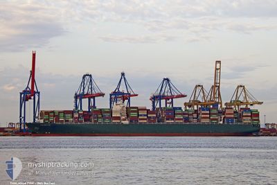
THALASSA TYHI
Container Ship
Current Trip
| Time Travelled | 27 days |
|---|---|
| Remaining Time | 6 h, 17 mins |
| Distance Travelled | 12373.72 nm |
| Remaining Distance | 104.37 nm |
| AVG Speed | 18.2 Knop |
| MAX Speed | 23 Knop |
| AVG Wind | 11.3 knots |
| MAX Wind | 25.5 knots |
| MIN Temp | 14.4°C / 57.92°F |
| MAX Temp | 30.6°C / 87.08°F |
| Djupgående | 16.2 m |
| Position mottagen | 23 m sen |
Current Position
| Longitud | 23.27415° |
|---|---|
| Latitude | 36.28002° |
| Status | Under way using engine |
| Fart | 15.8 Knop |
| Kurs | 25.2° |
| Område | Aegean Sea |
| Station | T-AIS |
| Position mottagen | 23 m sen |
Info
Information
The current position of THALASSA TYHI is in Aegean Sea with coordinates 36.28002° / 23.27415° as reported on 2024-04-30 00:54 by AIS to our vessel tracker app. The vessel's current speed is 15.8 Knop and is heading at the port of PIRAEUS. The estimated time of arrival as calculated by MyShipTracking vessel tracking app is 2024-04-30 07:35 LT
The vessel THALASSA TYHI (IMO: 9667162, MMSI: 636018702) is a Container Ship that was built in 2014 ( 10 År gammal ). It's sailing under the flag of [LR] Liberia.
In this page you can find informations about the vessels current position, last detected port calls, and current voyage information. If the vessels is not in coverage by AIS you will find the latest position.
The current position of THALASSA TYHI is detected by our AIS receivers and we are not responsible for the reliability of the data. The last position was recorded while the vessel was in Coverage by the Ais receivers of our vessel tracking app.
The current draught of THALASSA TYHI as reported by AIS is 16.2 meters
Weather
| Temperature | 17.9°C / 64.22°F |
|---|---|
| Wind Speed | 19 knots |
| Direction | 33° NNE |
| Pressure | 1018.5 hPa |
| Humidity | 72.3 % |
| Cloud Coverage | --- |
Featured Company
Last Port Calls
| Port | Arrival | Departure | Time In Port |
|---|---|---|---|
| 2024-04-01 05:09 | 2024-04-02 04:22 | 23 h | |
| 2024-03-24 03:35 | 2024-03-24 19:23 | 15 h | |
| 2024-03-22 23:25 | 2024-03-23 21:54 | 22 h | |
| 2024-03-21 08:05 | 2024-03-22 03:49 | 19 h | |
| 2024-03-14 02:51 | 2024-03-15 01:57 | 23 h | |
| 2024-03-08 01:21 | 2024-03-08 17:18 | 15 h | |
| 2024-02-08 22:51 | 2024-02-10 22:45 | 1 d | |
| 2024-02-05 13:26 | 2024-02-08 02:59 | 2 d | |
| 2024-02-03 02:45 | 2024-02-04 23:20 | 1 d | |
| 2024-02-02 01:26 |
Last Trips
| Origin | Departure | Destination | Arrival | Distance | |
|---|---|---|---|---|---|
| 2024-03-25 03:23 | 2024-04-01 13:09 | 1581.43 nm | |||
| 2024-03-24 05:54 | 2024-03-24 11:35 | 58.81 nm | |||
| 2024-03-22 11:49 | 2024-03-23 07:25 | 353.28 nm | |||
| 2024-03-15 09:57 | 2024-03-21 16:05 | 1019.02 nm | |||
| 2024-03-09 01:18 | 2024-03-14 10:51 | 2514.52 nm | |||
| 2024-02-10 23:45 | 2024-03-08 09:21 | 10976.34 nm | |||
| 2024-02-08 03:59 | 2024-02-08 23:51 | 351.03 nm | |||
| 2024-02-05 00:20 | 2024-02-05 14:26 | 258.37 nm | |||
| 2024-02-02 02:26 | 2024-02-03 03:45 | 80.07 nm |
Events
| Tid | Event | Detaljer | Position / Dest | Information |
|---|---|---|---|---|
| 2024-04-30 00:57 | Status ändrad | Default Under way using engine |
36.29005 / 23.27997
GRPIR
|
Fart: 15.8 kn Kurs: 25.2° |
| 2024-04-30 00:50 | Byter havsområde | Greek part of the Aegean Sea Greek part of the Mediterranean Sea - Eastern Basin |
36.26250 / 23.26400
Aegean Sea
GRPIR
|
Fart: 15.7 kn Kurs: 25.1° |
| 2024-04-30 00:50 | Status ändrad | Under way using engine Default |
36.26250 / 23.26400
GRPIR
|
Fart: 15.7 kn Kurs: 25° |
| 2024-04-30 00:38 | I täckningsområde |
36.26250 / 23.26400
Aegean Sea
GRPIR
|
Fart: 15.7 kn Kurs: 25.1° |
|
| 2024-04-29 20:48 | Status ändrad | Default Under way using engine |
36.08931 / 22.10771
GRPIR
|
Fart: 16.2 kn Kurs: 92.8° |
| 2024-04-29 20:34 | UTANFÖR täckningsområde |
36.09260 / 22.02723
Mediterranean Sea - Eastern Basin
GRPIR
|
Fart: 16.2 kn Kurs: 92.8° |
|
| 2024-04-29 19:33 | Status ändrad | Under way using engine Default |
36.10720 / 21.68990
GRPIR
|
Fart: 16.6 kn Kurs: 93° |
| 2024-04-29 19:31 | Status ändrad | Default Under way using engine |
36.10790 / 21.67359
GRPIR
|
Fart: 16.6 kn Kurs: 93.1° |
| 2024-04-29 19:05 | Status ändrad | Under way using engine Default |
36.11454 / 21.52683
GRPIR
|
Fart: 16.7 kn Kurs: 92° |
| 2024-04-29 18:45 | I täckningsområde |
36.11454 / 21.52683
Mediterranean Sea - Eastern Basin
GRPIR
|
Fart: 16.7 kn Kurs: 93.2° |