
THALASSA TYHI
Container Ship
Current Trip
| Time Travelled | 16 days |
|---|---|
| Remaining Time | --- |
| Distance Travelled | 7289.13 nm |
| Remaining Distance | --- |
| AVG Speed | 17.7 Knots |
| MAX Speed | 22.6 Knots |
| AVG Wind | 10.3 knots |
| MAX Wind | 25.5 knots |
| MIN Temp | 17.7°C / 63.86°F |
| MAX Temp | 30.6°C / 87.08°F |
| Draught | 16.2 m |
| Position Received | 3 d ago |
Current Position
| Longitude | 17.69735° |
|---|---|
| Latitude | -34.18391° |
| Status | Under way using engine |
| Speed | 18.4 Knots |
| Course | 316.6° |
| Area | South Atlantic Ocean |
| Station | T-AIS |
| Position Received | 3 d ago |
Info
Information
The current position of THALASSA TYHI is in South Atlantic Ocean with coordinates -34.18391° / 17.69735° as reported on 2024-04-15 17:19 by AIS to our vessel tracker app. The vessel's current speed is 18.4 Knots and is heading at the port of PIRAEUS. The estimated time of arrival as calculated by MyShipTracking vessel tracking app is 2024-04-30 10:00 LT
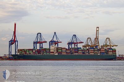
The vessel THALASSA TYHI (IMO: 9667162, MMSI: 636018702) is a Container Ship that was built in 2014 ( 10 years old ). It's sailing under the flag of [LR] Liberia.
In this page you can find informations about the vessels current position, last detected port calls, and current voyage information. If the vessels is not in coverage by AIS you will find the latest position.
The current position of THALASSA TYHI is detected by our AIS receivers and we are not responsible for the reliability of the data. The last position was recorded while the vessel was in Coverage by the Ais receivers of our vessel tracking app.
The current draught of THALASSA TYHI as reported by AIS is 16.2 meters
Weather
| Temperature | 24.3°C / 75.74°F |
|---|---|
| Wind Speed | 13 knots |
| Direction | 98° E |
| Pressure | 1014.5 hPa |
| Humidity | 83.6 % |
| Cloud Coverage | 3 % |
Featured Company
Last Port Calls
| Port | Arrival | Departure | Time In Port |
|---|---|---|---|
| 2024-04-01 05:09 | 2024-04-02 04:22 | 23 h | |
| 2024-03-24 03:35 | 2024-03-24 19:23 | 15 h | |
| 2024-03-22 23:25 | 2024-03-23 21:54 | 22 h | |
| 2024-03-21 08:05 | 2024-03-22 03:49 | 19 h | |
| 2024-03-14 02:51 | 2024-03-15 01:57 | 23 h | |
| 2024-03-08 01:21 | 2024-03-08 17:18 | 15 h | |
| 2024-02-08 22:51 | 2024-02-10 22:45 | 1 d | |
| 2024-02-05 13:26 | 2024-02-08 02:59 | 2 d | |
| 2024-02-03 02:45 | 2024-02-04 23:20 | 1 d | |
| 2024-02-02 01:26 |
Last Trips
| Origin | Departure | Destination | Arrival | Distance | |
|---|---|---|---|---|---|
| 2024-03-25 03:23 | 2024-04-01 13:09 | 1581.43 nm | |||
| 2024-03-24 05:54 | 2024-03-24 11:35 | 58.81 nm | |||
| 2024-03-22 11:49 | 2024-03-23 07:25 | 353.28 nm | |||
| 2024-03-15 09:57 | 2024-03-21 16:05 | 1019.02 nm | |||
| 2024-03-09 01:18 | 2024-03-14 10:51 | 2514.52 nm | |||
| 2024-02-10 23:45 | 2024-03-08 09:21 | 10976.34 nm | |||
| 2024-02-08 03:59 | 2024-02-08 23:51 | 351.03 nm | |||
| 2024-02-05 00:20 | 2024-02-05 14:26 | 258.37 nm | |||
| 2024-02-02 02:26 | 2024-02-03 03:45 | 80.07 nm |
Events
| Time | Event | Details | Position / Dest | Info |
|---|---|---|---|---|
| 2024-04-15 17:23 | Status Changed | Default Under way using engine |
-34.17040 / 17.68189
GRPIR
|
Speed: 18.4 kn Course: 316.6° |
| 2024-04-15 17:19 | OUT of Coverage |
-34.18391 / 17.69735
South Atlantic Ocean
GRPIR
|
Speed: 18.4 kn Course: 316.6° |
|
| 2024-04-15 17:16 | Status Changed | Under way using engine Default |
-34.19768 / 17.71285
GRPIR
|
Speed: 18.3 kn Course: 318° |
| 2024-04-15 17:12 | Status Changed | Default Under way using engine |
-34.21241 / 17.72966
GRPIR
|
Speed: 18.4 kn Course: 315° |
| 2024-04-15 17:08 | Status Changed | Under way using engine Default |
-34.22463 / 17.74380
GRPIR
|
Speed: 18.5 kn Course: 316° |
| 2024-04-15 17:04 | Status Changed | Default Under way using engine |
-34.24222 / 17.76455
GRPIR
|
Speed: 18.5 kn Course: 317.3° |
| 2024-04-15 16:51 | Status Changed | Under way using engine Default |
-34.28771 / 17.81754
GRPIR
|
Speed: 18.5 kn Course: 314° |
| 2024-04-15 16:46 | Status Changed | Default Under way using engine |
-34.30883 / 17.84306
GRPIR
|
Speed: 18.6 kn Course: 314.5° |
| 2024-04-15 16:40 | Status Changed | Under way using engine Default |
-34.32793 / 17.86596
GRPIR
|
Speed: 18.8 kn Course: 316° |
| 2024-04-15 16:17 | Status Changed | Default Under way using engine |
-34.41528 / 17.97143
GRPIR
|
Speed: 19.9 kn Course: 312.9° |