
THALASSA TYHI
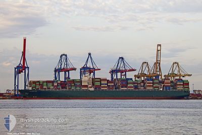
Container Ship
Current Trip
| Time Travelled | 28 days |
|---|---|
| Remaining Time | -3 mins |
| Distance Travelled | 12477.99 nm |
| Remaining Distance | 2.15 nm |
| AVG Speed | 18.1 Knots |
| MAX Speed | 23 Knots |
| AVG Wind | 11.4 knots |
| MAX Wind | 25.5 knots |
| MIN Temp | 14.4°C / 57.92°F |
| MAX Temp | 30.6°C / 87.08°F |
| Dybgang | 16.2 m |
| Position Modtaget | Nu |
Current Position
| Longitude | 23.57913° |
|---|---|
| Latitude | 37.93999° |
| Status | Under way using engine |
| Fart | 5.4 Knots |
| Kurs | 26.1° |
| Område | Aegean Sea |
| Station | T-AIS |
| Position Modtaget | Nu |
Info
Information
The current position of THALASSA TYHI is in Aegean Sea with coordinates 37.93999° / 23.57913° as reported on 2024-04-30 07:59 by AIS to our vessel tracker app. The vessel's current speed is 5.4 Knots and is heading at the port of PIRAEUS. The estimated time of arrival as calculated by MyShipTracking vessel tracking app is 2024-04-30 07:57 LT
The vessel THALASSA TYHI (IMO: 9667162, MMSI: 636018702) is a Container Ship that was built in 2014 ( 10 år gamle ). It's sailing under the flag of [LR] Liberia.
In this page you can find informations about the vessels current position, last detected port calls, and current voyage information. If the vessels is not in coverage by AIS you will find the latest position.
The current position of THALASSA TYHI is detected by our AIS receivers and we are not responsible for the reliability of the data. The last position was recorded while the vessel was in Coverage by the Ais receivers of our vessel tracking app.
The current draught of THALASSA TYHI as reported by AIS is 16.2 meters
Weather
| Temperature | 18.2°C / 64.76°F |
|---|---|
| Wind Speed | 17 knots |
| Direction | 358° N |
| Pressure | 1019.1 hPa |
| Humidity | 58.3 % |
| Cloud Coverage | --- |
Featured Company
Last Port Calls
| Port | Arrival | Departure | Time In Port |
|---|---|---|---|
| 2024-04-01 05:09 | 2024-04-02 04:22 | 23 h | |
| 2024-03-24 03:35 | 2024-03-24 19:23 | 15 h | |
| 2024-03-22 23:25 | 2024-03-23 21:54 | 22 h | |
| 2024-03-21 08:05 | 2024-03-22 03:49 | 19 h | |
| 2024-03-14 02:51 | 2024-03-15 01:57 | 23 h | |
| 2024-03-08 01:21 | 2024-03-08 17:18 | 15 h | |
| 2024-02-08 22:51 | 2024-02-10 22:45 | 1 d | |
| 2024-02-05 13:26 | 2024-02-08 02:59 | 2 d | |
| 2024-02-03 02:45 | 2024-02-04 23:20 | 1 d | |
| 2024-02-02 01:26 |
Last Trips
| Origin | Departure | Destination | Arrival | Distance | |
|---|---|---|---|---|---|
| 2024-03-25 03:23 | 2024-04-01 13:09 | 1581.43 nm | |||
| 2024-03-24 05:54 | 2024-03-24 11:35 | 58.81 nm | |||
| 2024-03-22 11:49 | 2024-03-23 07:25 | 353.28 nm | |||
| 2024-03-15 09:57 | 2024-03-21 16:05 | 1019.02 nm | |||
| 2024-03-09 01:18 | 2024-03-14 10:51 | 2514.52 nm | |||
| 2024-02-10 23:45 | 2024-03-08 09:21 | 10976.34 nm | |||
| 2024-02-08 03:59 | 2024-02-08 23:51 | 351.03 nm | |||
| 2024-02-05 00:20 | 2024-02-05 14:26 | 258.37 nm | |||
| 2024-02-02 02:26 | 2024-02-03 03:45 | 80.07 nm |
Events
| Tid | Hændelsen | Detaljer | Position / Dest | Info |
|---|---|---|---|---|
| 2024-04-30 02:52 | Status er ændret | Under way using engine Default |
36.75799 / 23.53514
GRPIR
|
Fart: 16 kn Kurs: 21° |
| 2024-04-30 02:24 | Status er ændret | Default Under way using engine |
36.64287 / 23.47936
GRPIR
|
Fart: 16 kn Kurs: 22.6° |
| 2024-04-30 02:21 | Status er ændret | Under way using engine Default |
36.62920 / 23.47229
GRPIR
|
Fart: 16 kn Kurs: 23° |
| 2024-04-30 02:21 | Indenfor Dækning |
36.63744 / 23.47655
Aegean Sea
GRPIR
|
Fart: 16 kn Kurs: 22.6° |
|
| 2024-04-30 00:57 | Status er ændret | Default Under way using engine |
36.29005 / 23.27997
GRPIR
|
Fart: 15.8 kn Kurs: 25.2° |
| 2024-04-30 00:54 | Udenfor Dækning |
36.28002 / 23.27415
Aegean Sea
GRPIR
|
Fart: 15.8 kn Kurs: 25.2° |
|
| 2024-04-30 00:50 | Ændre havområde | Greek part of the Aegean Sea Greek part of the Mediterranean Sea - Eastern Basin |
36.26250 / 23.26400
Aegean Sea
GRPIR
|
Fart: 15.7 kn Kurs: 25.1° |
| 2024-04-30 00:50 | Status er ændret | Under way using engine Default |
36.26250 / 23.26400
GRPIR
|
Fart: 15.7 kn Kurs: 25° |
| 2024-04-30 00:38 | Indenfor Dækning |
36.26250 / 23.26400
Aegean Sea
GRPIR
|
Fart: 15.7 kn Kurs: 25.1° |
|
| 2024-04-29 20:34 | Udenfor Dækning |
36.09260 / 22.02723
Mediterranean Sea - Eastern Basin
GRPIR
|
Fart: 16.2 kn Kurs: 92.8° |