
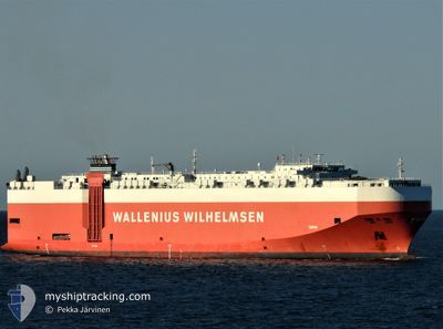
TAIPAN
Vehicles Carrier
Current Trip
| Trip Time | 35 days |
|---|---|
| Trip Distance | 10529.82 nm |
| AVG Speed | 13 Knop |
| MAX Speed | 18.4 Knop |
| Djupgående | 8.9 m |
| AVG Wind | 13.2 knots |
| MAX Wind | 30 knots |
| MIN Temp | 10.7°C / 51.26°F |
| MAX Temp | 33.9°C / 93.02°F |
| Position mottagen | 5 m sen |
Current Position
| Longitud | -81.53280° |
|---|---|
| Latitude | 31.13092° |
| Status | Moored |
| Fart | |
| Kurs | 110° |
| Område | North Atlantic Ocean |
| Station | T-AIS |
| Position mottagen | 5 m sen |
Info
Information
The current position of TAIPAN is in North Atlantic Ocean with coordinates 31.13092° / -81.53280° as reported on 2024-04-27 02:10 by AIS to our vessel tracker app. The vessel's current speed is 0 Knop and is currently inside the port of BRUNSWICK.
The vessel TAIPAN (IMO: 9311866, MMSI: 308921000) is a Vehicles Carrier that was built in 2006 ( 18 År gammal ). It's sailing under the flag of [BS] Bahamas.
In this page you can find informations about the vessels current position, last detected port calls, and current voyage information. If the vessels is not in coverage by AIS you will find the latest position.
The current position of TAIPAN is detected by our AIS receivers and we are not responsible for the reliability of the data. The last position was recorded while the vessel was in Coverage by the Ais receivers of our vessel tracking app.
The current draught of TAIPAN as reported by AIS is 8.9 meters
Weather
| Temperature | 18.8°C / 65.84°F |
|---|---|
| Wind Speed | 5 knots |
| Direction | 53° NE |
| Pressure | 1024.6 hPa |
| Humidity | 86.5 % |
| Cloud Coverage | 8 % |
Featured Company
Most Visited Ports (Last year)
| Port | Arrivals | |
|---|---|---|
| 4 | ||
| 4 | ||
| 3 | ||
| 3 | ||
| 3 | ||
| 3 |
Last Trips
| Origin | Departure | Destination | Arrival | Distance | |
|---|---|---|---|---|---|
| 2024-03-22 16:38 | 2024-04-26 15:23 | 10529.82 nm | |||
| 2024-03-02 16:57 | 2024-03-19 21:35 | 5237.11 nm | |||
| 2024-02-25 07:29 | 2024-02-27 22:51 | 36.99 nm | |||
| 2024-02-05 18:14 | 2024-02-22 02:17 | 4703.42 nm | |||
| 2024-01-30 17:37 | 2024-02-02 17:49 | 522.25 nm |
Events
| Tid | Event | Detaljer | Position / Dest | Information |
|---|---|---|---|---|
| 2024-04-26 20:31 | Status ändrad | Moored Under way using engine |
31.13092 / -81.53279
[US] BRUNSWICK
|
Fart: Kurs: 109° |
| 2024-04-26 20:14 | STOPPAR förflyttning |
31.13105 / -81.53264
[US] BRUNSWICK
|
Fart: 0.3 kn Kurs: 113° |
|
| 2024-04-26 19:23 | ANLÄNDER HAMN |
|
31.11124 / -81.47056
[US] BRUNSWICK
|
Fart: 9.8 kn Kurs: 293.5° |
| 2024-04-26 18:42 | Status ändrad | Under way using engine Default |
31.10249 / -81.33745
USSSI
|
Fart: 12 kn Kurs: 303° |
| 2024-04-26 18:29 | Status ändrad | Default Under way using engine |
31.07833 / -81.29500
USSSI
|
Fart: 13 kn Kurs: 303.1° |
| 2024-04-26 18:10 | Status ändrad | Under way using engine Default |
31.03834 / -81.23709
USSSI
|
Fart: 9 kn Kurs: 308° |
| 2024-04-26 17:56 | Status ändrad | Default Under way using engine |
31.01667 / -81.20667
USSSI
|
Fart: 4 kn Kurs: 343° |
| 2024-04-26 17:56 | STARTAR förflyttning | 16.7 nm, South East of BRUNSWICK |
31.01667 / -81.20667
USSSI
|
Fart: 9 kn Kurs: 308° |
| 2024-04-26 17:47 | Status ändrad | Under way using engine At anchor |
31.00588 / -81.19497
USSSI
|
Fart: Kurs: 12° |
| 2024-04-26 17:39 | Status ändrad | At anchor Default |
31.00575 / -81.19487
USSSI
|
Fart: Kurs: -1° |