
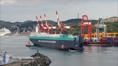
TAIPAN
Vehicles Carrier
Current Trip
| Time Travelled | 11 h, 45 mins |
|---|---|
| Remaining Time | 1 day |
| Distance Travelled | 167.40 nm |
| Remaining Distance | 254.74 nm |
| AVG Speed | 14.2 Knopen |
| MAX Speed | 19 Knopen |
| AVG Wind | 9.9 knots |
| MAX Wind | 25 knots |
| MIN Temp | 1.3°C / 34.34°F |
| MAX Temp | 7.3°C / 45.14°F |
| Diepgang | 8.5 M |
| Positie ontvangen | 33 m geleden |
Current Position
| Lengtegraad | --- |
|---|---|
| Breedtegraat | --- |
| Status | Under way using engine |
| Snelheid | 8 Knopen |
| Koers | 63° |
| Gebied | North Atlantic Ocean |
| Station | T-AIS |
| Positie ontvangen | 33 m geleden |
Info
Information
The current position of TAIPAN is in North Atlantic Ocean with coordinates 37.00032° / -75.68402° as reported on 2025-12-08 13:40 by AIS to our vessel tracker app. The vessel's current speed is 8 Knopen and is heading at the port of NEW YORK. The estimated time of arrival as calculated by MyShipTracking vessel tracking app is 2025-12-09 17:39 LT
The vessel TAIPAN (IMO: 9311866, MMSI: 308921000) is a Vehicles Carrier that was built in 2006 ( 19 Jaar oud ). It's sailing under the flag of [BS] Bahamas.
In this page you can find informations about the vessels current position, last detected port calls, and current voyage information. If the vessels is not in coverage by AIS you will find the latest position.
The current position of TAIPAN is detected by our AIS receivers and we are not responsible for the reliability of the data. The last position was recorded while the vessel was in Coverage by the Ais receivers of our vessel tracking app.
The current draught of TAIPAN as reported by AIS is 8.5 meters
Weather
| Temperature | 7.8°C / 46.04°F |
|---|---|
| Wind Speed | 24 knots |
| Direction | 29° NNE |
| Pressure | 1019.4 hPa |
| Humidity | 75.1 % |
| Cloud Coverage | 100 % |
Featured Company
Last Port Calls
| Port | Arrival | Departure | Time In Port |
|---|---|---|---|
| 2025-12-07 06:06 | 2025-12-07 21:28 | 15 h | |
| 2025-12-04 09:09 | 2025-12-05 00:28 | 15 h | |
| 2025-11-28 12:21 | 2025-11-30 16:07 | 2 d | |
| 2025-11-25 05:05 | 2025-11-25 17:24 | 12 h | |
| 2025-11-22 05:18 | 2025-11-23 00:15 | 18 h | |
| 2025-11-17 22:58 | 2025-11-18 03:06 | 4 h | |
| 2025-11-17 21:01 | |||
| 2025-11-17 20:34 | |||
| 2025-11-17 19:02 | |||
| 2025-11-17 00:26 |
Most Visited Ports (Last year)
| Port | Arrivals | |
|---|---|---|
| 4 | ||
| 3 | ||
| 3 | ||
| 2 | ||
| 2 | ||
| 2 |
Last Trips
| Origin | Departure | Destination | Arrival | Distance | |
|---|---|---|---|---|---|
| 2025-12-05 00:28 | 2025-12-07 06:06 | 686.46 nm | |||
| 2025-11-30 16:07 | 2025-12-04 09:09 | 1448.13 nm | |||
| 2025-11-25 17:24 | 2025-11-28 12:21 | 612.69 nm | |||
| 2025-11-23 00:15 | 2025-11-25 05:05 | 637.07 nm | |||
| 2025-11-18 03:06 | 2025-11-22 05:18 | 1512.54 nm | |||
| 2025-11-04 17:57 | 2025-11-17 22:58 | 4598.68 nm | |||
| 2025-11-04 17:57 | 2025-11-17 21:01 | 4598.68 nm | |||
| 2025-11-04 17:57 | 2025-11-17 20:34 | 4598.68 nm | |||
| 2025-11-04 17:57 | 2025-11-17 19:02 | 4598.68 nm | |||
| 2025-11-04 17:57 | 2025-11-17 00:26 | 4598.60 nm |
Events
| Tijd | Evenement | Details | Positie / Bestemming | Info |
|---|---|---|---|---|
| 2025-12-08 13:47 | Status Changed | Default Under way using engine |
37.00740 / -75.66653
USNYC
|
Snelheid: 8 kn Koers: 63° |
| 2025-12-08 13:40 | Status Changed | Under way using engine Default |
37.00032 / -75.68402
USNYC
|
Snelheid: 8.1 kn Koers: 61° |
| 2025-12-08 13:31 | Status Changed | Default Under way using engine |
36.99124 / -75.70589
USNYC
|
Snelheid: 8.1 kn Koers: 66.3° |
| 2025-12-08 13:24 | Status Changed | Under way using engine Default |
36.98456 / -75.72218
USNYC
|
Snelheid: 8 kn Koers: 66° |
| 2025-12-08 13:19 | Status Changed | Default Under way using engine |
36.97925 / -75.73674
USNYC
|
Snelheid: 8.2 kn Koers: 59.2° |
| 2025-12-08 13:10 | Status Changed | Under way using engine Default |
36.96864 / -75.75875
USNYC
|
Snelheid: 8.2 kn Koers: 59° |
| 2025-12-08 13:03 | Status Changed | Default Under way using engine |
36.96083 / -75.77569
USNYC
|
Snelheid: 7.6 kn Koers: 66° |
| 2025-12-08 12:53 | Status Changed | Under way using engine Default |
36.95108 / -75.79950
USNYC
|
Snelheid: 7.4 kn Koers: 76° |
| 2025-12-08 12:51 | Status Changed | Default Under way using engine |
36.94986 / -75.80527
USNYC
|
Snelheid: 7.4 kn Koers: 76.1° |
| 2025-12-08 11:53 | Status Changed | Under way using engine Default |
36.92753 / -75.95352
USNYC
|
Snelheid: 8.4 kn Koers: 111° |