
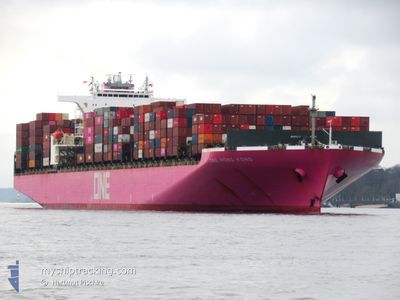
ONE HONG KONG
Container Ship
Current Trip
SG SIN PWBGA
| Time Travelled | 1 day |
|---|---|
| Remaining Time | --- |
| Distance Travelled | 581.65 nm |
| Remaining Distance | --- |
| AVG Speed | 12.8 Knop |
| MAX Speed | 16.4 Knop |
| AVG Wind | 13.4 knots |
| MAX Wind | 27.9 knots |
| MIN Temp | 12.3°C / 54.14°F |
| MAX Temp | 18.8°C / 65.84°F |
| Djupgående | 12.9 m |
| Position mottagen | 1 h, 29 m sen |
Current Position
| Longitud | -9.00222° |
|---|---|
| Latitude | 44.73942° |
| Status | Under way using engine |
| Fart | 13.9 Knop |
| Kurs | 212.4° |
| Område | North Atlantic Ocean |
| Station | T-AIS |
| Position mottagen | 1 h, 29 m sen |
Info
Information
The current position of ONE HONG KONG is in North Atlantic Ocean with coordinates 44.73942° / -9.00222° as reported on 2024-05-13 12:52 by AIS to our vessel tracker app. The vessel's current speed is 13.9 Knop
The vessel ONE HONG KONG (IMO: 9395161, MMSI: 355271000) is a Container Ship that was built in 2009 ( 15 År gammal ). It's sailing under the flag of [PA] Panama.
In this page you can find informations about the vessels current position, last detected port calls, and current voyage information. If the vessels is not in coverage by AIS you will find the latest position.
The current position of ONE HONG KONG is detected by our AIS receivers and we are not responsible for the reliability of the data. The last position was recorded while the vessel was in Coverage by the Ais receivers of our vessel tracking app.
The current draught of ONE HONG KONG as reported by AIS is 12.9 meters
Weather
| Temperature | 13.8°C / 56.84°F |
|---|---|
| Wind Speed | 25 knots |
| Direction | 264° W |
| Pressure | 1008.5 hPa |
| Humidity | 82.7 % |
| Cloud Coverage | 5 % |
Featured Company
Last Port Calls
| Port | Arrival | Departure | Time In Port |
|---|---|---|---|
| 2024-05-10 04:10 | 2024-05-11 20:31 | 1 d | |
| 2024-05-06 21:00 | 2024-05-08 18:29 | 1 d | |
| 2024-05-03 15:16 | 2024-05-05 14:18 | 1 d | |
| 2024-03-30 10:44 | 2024-03-31 22:02 | 1 d | |
| 2024-03-22 07:04 | 2024-03-23 04:49 | 21 h | |
| 2024-03-19 18:57 | 2024-03-21 09:33 | 1 d | |
| 2024-03-18 06:55 | 2024-03-19 03:42 | 20 h | |
| 2024-03-16 07:34 | 2024-03-17 05:41 | 22 h | |
| 2024-03-01 18:12 |
Last Trips
| Origin | Departure | Destination | Arrival | Distance | |
|---|---|---|---|---|---|
| 2024-05-08 18:29 | 2024-05-10 04:10 | 522.89 nm | |||
| 2024-05-05 14:18 | 2024-05-06 21:00 | 320.26 nm | |||
| 2024-03-31 22:02 | 2024-05-03 15:16 | 11853.51 nm | |||
| 2024-03-23 04:49 | 2024-03-30 10:44 | 2917.95 nm | |||
| 2024-03-21 09:33 | 2024-03-22 07:04 | 224.03 nm | |||
| 2024-03-19 03:42 | 2024-03-19 18:57 | 251.15 nm | |||
| 2024-03-17 05:41 | 2024-03-18 06:55 | 342.85 nm | |||
| 2024-03-01 18:12 | 2024-03-16 07:34 | 5160.34 nm |
Events
| Tid | Event | Detaljer | Position / Dest | Information |
|---|---|---|---|---|
| 2024-05-13 12:55 | Status ändrad | Default Under way using engine |
44.72666 / -9.01167
SG SIN PWBGA
|
Fart: 13.9 kn Kurs: 212.4° |
| 2024-05-13 12:52 | UTANFÖR täckningsområde |
44.73942 / -9.00222
North Atlantic Ocean
|
Fart: 13.9 kn Kurs: 212.4° |
|
| 2024-05-13 12:42 | Status ändrad | Under way using engine Default |
44.77324 / -8.97317
SG SIN PWBGA
|
Fart: 14 kn Kurs: 210° |
| 2024-05-13 12:22 | Status ändrad | Default Under way using engine |
44.83667 / -8.91833
SG SIN PWBGA
|
Fart: 14 kn Kurs: 210.8° |
| 2024-05-13 10:37 | Byter havsområde | Spanish part of the North Atlantic Ocean French part of the Celtic Sea |
45.20954 / -8.63421
North Atlantic Ocean
|
Fart: 14.2 kn Kurs: 210.1° |
| 2024-05-13 10:37 | Status ändrad | Under way using engine Default |
45.20954 / -8.63421
SG SIN PWBGA
|
Fart: 14 kn Kurs: 209° |
| 2024-05-13 10:31 | I täckningsområde |
45.20954 / -8.63421
North Atlantic Ocean
|
Fart: 14.2 kn Kurs: 210.1° |
|
| 2024-05-12 22:28 | Status ändrad | Default Under way using engine |
47.60667 / -6.76667
SG SIN PWBGA
|
Fart: 14.6 kn Kurs: 207.7° |
| 2024-05-12 22:25 | UTANFÖR täckningsområde |
47.61905 / -6.75915
Celtic Sea
|
Fart: 14.6 kn Kurs: 207.7° |
|
| 2024-05-12 22:16 | Status ändrad | Under way using engine Default |
47.65030 / -6.73450
SG SIN PWBGA
|
Fart: 14 kn Kurs: 208° |