
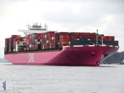
ONE HONG KONG
Container Ship
Current Trip
| Time Travelled | 19 days |
|---|---|
| Remaining Time | --- |
| Distance Travelled | 7915.56 nm |
| Remaining Distance | --- |
| AVG Speed | 16.8 Knots |
| MAX Speed | 21.2 Knots |
| AVG Wind | 12.1 knots |
| MAX Wind | 33.4 knots |
| MIN Temp | 12.7°C / 54.86°F |
| MAX Temp | 29.9°C / 85.82°F |
| Draught | 14 m |
| Position Received | 5 d ago |
Current Position
| Longitude | 17.88955° |
|---|---|
| Latitude | -34.34831° |
| Status | Under way using engine |
| Speed | 17.6 Knots |
| Course | 310.4° |
| Area | South Atlantic Ocean |
| Station | T-AIS |
| Position Received | 5 d ago |
Info
Information
The current position of ONE HONG KONG is in South Atlantic Ocean with coordinates -34.34831° / 17.88955° as reported on 2024-04-14 17:34 by AIS to our vessel tracker app. The vessel's current speed is 17.6 Knots and is heading at the port of ROTTERDAM. The estimated time of arrival as calculated by MyShipTracking vessel tracking app is 2024-04-29 10:00 LT
The vessel ONE HONG KONG (IMO: 9395161, MMSI: 355271000) is a Container Ship that was built in 2009 ( 15 years old ). It's sailing under the flag of [PA] Panama.
In this page you can find informations about the vessels current position, last detected port calls, and current voyage information. If the vessels is not in coverage by AIS you will find the latest position.
The current position of ONE HONG KONG is detected by our AIS receivers and we are not responsible for the reliability of the data. The last position was recorded while the vessel was in Coverage by the Ais receivers of our vessel tracking app.
The current draught of ONE HONG KONG as reported by AIS is 14 meters
Weather
| Temperature | 28.7°C / 83.66°F |
|---|---|
| Wind Speed | 12 knots |
| Direction | 129° SE |
| Pressure | 1010.6 hPa |
| Humidity | 73.3 % |
| Cloud Coverage | 98 % |
Featured Company
Last Port Calls
| Port | Arrival | Departure | Time In Port |
|---|---|---|---|
| 2024-03-30 02:44 | 2024-03-31 14:02 | 1 d | |
| 2024-03-21 22:04 | 2024-03-22 19:49 | 21 h | |
| 2024-03-19 09:57 | 2024-03-21 00:33 | 1 d | |
| 2024-03-17 21:55 | 2024-03-18 18:42 | 20 h | |
| 2024-03-15 22:34 | 2024-03-16 20:41 | 22 h | |
| 2024-02-29 15:32 | 2024-03-02 02:12 | 1 d | |
| 2024-02-23 14:02 | 2024-02-28 01:07 | 4 d | |
| 2024-02-08 22:04 | 2024-02-11 08:15 | 2 d | |
| 2024-02-06 09:02 | 2024-02-07 20:33 | 1 d | |
| 2024-02-03 22:12 | 2024-02-05 13:30 | 1 d |
Last Trips
| Origin | Departure | Destination | Arrival | Distance | |
|---|---|---|---|---|---|
| 2024-03-23 04:49 | 2024-03-30 10:44 | 2917.95 nm | |||
| 2024-03-21 09:33 | 2024-03-22 07:04 | 224.03 nm | |||
| 2024-03-19 03:42 | 2024-03-19 18:57 | 251.15 nm | |||
| 2024-03-17 05:41 | 2024-03-18 06:55 | 342.85 nm | |||
| 2024-03-01 18:12 | 2024-03-16 07:34 | 5160.34 nm | |||
| 2024-02-27 17:07 | 2024-02-29 07:32 | 409.51 nm | |||
| 2024-02-11 17:15 | 2024-02-23 06:02 | 4933.79 nm | |||
| 2024-02-08 05:33 | 2024-02-09 07:04 | 232.54 nm | |||
| 2024-02-05 22:30 | 2024-02-06 18:02 | 257.74 nm | |||
| 2024-01-27 08:18 | 2024-02-04 07:12 | 2713.94 nm |
Events
| Time | Event | Details | Position / Dest | Info |
|---|---|---|---|---|
| 2024-04-14 17:42 | Status Changed | Default Under way using engine |
-34.32167 / 17.85333
NL RTM
|
Speed: 17.6 kn Course: 310.4° |
| 2024-04-14 17:34 | Status Changed | Under way using engine Default |
-34.34831 / 17.88955
NL RTM
|
Speed: 17.6 kn Course: 311° |
| 2024-04-14 17:34 | OUT of Coverage |
-34.34831 / 17.88955
South Atlantic Ocean
NL RTM
|
Speed: 17.6 kn Course: 310.4° |
|
| 2024-04-14 17:21 | Status Changed | Default Under way using engine |
-34.38921 / 17.94729
NL RTM
|
Speed: 19.2 kn Course: 309.3° |
| 2024-04-14 15:13 | Status Changed | Under way using engine Default |
-34.70399 / 18.63501
NL RTM
|
Speed: 18.5 kn Course: 286° |
| 2024-04-14 15:00 | IN Coverage |
-34.70399 / 18.63501
South Atlantic Ocean
NL RTM
|
Speed: 18.6 kn Course: 286.2° |
|
| 2024-04-14 14:16 | Status Changed | Default Under way using engine |
-34.78402 / 18.97160
NL RTM
|
Speed: 18.4 kn Course: 286.1° |
| 2024-04-14 14:11 | Status Changed | Under way using engine Default |
-34.79095 / 19.00160
NL RTM
|
Speed: 18.3 kn Course: 285° |
| 2024-04-14 14:11 | OUT of Coverage |
-34.79095 / 19.00160
South Atlantic Ocean
NL RTM
|
Speed: 18.4 kn Course: 286.1° |
|
| 2024-04-14 14:03 | Status Changed | Default Under way using engine |
-34.80167 / 19.04833
NL RTM
|
Speed: 18 kn Course: 286° |