
ALFRED
Tanker
Current Trip
| Time Travelled | 28 days |
|---|---|
| Remaining Time | --- |
| Distance Travelled | 5316.30 nm |
| Remaining Distance | --- |
| AVG Speed | 9.9 Knop |
| MAX Speed | 15.1 Knop |
| AVG Wind | 11.3 knots |
| MAX Wind | 28.4 knots |
| MIN Temp | 2.2°C / 35.96°F |
| MAX Temp | 21.7°C / 71.06°F |
| Djupgående | 9 m |
| Position mottagen | 1 d sen |
Current Position
| Longitud | 29.63364° |
|---|---|
| Latitude | 41.42900° |
| Status | Under way using engine |
| Fart | 12.7 Knop |
| Kurs | 65.9° |
| Område | Black Sea |
| Station | T-AIS |
| Position mottagen | 1 d sen |
Info
Information
The current position of ALFRED is in Black Sea with coordinates 41.42900° / 29.63364° as reported on 2024-05-08 16:54 by AIS to our vessel tracker app. The vessel's current speed is 12.7 Knop
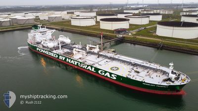
The vessel ALFRED (IMO: 9826897, MMSI: 636018830) is a Tanker It's sailing under the flag of [LR] Liberia.
In this page you can find informations about the vessels current position, last detected port calls, and current voyage information. If the vessels is not in coverage by AIS you will find the latest position.
The current position of ALFRED is detected by our AIS receivers and we are not responsible for the reliability of the data. The last position was recorded while the vessel was in Coverage by the Ais receivers of our vessel tracking app.
The current draught of ALFRED as reported by AIS is 9 meters
Weather
| Temperature | 14.2°C / 57.56°F |
|---|---|
| Wind Speed | 18 knots |
| Direction | 63° ENE |
| Pressure | 1017.1 hPa |
| Humidity | 82.3 % |
| Cloud Coverage | 100 % |
Featured Company
Most Visited Ports (Last year)
| Port | Arrivals | |
|---|---|---|
| 3 | ||
| 2 | ||
| 2 | ||
| 2 | ||
| 2 | ||
| 1 |
Last Trips
| Origin | Departure | Destination | Arrival | Distance | |
|---|---|---|---|---|---|
| 2024-03-08 08:30 | 2024-04-10 05:58 | 6380.14 nm | |||
| 2024-02-20 02:35 | 2024-03-08 08:31 | 1707.90 nm |
Events
| Tid | Event | Detaljer | Position / Dest | Information |
|---|---|---|---|---|
| 2024-05-08 16:56 | Status ändrad | Default Under way using engine |
41.43209 / 29.64296
RU NVS
|
Fart: 12.7 kn Kurs: 65.9° |
| 2024-05-08 16:54 | UTANFÖR täckningsområde |
41.42900 / 29.63364
Black Sea
RU NVS
|
Fart: 12.7 kn Kurs: 65.9° |
|
| 2024-05-08 16:36 | Status ändrad | Under way using engine Default |
41.40715 / 29.55633
RU NVS
|
Fart: 12.7 kn Kurs: 60° |
| 2024-05-08 16:14 | Status ändrad | Default Under way using engine |
41.36702 / 29.46491
RU NVS
|
Fart: 12.6 kn Kurs: 60.5° |
| 2024-05-08 14:53 | Byter havsområde | Turkish part of the Black Sea Turkish part of the Sea of Marmara |
41.23588 / 29.14484
Black Sea
RU NVS
|
Fart: 10.5 kn Kurs: 39.6° |
| 2024-05-08 06:30 | ETA ändrat | 2024/05/13 19:00 2025/01/15 12:00 |
40.73927 / 28.50253
RU NVS
|
Fart: 1.2 kn Kurs: 228° |
| 2024-05-08 00:45 | STARTAR förflyttning | 13.67 nm, South West of AMBARLI |
40.77853 / 28.49197
RU NVS
|
Fart: 3.3 kn Kurs: 130° |
| 2024-05-07 20:31 | STOPPAR förflyttning | 16.58 nm, South West of AMBARLI |
40.71450 / 28.50633
RU NVS
|
Fart: 0.3 kn Kurs: 161° |
| 2024-05-07 04:48 | STARTAR förflyttning | 10.48 nm, South of AMBARLI |
40.79394 / 28.60136
RU NVS
|
Fart: 3.2 kn Kurs: 165° |
| 2024-05-06 19:24 | STOPPAR förflyttning | 15.19 nm, South of AMBARLI |
40.71182 / 28.60585
RU NVS
|
Fart: 0.2 kn Kurs: 131° |