
ALFRED
Tanker
Current Trip
| Time Travelled | 12 days |
|---|---|
| Remaining Time | --- |
| Distance Travelled | 3528.52 nm |
| Remaining Distance | --- |
| AVG Speed | 11 Knopen |
| MAX Speed | 15.1 Knopen |
| AVG Wind | 16.6 knots |
| MAX Wind | 28.4 knots |
| MIN Temp | 2.2°C / 35.96°F |
| MAX Temp | 17.3°C / 63.14°F |
| Diepgang | 14.4 M |
| Positie ontvangen | 1 d geleden |
Current Position
| Lengtegraad | 0.22640° |
|---|---|
| Breedtegraat | 36.73955° |
| Status | Under way using engine |
| Snelheid | 12.1 Knopen |
| Koers | 78° |
| Gebied | Mediterranean Sea - Western Basin |
| Station | T-AIS |
| Positie ontvangen | 1 d geleden |
Info
Information
The current position of ALFRED is in Mediterranean Sea - Western Basin with coordinates 36.73955° / 0.22640° as reported on 2024-04-22 12:31 by AIS to our vessel tracker app. The vessel's current speed is 12.1 Knopen and is heading at the port of IZMIT. The estimated time of arrival as calculated by MyShipTracking vessel tracking app is 2024-04-27 20:00 LT
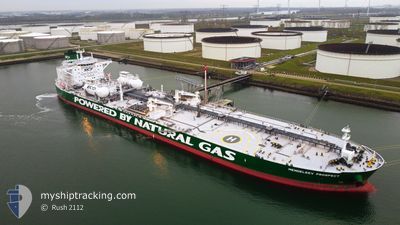
The vessel ALFRED (IMO: 9826897, MMSI: 636018830) is a Tanker It's sailing under the flag of [LR] Liberia.
In this page you can find informations about the vessels current position, last detected port calls, and current voyage information. If the vessels is not in coverage by AIS you will find the latest position.
The current position of ALFRED is detected by our AIS receivers and we are not responsible for the reliability of the data. The last position was recorded while the vessel was in Coverage by the Ais receivers of our vessel tracking app.
The current draught of ALFRED as reported by AIS is 14.4 meters
Weather
| Temperature | 12.2°C / 53.96°F |
|---|---|
| Wind Speed | 14 knots |
| Direction | 327° NNW |
| Pressure | 1014.9 hPa |
| Humidity | 72.5 % |
| Cloud Coverage | 91 % |
Featured Company
Last Port Calls
| Port | Arrival | Departure | Time In Port |
|---|---|---|---|
| 2024-04-10 02:58 | 2024-04-11 10:46 | 1 d | |
| 2024-03-08 07:31 | |||
| 2024-03-08 07:30 | |||
| 2024-02-18 14:27 | 2024-02-20 01:35 | 1 d |
Most Visited Ports (Last year)
| Port | Arrivals | |
|---|---|---|
| 3 | ||
| 2 | ||
| 2 | ||
| 2 | ||
| 2 | ||
| 2 |
Last Trips
| Origin | Departure | Destination | Arrival | Distance | |
|---|---|---|---|---|---|
| 2024-03-08 08:30 | 2024-04-10 05:58 | 6380.14 nm | |||
| 2024-02-20 02:35 | 2024-03-08 08:31 | 1707.90 nm | |||
| 2023-12-29 16:02 | 2024-02-18 15:27 | 6249.09 nm |
Events
| Tijd | Evenement | Details | Positie / Bestemming | Info |
|---|---|---|---|---|
| 2024-04-22 12:59 | Status Changed | Default Under way using engine |
36.76167 / .37333
IZMIT \ TURKEY
|
Snelheid: 12.1 kn Koers: 78° |
| 2024-04-22 12:31 | Buitenbereik |
36.73955 / .22640
Mediterranean Sea - Western Basin
IZMIT \ TURKEY
|
Snelheid: 12.1 kn Koers: 78° |
|
| 2024-04-22 12:26 | Status Changed | Under way using engine Default |
36.73782 / .21615
IZMIT \ TURKEY
|
Snelheid: 12 kn Koers: 78° |
| 2024-04-22 12:14 | Status Changed | Default Under way using engine |
36.73333 / .18833
IZMIT \ TURKEY
|
Snelheid: 12.1 kn Koers: 76.9° |
| 2024-04-22 12:04 | Status Changed | Under way using engine Default |
36.72497 / .14456
IZMIT \ TURKEY
|
Snelheid: 12 kn Koers: 77° |
| 2024-04-22 11:29 | Status Changed | Default Under way using engine |
36.69833 / .00500
IZMIT \ TURKEY
|
Snelheid: 12 kn Koers: 80.1° |
| 2024-04-22 10:58 | Status Changed | Under way using engine Default |
36.67828 / -.13072
IZMIT \ TURKEY
|
Snelheid: 12 kn Koers: 76° |
| 2024-04-22 10:50 | Status Changed | Default Under way using engine |
36.67333 / -.15500
IZMIT \ TURKEY
|
Snelheid: 11.9 kn Koers: 76.3° |
| 2024-04-22 09:40 | Status Changed | Under way using engine Default |
36.60776 / -.46095
IZMIT \ TURKEY
|
Snelheid: 12 kn Koers: 73° |
| 2024-04-22 09:31 | Status Changed | Default Under way using engine |
36.60667 / -.46333
IZMIT \ TURKEY
|
Snelheid: 11.9 kn Koers: 75.9° |