
ALFRED
Tanker
Current Trip
| Time Travelled | 6 days |
|---|---|
| Remaining Time | --- |
| Distance Travelled | 1806.39 nm |
| Remaining Distance | --- |
| AVG Speed | 10.5 Noeuds |
| MAX Speed | 14.4 Noeuds |
| AVG Wind | 18.9 knots |
| MAX Wind | 27.5 knots |
| MIN Temp | 2.2°C / 35.96°F |
| MAX Temp | 11.3°C / 52.34°F |
| Tirant d eau | 14.4 m |
| Position reçue | 3 h, 38 m depuis |
Current Position
| Longitude | -4.21590° |
|---|---|
| Latitude | 49.55281° |
| Etat | Under way using engine |
| Vitesse | 11.9 Noeuds |
| Parcours | 238.1° |
| Zone | English Channel |
| Station | T-AIS |
| Position reçue | 3 h, 38 m depuis |
Info
Information
The current position of ALFRED is in English Channel with coordinates 49.55281° / -4.21590° as reported on 2024-04-17 21:46 by AIS to our vessel tracker app. The vessel's current speed is 11.9 Noeuds and is heading at the port of IZMIT. The estimated time of arrival as calculated by MyShipTracking vessel tracking app is 2024-04-27 20:00 LT
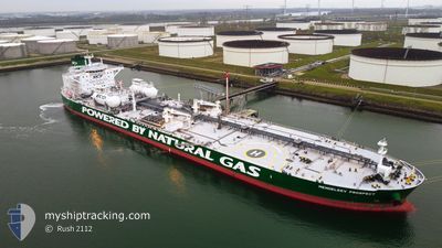
The vessel ALFRED (IMO: 9826897, MMSI: 636018830) is a Tanker It's sailing under the flag of [LR] Liberia.
In this page you can find informations about the vessels current position, last detected port calls, and current voyage information. If the vessels is not in coverage by AIS you will find the latest position.
The current position of ALFRED is detected by our AIS receivers and we are not responsible for the reliability of the data. The last position was recorded while the vessel was in Coverage by the Ais receivers of our vessel tracking app.
The current draught of ALFRED as reported by AIS is 14.4 meters
Weather
| Temperature | 11°C / 51.8°F |
|---|---|
| Wind Speed | 15 knots |
| Direction | 34° NE |
| Pressure | 1020.2 hPa |
| Humidity | 88.4 % |
| Cloud Coverage | 100 % |
Featured Company
Last Port Calls
| Port | Arrival | Departure | Time In Port |
|---|---|---|---|
| 2024-04-10 02:58 | 2024-04-11 10:46 | 1 d | |
| 2024-03-08 07:31 | |||
| 2024-03-08 07:30 | |||
| 2024-02-18 14:27 | 2024-02-20 01:35 | 1 d |
Most Visited Ports (Last year)
| Port | Arrivals | |
|---|---|---|
| 3 | ||
| 2 | ||
| 2 | ||
| 2 | ||
| 2 | ||
| 2 |
Last Trips
| Origin | Departure | Destination | Arrival | Distance | |
|---|---|---|---|---|---|
| 2024-03-08 08:30 | 2024-04-10 05:58 | 6380.14 nm | |||
| 2024-02-20 02:35 | 2024-03-08 08:31 | 1707.90 nm | |||
| 2023-12-29 16:02 | 2024-02-18 15:27 | 6249.09 nm |
Events
| Heure | Evenement | Détails | Position/ Destination | Info |
|---|---|---|---|---|
| 2024-04-17 21:51 | Etat Changé | Default Under way using engine |
49.54498 / -4.23518
IZMIT \ TURKEY
|
Vitesse: 11.9 kn Parcours: 238.1° |
| 2024-04-17 21:46 | Hors de la zone couverte |
49.55281 / -4.21590
English Channel
IZMIT \ TURKEY
|
Vitesse: 11.9 kn Parcours: 238.1° |
|
| 2024-04-17 21:39 | Etat Changé | Under way using engine Default |
49.56497 / -4.18573
IZMIT \ TURKEY
|
Vitesse: 11.9 kn Parcours: 238° |
| 2024-04-17 21:27 | Etat Changé | Default Under way using engine |
49.58620 / -4.13128
IZMIT \ TURKEY
|
Vitesse: 12 kn Parcours: 244.3° |
| 2024-04-17 21:13 | Etat Changé | Under way using engine Default |
49.60707 / -4.06979
IZMIT \ TURKEY
|
Vitesse: 12.1 kn Parcours: 239° |
| 2024-04-17 21:11 | Etat Changé | Default Under way using engine |
49.61129 / -4.05860
IZMIT \ TURKEY
|
Vitesse: 12.3 kn Parcours: 239.9° |
| 2024-04-17 21:04 | Etat Changé | Under way using engine Default |
49.62267 / -4.02867
IZMIT \ TURKEY
|
Vitesse: 12.2 kn Parcours: 234° |
| 2024-04-17 21:03 | Etat Changé | Default Under way using engine |
49.62524 / -4.02294
IZMIT \ TURKEY
|
Vitesse: 12.3 kn Parcours: 232.9° |
| 2024-04-17 18:32 | Etat Changé | Under way using engine Default |
49.90167 / -3.34407
IZMIT \ TURKEY
|
Vitesse: 12.1 kn Parcours: 236° |
| 2024-04-17 18:15 | Etat Changé | Default Under way using engine |
49.93285 / -3.27137
IZMIT \ TURKEY
|
Vitesse: 11.9 kn Parcours: 240° |